Remnants of Vardah to give rain over Karnataka, Tamil Nadu, Goa
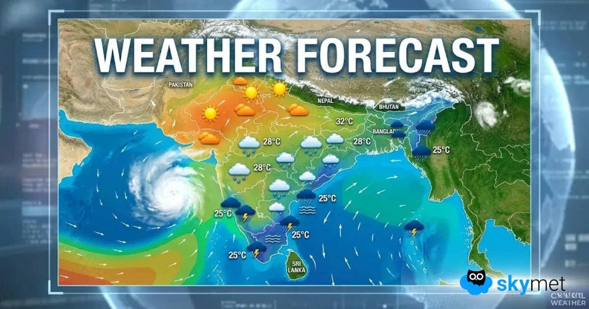
Cyclone Vardah which left a trail of destruction in Chennai and other parts of Tamil Nadu has become a low pressure area and is presently lying over coastal Karnataka, North Kerala and Southeast Arabian Sea. The system is expected to move westwards and weaken further in next 24 hours.
The remnants of the weather system are likely to give scattered rain and thundershower over parts of Tamil Nadu, Karnataka, Andhra Pradesh and isolated parts of Goa during next 24 hours.
Though the cyclone has moved away fromChennai, it has caused severe damage to the southern state of Tamil Nadu and according to Assocham, Cyclone Vardah has inflicted a loss of over Rs. 6,000 crore onTamil Nadu.
Even though airport operations have resumed in Chennai, the city is still grappling with aftermath of the cyclone where several uprooted trees and power outage has left the residents crippled for next few days.
Cyclone Vardah now a depression, Chennai rains to continue
After making landfall as a severe cyclonic storm, Cyclonic Vardah has now weakened significantly into a depression. It is presently centered at 12.5ºN and 78.0ºE, about 50 km west of Tiruppattur and 40 km north of Dharmapuri.
The system is now seen north InteriorTamil Naduand will continue to move in west- southwest towards SouthKarnataka.
As it will continue to move inland, Vardah will further lose more strength and that too at a rapid pace. It is likely to weaken into a well-marked low pressure area in the next 4-5 hours.
With this, intensity of rains will now reduce overChennaibut city will continue to witness light showers. Some moderate rains and thundershowers are also expected during the afternoon hours.
Meanwhile, moderate to heavy rains will now aimBangalorealong with parts of South Interior Karnataka and Interior Tamil Nadu.
Groups and groups of volunteers out and about to clear arterial roads. Chennai. 🙂#Vardahpic.twitter.com/xgLpkXItZo
— Subadra (@SoBadRa)December 13, 2016
This is the state of most streets in#Chennainow#Vardah#cyclonevardahpic.twitter.com/noa00zNOcO— T R B Rajaa (@TRBRajaa)December 13, 2016
Day after Vardah: Chennai feels like a foresthttps://t.co/8i5Hr2sPLhpic.twitter.com/H2iZsrUmlV
— Snotting.com (@snottingcom)December 13, 2016
That's how#bangalorelooks like today. After effect of chennai vardah cyclone, it's been raining for last 18 hourspic.twitter.com/Yy6BFyl5rJ— girish shet (@girishshet)December 13, 2016
#Karnataka:#Bengaluruwitnesses light showers after#cyclonevardahmade a landfall in#Chennai, yesterdaypic.twitter.com/qGYqZElsF9
— News Pictures (@News_Pictures1)December 13, 2016
Cyclone Vardah: Trees tumble, roofs fly, Chennai stands stronghttps://t.co/vGaVz7ujPjvia@TOIChennaipic.twitter.com/CjL5SSNwCz— Times of India (@timesofindia)December 13, 2016
Live Blog: Chennai Rain intensifies as Cyclone Vardah makes landfall
#CycloneVardahgive heavy#rainsin#Chennai: Video by Abhishek Mishra in Chennai.#ChennaiRains#Vardahpic.twitter.com/uA6t1aRC46
— SkymetWeather (@SkymetWeather)December 12, 2016
Strong winds rattling the city of Chennai: Video by Abhishek Mishra in#Chennai.#CycloneVardah#Vardahpic.twitter.com/K5a2hlAzKn— SkymetWeather (@SkymetWeather)December 12, 2016
Cyclone Vardah has made landfall near Chennai as a severe cyclonic storm. The arm of the cyclonic storm has entered the landmass bringing heavy rains over the region. Wind speed of 80 to 100kmph has been reported with some areas witnessing gusting wind speed of at least 120kmph.
No destruction to life has been reported as of now but by looking at various social media channels we can see the destruction to various forms of property can be seen.
Thankfully, the special task force by National Disaster Management Authority has been in place which is doing phenomenal work in keeping the city safe. More the 7000 people have been evacuated to safer places by the task force.
The Chennai Airport has been shut off for till 0600 in the evening due to mammoth rainfall figures. In the span of 6 hours from 0830am to 0230pm Chennai airport has received 177 mm of rainfall while in the same amount of time Chennai city has recorded 99 mm of rainfall.
@MadrassanMassive tree down at 18th mainroad Anna Nagar and at various places of city.Road Blocks and disruption of Electric Lines#Vardahpic.twitter.com/hNzkdCLJ7Q
— Stephen Surendran (@Pitch_kalome)December 12, 2016
Just#Vardahthings.#Vardahcyclone#trees#wind#rainfall#climate#lethallovepic.twitter.com/rpkXOnoSDd— Amresh Chandran (@AmreshChandran)December 12, 2016
Amazon Office Chennai !!!! Stay safe Friends !!!#CycloneVardah#Chennai#chennairains#Vardah#staysafechennaipic.twitter.com/PfTcvGXAGt
— Harshavardhan (@Harsha_JTCBE)December 12, 2016
#chennairains#chennaicyclone#Vardah#staysafechennai#staystrongpic.twitter.com/1EpJDOSifl— Neeraj Yadav (@armybuoy)December 12, 2016
#Vardah#cyclonevardah#Chennai#chennairainspic.twitter.com/F1MdpW2MMC
— Venkataseshan (@venkatusharma)December 12, 2016
#Chennai#ChennaiRains#Cyclone#Vardah#Winds#ChennaiNow#NoPower#Hyatt#RameeMall#WAFwdpic.twitter.com/uzyFMwe0J5— Anand Mohan (@AnandMohan1977)December 12, 2016
#cyclonevardahआंध्र प्रदेश सुल्लुरपेटा में तेज हवाओं और तूफान के कारण कच्चे तेल का टैंकर पलट गया।@SkymetWeatherpic.twitter.com/JcRVTLMeJS
— News World Hindi (@Khabar_NWI)December 12, 2016
#cyclonevardah@dlfchennaipic.twitter.com/bVA1vgcRCt— Ragavan Rajan (@ragavanrajan)December 12, 2016
Heavy cyclone in Chennaipic.twitter.com/mDEySmCaPU
— M.Tejesh (@MTejesh6)December 12, 2016
Horrible horrible weather! Never experienced such winds. Stay safe and strong Chennai!#cyclonevardah#Vardah#chennairainspic.twitter.com/ZXYCZF8cib— Nikhilesh Ganesan (@naaikaay)December 12, 2016
Strength to those living in#Chennai#StaySafeChennai#cyclonevardahpic.twitter.com/mj81JWPKUP
— Anuja Chandramouli (@anujamouli)December 12, 2016
Cyclone vardah is presently 30 Kms East-Northeast of Chennai: National Disaster Management Authoritypic.twitter.com/PiM7eGLVv4— prashant sharma (@prashan86388870)December 12, 2016
#Vardahcyclone#staysafe#chennaipic.twitter.com/PuhyISZE21
— Manoj (@Manoj_1927)December 12, 2016
#Vardahin full swing!!! Shot at Alandur!!!#ChennaiBrace yourself for the impact!!!pic.twitter.com/bvaj3C9M4J— Arjun Deepak (@Arjundevil143)December 12, 2016
Scary scenes in navalur. Video taken by@NibuAlex.#chennai#cyclonevardah@dhanyarajendran@thenewsminutepic.twitter.com/gOrT57znJA— Ram Prakash (@ramprakash74)December 12, 2016
Getting a lot more gustier..#Chennai#Vardahpic.twitter.com/NmKgJ9vP5K— Thivahar Bethune (@ThivaharBethune)December 12, 2016
#Vardah#MyBalconyView@dhanyarajendran@praddy06@thenewsminute#Tambaram#Chennai@thanthitv@CNNnews18@news7tamil@ChennaiTimesTOIpic.twitter.com/GTdrFk9jsu— Ganesh Nagaraj (@GaneshNg2)December 12, 2016
Never seen like this before.#chennai#Vardahcyclone#Vardahpic.twitter.com/DoMV4MLCBt— வித்யாதரன் (@avidyadharan)December 12, 2016
Live Cyclone Vardah starts crossing near Chennaihttps://t.co/djf14ZWGI1#gis#geopic.twitter.com/tDsjUra7Ls— RMSI Pvt. Ltd. (@RMSI_Global)December 12, 2016
Chennai 1 pm#ECR#Vardahpic.twitter.com/KqNlByG0wf— Jain Roy (@jain_ed)December 12, 2016
Trees fall, thatched roofs shattered.#Chennai#cyclonevardah@ANN_Newsablepic.twitter.com/3xaTV0ngF3— Pratiba Raman (@PratibaRaman)December 12, 2016
@prasannab__@dhanyarajendranWind speed right now at Pallikaranai, Chennai#CycloneVardah#cyclonevardah#Vardahpic.twitter.com/Mt8r5Gpz1c— KOLAPPA THANDESH (@skthandesh)December 12, 2016
Total savage here in Chennai#vardahStay safe peoplepic.twitter.com/DLabAtd6GP— Manoj S Nagendra (@manojshesh24)December 12, 2016
#FLASHAll operations at the Chennai airport suspended till 3 PM today#cyclonevardah— ANI (@ANI_news)December 12, 2016
Cyclone#Vardah's distance from Chennai is 50 kms now: NDMA — ANI (@ANI_news)December 12, 2016
7357 people are evacuated to 54 relief centres safely so far: TN Government#cyclonevardah— ANI (@ANI_news)December 12, 2016
Naval aircraft also standing-by at the Naval Air Stations Rajali & Dega to be pressed into action to augment HADR ops: Navy#cyclonevardah— ANI (@ANI_news)December 12, 2016
One Survey ship has been kept standby to undertake harbour survey in case of requirement: Navy#cyclonevardah— ANI (@ANI_news)December 12, 2016
22 diving teams have been kept standby at Visakhapatnam for immediate deployment, should the situation warrant.#cyclonevardah— ANI (@ANI_news)December 12, 2016
Situation @ MSM GUINDY CHENNAI 32pic.twitter.com/zN7DBz6b0F— Arunkumar (@Arunmsm)December 12, 2016
Views from my balcony. Trees broken on the street. And#CycloneVardahhasn't even hit#Chennaiyet.pic.twitter.com/QHVnKqM6vZ— Asmita (@asmitaghosh18)December 12, 2016
#Vardah#Vardahcyclone#Chennaipic.twitter.com/12ApMo0MQs— Prakash Janakiraman (@Prakashpathy)December 12, 2016
@SkymetWeatherits near our flat at ambatturpic.twitter.com/D5VZfcJ1yE— balaG (@cbalaganesh)December 12, 2016
#ChennaiRailway Beach Station !#Vardah!#Vardahcyclone!pic.twitter.com/oJaGcX3FgA— Cine Time (@CineTimee)December 12, 2016
Some house somewhere in Chennaipic.twitter.com/H7IblsPpM1— JoiningUnrelatedDots (@J_Mareeswaran)December 12, 2016
Cyclone Vardah slamming over Chennai with high speed winds. How it is in Adambakkam. Less than 50 km away.#Vardah#cyclonevardah#monsoonpic.twitter.com/gcmkCQdveb— Krishnakumar Raghu (@krishnivas)December 12, 2016
Cyclone Vardah slamming over Chennai with high speed winds. How it is in Adambakkam. Less than 50 km away.#Vardah#cyclonevardah#monsoonpic.twitter.com/gcmkCQdveb— Krishnakumar Raghu (@krishnivas)December 12, 2016
#Cyclone'VARDAH' is now less than 50 Kmph from#Chennai. May make landfall in another 1to 2 hours.@SkymetWeather— Mahesh Palawat (@Mpalawat)December 12, 2016
Two ships of Navy Shivalik & Kadmatt already in north of area likely to b affected to render immediate assistance if required:Navy chief PRO — ANI (@ANI_news)December 12, 2016
Massive uprooting of trees reported, Cyclone#Vardahlikely to make landfall by 1330 hrs: Navy chief PRO captain DK Sharma — ANI (@ANI_news)December 12, 2016
Tidal wave will be one meter high,people advised to be in safe places & stick to instructions given by government: MeT Dir#cyclonevardah— ANI (@ANI_news)December 12, 2016
Click here for Live Lightning & Radar over Chennai
#ChennaiRains&#cyclonevardahhelpline Numbers.#StayStrong#Chennaipic.twitter.com/KtYWZhm9gk— Anirban Halder (@AnirBong)December 12, 2016
Due to cyclonic weather over Chennai airport, flights are diverted and departures are delayed.#cyclonevardah— ANI (@ANI_news)December 12, 2016
Related Post:10 Latest developments on Cyclone Vardah and Chennai Rains
#VardahWinds all set to go up a notch along with rains. Stay indoors guys.#Chennai@dhanyarajendran#Kelambakkampic.twitter.com/sRxtzt2Pl3— Abubacker (@AbuCric)December 12, 2016
Telecommunications is cut is some places in#Chennaidue to heavy winds#Vardah.The cyclone now inside the city area with heavy rains — Aravind Swamy (@iamaravindswamy)December 12, 2016
@the_hindufrom my balcony@omrchennai#cyclonevardahpic.twitter.com/xH5lUNO401— Vivek Raju (@bibbanvivek)December 12, 2016
Chennai rains have begun and are on their way to wreaking havoc over the capital city of Tamil Nadu.
During the last 11 hours from 9:30 pm on Sunday to 8:30 am today, Chennai has recorded a whopping 57 mm of rain which is more than the city received during the entire month of November.
Due to these rains, air traffic has taken a beating. As per media reports, at least 25 flights have been diverted and five other flights have been cancelled from the Chennai airport.
As the cyclone nears Chennai, more rains are expected over the capital city of Tamil Nadu. In fact, residents have been advised to stay indoors and charge their mobile phones due to possibility of power outage. Power outage has been witnessed in northern parts of Chennai.
Local train services from various areas of like Chennai Beach to Velachery, and Chennai Central to Gummidipoondi and Sulurpettah have been temporarily suspended until further notice due to the storm.
Trains on the Chennai Beach-Tambaram-Chengalpattu line will run once at a time interval of 45 minutes.
Cyclone Vardah not very far away from Chennai, to make landfall today
Sustaining its strength, very severe Cyclone Vardah has moved further closer to theChennaicoast. The system continues to move in west direction and is presently centered at 13.3°N and 83°E.
It is around 175 km from Chennai and around 200 km fromNellorecoast. According to weathermen, the increasing proximity to land may result in gradual weakening of system and it is most likely to make a landfall as a cyclonic storm.
The system is expected to hit theTamil Naduand adjoining SouthAndhra Pradeshcoast during the Monday afternoon.
In wake of this, moderate to heavy rains have already started over several parts of North Coastal Tamil Nadu and South Andhra Pradesh.
Chennai has also been witnessing incessant rains since Sunday night. At present also, the state capital is witnessing moderate to heavy showers at several places.
We expect intensity of rains to increase manifolds in the next few hours over the coastal areas of the both neighbouring states including Chennai.
Squally winds of damage potential has been blowing along and off the coastal areas. Currently, the wind speed is between 80 kmph – 90 kmph, gusting up to 100 kmph.
Locals and fishermen, especially those residing in low-lying areas are strictly advised not to venture out in the sea. Sea conditions would remain rough to very rough.
Very severe Cyclone Vardah to make landfall tomorrow
Very severe cyclone Vardah is currently over west-central and adjoining south Bay of Bengal and is inching towards the North Tamil Nadu coast and South Andhra Pradesh Pradesh coast. In fact the system is expected to weaken into a severe cyclonic storm during the next few hours.
Thereafter, the system will further weaken into a cyclonic storm. The system is expected to make landfall close to Chennai during the afternoon hours tomorrow. During that time, the weather system will remain a cyclonic storm.
Heavy to very heavy rains are likely over Chennai and adjoining areas of North Tamil Nadu tomorrow. Some low lying areas may observe flood like conditions due to inundation. Isolated areas may witness extremely heavy spells as well.
Fishermen have been advised to stay off the coast as sea conditions will remain rough to very rough. Winds are expected to gust up to 100 kmph.
Very severe cyclone Vardah inches closer to coast
Severe cyclone Vardah has now intensified into a severe cyclonic storm. The system which was over west central and adjoining south Bay of Bengal moved at a speed of 11 kmph. At present the system is near latitude 13.3°N and longitude 84.7°E.
The system is 520 km ESE of Nellore, 490 km ESE of Machilipatnam and 480 km ENE of Chennai. Vardah has now reached its peak intensity and is expected to move in the west-southwestward direction.
Also Read:Vardah to give rains over Chennai soon
The intensity of the storm is expected to remain the same until today evening. Thereafter, gradual weakening of the system is expected. Vardah will then move towards South Coastal Andhra Pradesh and North Tamil Nadu coast.
The likely landfall of the storm is expected to be on December 12 during the afternoon hours, close to Chennai. Thus, rains are likely to begin in Chennai starting today itself. Intensity of these rains will increase by tomorrow and moderate to heavy rains will occur over the city.
Severe Cyclone Vardah gradually inching closer to Andhra
As predicted, Cyclone Vardah over southeast Bay of Bengal has further intensified into a severe cyclonic storm. It is presently centered at 12.7ºN and 88ºE, about 880 km east-southeast of Nellore and 830 km southeast of Machilipatnam.
According to weathermen, it is a slow moving system and currently it is tracking west-northwestwards at a speed of 7 kmph. With the system still brewing in the sea, it is likely to get more marked during the next 24 hours and move further closer to the Andhra coast in west-northwest direction.
The system has now reached its peak and is most likely to sustain its strength up to evening of December 11. Thereafter, it is start weakening gradually as the system will start moving in unfavourable conditions.
The system is expected to make a landfall over Andhra Pradesh coast between Nellore and Machilipatnam during the afternoon or evening hours of December 12.
Cyclone Vardah to further intensify shortly
Cyclonic storm Vardah which has been giving heavy to very heavy rains over Andaman and Nicobar Islands is expected to intensify into a severe cyclonic storm during the next 12 hours. Sea conditions are favourable for its further intensification.
During the last six hours, the cyclone underwent slight intensification and further moved in a north-north direction at a speed of 10 kmph. Presently, the system is near Latitude 12.1°N and Longitude 90.4°E and lies about 990 km SE ofVisakhapatnam, 1090 km ESE ofMachilipatnamand 250 km WNW of Port Blair.
Also Read:Cyclone Vardah to give heavy rains over Andhra Pradesh
The storm is expected to initially move north-northwestwards and furthermore in the west-north-west direction. It is likely to cross the Andhra Coast betweenNelloreandKakinadaduring the afternoon or evening hours of December 12. During that time, the system may weaken slightly before it makes a landfall.
Moderate to heavy rains are expected over coastal areas of Andhra Pradesh starting December 11. While the intensity will be light on December 11, the weather system will give moderate to heavy rains on Sunday.
Cyclone Vardah to intensify into a severe cyclonic storm by tomorrow
The third cyclone of the season, Vardah has formed in the Southeast Bay of Bengal and has moved in the northwest direction during the last six hours. So much so that the system is currently at 11.5°N and Longitude 90.5°E. The system lies 1040 km ESE of Visakhapatnam, 1135 km ESE of Machilipatnam, 360 km NW of Car Nicobar and 240 km WSW of Port Blair.
Further intensification of the system is very likely. In fact, during the next 24 hours, the weather system is expected to become a severe cyclonic storm. The movement of the system will remain in the north direction and further northwestwards.
Also Read:Chennai to escape Cyclone Vardah's fury
Around December 12, during the late morning hours or by afternoon, the system is expected to cross the Andhra Coast between Kakinada and Nellore. During the landfall, the system is expected to weaken slightly.
In the wake of the system, heavy rains is expected to continue over the Andaman and Nicobar Islands during the next 24 to 48 hours accompanied by winds gusting up to 50 kmph. Sea conditions will continue to be rough.
The third cyclonic storm of the season, Vardah has finally formed in the Southeast Bay of Bengal. After Cyclone Kyant and Nada, this is the third cyclonic storm to have formed during the Northeast Monsoon season.
Last night, the system had intensified into a deep depression in Southeast Bay of Bengal and was moving northwards. Now, it has intensified into a cyclonic storm Vardah at 5:30 am in the morning. During that time, Vardah was near Latitude 11.2°N and Longitude 90.5°E. The system lies about 1060 km SE of Visakhapatnam and 1150 km ESE ofMachilipatnamalong with being 340 km NW ofCar Nicobarand 240 km WSW ofPort Blair.
The system is expected to further intensify into a severe cyclonic storm and will continue to move towards north for some time and will recurve in northwest towards Andhra Pradesh coast. This will be the first cyclone of this season to have gone under such intensification. All the other cyclones have only managed to become cyclonic storms and weakened thereafter.
Also Read:Port Blair receives 212 mm of rain, rescue operations at a halt
The reason for the intensification of this storm can be attributed to warm sea surface temperatures of the Bay of Bengal and longer sea travel. The system will continue to give heavy to very heavy rains over Andaman and Nicobar Islands during the next 24 to 48 hours.
Please Note: Any information picked from here must be attributed to skymetweather.com


