

There is no denying the fact that Delhi is counted amongst the top polluted cities across the world. While as per the World Health Organization (WHO), Delhi charts on 11th in this list, it also tops the list of ten top most polluted cities in India.
The level of pollution in the national capital has been a major concern for WHO and NGT (National Green Tribunal) as it causes major health hazards in populates of the city. The main reason for the rising pollution levels in the capital of the country can be attributed to the smoke emitted by factories and vehicles, burning of fossil fuels and last but not the least, by the crop residue being burnt in the adjoining states.
Also read: Delhi Pollution: NASA shows crop burning in Punjab, Haryana, NGT alarms
In general, the months from March to May are attributed with wheat burning which is the time for the blowing of the northwesterly winds.
As Punjab and Haryana lie towards northwest or Delhi, these winds carry smoke and pollutant particles towards Delhi. Moreover, as the city is densely populated with not much vegetation, these pollutants get mixed with the already polluted city that aggravates the situation.
Click here to see the pollution levels in Delhi and NCR
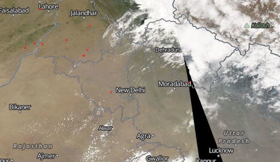
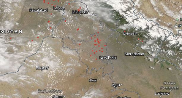
Though NGT has completely banned stubble burning, yet a massive increase in the number of crop fires in Delhi and adjoining states especially in Punjab and Haryana has been reported. NASA has recently revealed some pictures of enormous crop residue burning in Haryana and Punjab.
NASA’s Fire Mapper has exposed a few images that show a massive upsurge in the number of fires that out broke between April 25 and May 3. You can check the crop burning images revealed by NASA here:
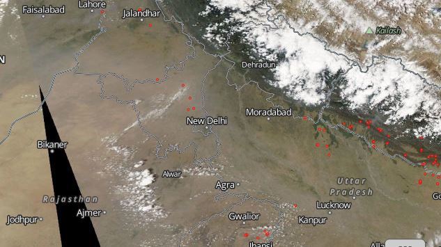
CROP RESIDUE BURNING AS ON APRIL 25

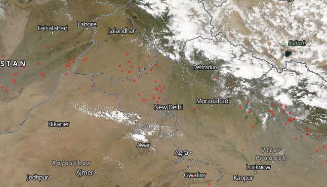
CROP RESIDUE BURNING AS ON APRIL 26
CROP RESIDUE BURNING AS ON APRIL 27
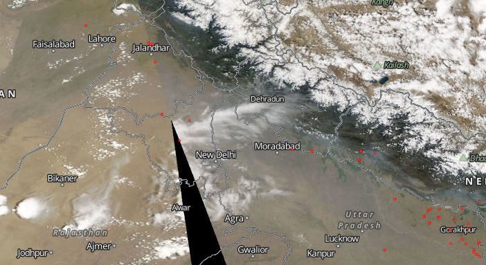
CROP RESIDUE BURNING AS ON APRIL 28
CROP RESIDUE BURNING AS ON APRIL 29
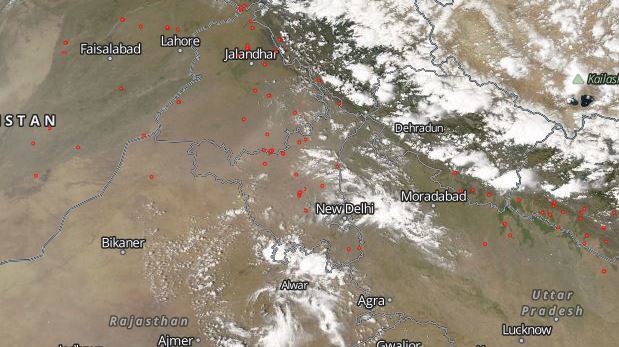
CROP RESIDUE BURNING AS ON APRIL 30
CROP RESIDUE BURNING AS ON MAY 1

CROP RESIDUE BURNING AS ON MAY 2
CROP RESIDUE BURNING AS ON MAY 3
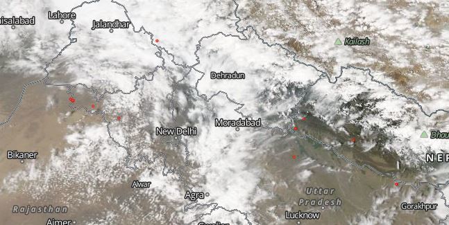
In all the images above, the red spots are the crop burning in the particular region.
Image Credit: NASA
Any information taken from here should be credited to skymetweather.com
