
Updated on January 6, 6:00 PM:
An Arctic air mass persistent in parts of the Northeast United States on Friday had sent temperatures below zero.
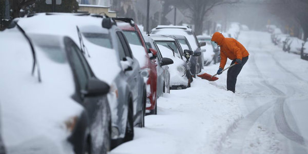
The frigid weather conditions are prevailing due to bomb cyclone and polar vortex that hit the East Coast.
Cyclone Bomb left some vehicles sheathed in ice on roads in Boston. It covered landmarks in New York with snow. Airports were also closed for hours in wake of the storm.
As per weathermen, wind chills in one part of New Hampshire were also in the forecast to hit -100°C.
As per the National Weather Service, cities such as Minneapolis and Boston are likely to reach below zero degrees on Saturday and with low wind chills. Many places could also witness a low as minus 40 degrees. Hefty snowfall activity has stopped, though chilly weather with harsh winds will prevail.
Updated on January 4, 4:00 PM:
An extreme winter storm is hitting the eastern provinces of the US, extending a chilly snap that has already killed eleven people. As per the weathermen, an excessive pressure drop is already bringing in the snow to Florida and will lead to an explosive wintry weather typhoon alongside the Eastern US.
The USA has been reeling under this record-breaking frigid temperature for the last 10 days that commenced around Christmas. But the expected new chilly storm has led meteorologists to coin a brand-new term - bomb cyclone.
The National Weather Service (NWS) has warned that the polar air mass will remain rooted over the eastern two-thirds of the country through the weekend. NWS further added that bone-chilling temperatures and hazardously cold wind chills are also expected predicted.
A "bomb cyclone" or "climate bomb" is an informal term used to refer an explosive cyclogenesis. This generally happens when the central pressure of a low-pressure system falls via 24 millibars in 24 hours. This would further cause violent winds developing around the system.
[yuzo_related]
The winds would be sturdy enough to cause trees tumbling and can cause structural damages. The upcoming winter is more like a winter hurricane which will be the eastern US’s most severe in decades.
It comes as the average temperature across the continental US hovered around -12.7 on Tuesday morning. On Thursday and Friday, the storm is predicted to increase alongside the eastern seaboard of the USA, bringing strong winds, rain, sleet, and snow.
The storm is forecast to go through speedy cyclogenesis over the Atlantic Ocean, and as per the predictions, areas north of New York carries the highest threat impacts from heavy snow and strong winds.
Predominant north-eastern cities such as Boston are vulnerable to blizzards and is expected to cause disruption in air and road traffic alongside power outages are also possible.
Parts of Florida, consisting of the northern town of Tallahassee, have already witnessed their first snow settling in decades. In the wake of the storm, hundreds of flights have reportedly been rescheduled or canceled by several airlines.
According to flight aware, almost 600 Thursday flights were not on time. The whole wide variety of cancellations for Thursday is coming near 2,800 flights. The airways canceled 500 flights on Wednesday.
Image Credit: VOX
