
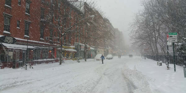
As a winter storm from the Ohio Valley arrives, snow and the risk of slippery travel in the northeastern United States has increased and may not end soon. According to reports, the storm may result in the spread of wintry weather over a large area right from the Central Plains to the Northeast.
[yuzo_related]
With this, the storm is likely to spread a lot of snow, during the first two days of February, causing many disruptions across the Central Plains, lower Midwest and into the northeast.
Although a boost of milder air may cause rainfall after the storm, which will make it worse for motorists and those traveling by foot. Due to these cold winds, along with rain and snow show, wet roads and sidewalks may turn icy.
Residents from St. Louis to Cincinnati, Ohio, to Pittsburgh, Washington, D.C., Philadelphia, New York City and Boston could see flight cancellations, slippery travel, school closures and disruptions in other daily routines.
When Punxsutawney Phil emerges from gobbler’s knob in Pennsylvania, there may be snow on the ground or falling. Thus, there may be some snow show on Groundhog Day as well. Thus, cloudy and snowy weather may cause difficulties in Phil seeing its shadow on the day. Phil not seeing his shadow, which indicates early spring, has happened only four times in 17 years.
Despite the storm’s track and Phil’s prediction, winters will continue to trouble the Northeast and Midwest.
Frigid air may continue through the first half of February and create the possibility of winter storms across the central and eastern half of the US.
Image Credits - Twitter
Any information taken from here should be credited to skymetweather.com
