
While the bushfire nation has seen some rains, there is a bomb cyclone between Greenland and Iceland. Along with this, another bomb cyclone is likely in the Canadian Nova Scotia region. A bomb cyclone occurs when the low pressure area deepens by 24 mb in 24 hours.
Jet stream, which is at 12 km height is encouraging a Cyclone at the top of the atmosphere at 400km per hour. This wind is the definition of the convergence of two masses of air one being the cold Arctic winds, and the other being slightly on the warmer side. The centre of the storm will soon be steered across the Newfoundland region.
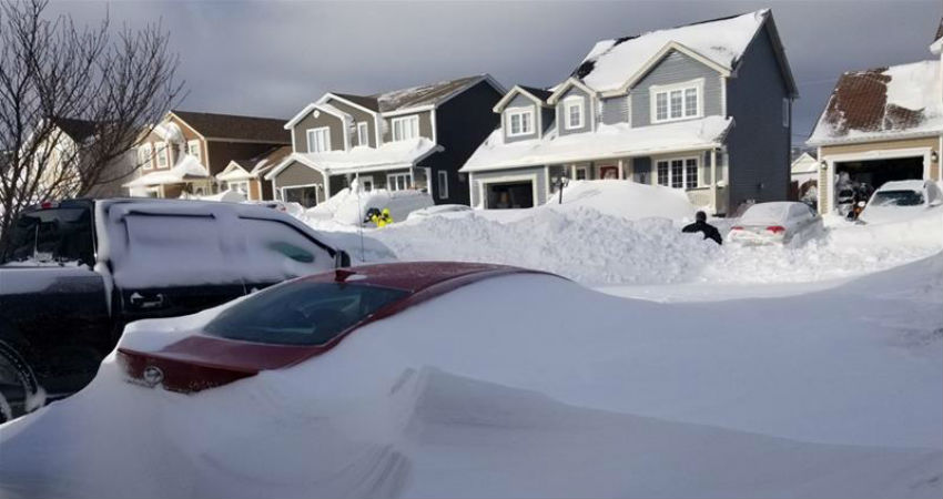
Now, this will be the season’s second heavy snowfall for Newfoundland. In fact, winters will be very significant for the region. There is likelihood of intense gale, heavy snowfall, ice pellets as well as freezing rainfall.
Red weather warnings have been sent in by the Environment Canada way in advance. Thereafter, when the bomb cyclone of Greenland will relax hurricane-force winds, it will help in steering the Newfoundland cyclone towards northwest parts of Europe directly. It is here that it will act as Storm Ciara, bringing in widespread potentially damaging winds.
As per the Irish meteorological service, warnings have been issued for parts of Ireland and the United Kingdom for the next couple of days.
Story and Image Source: Al Jazeera
