Well Marked Low Pressure Area Over Arabian Sea, May Intensify Further
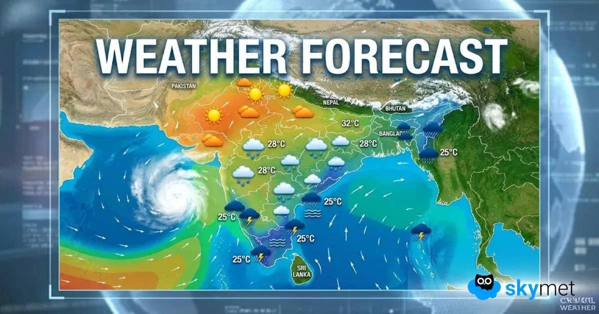
The low-pressure area over the east-central Arabian Sea has become well marked now. The system has shifted a little closer to the coast and is centered around 18°N and 72.5°E, today at 8.30 a.m. It is likely to move northward slowly and may intensify into a depression in the next 24 hours. Further strengthening is put on hold for the time being.
The weather system has not behaved on the expected lines in the past 24 hours or so. A close analytical scrutiny suggests the low pressure as a disorganized area of convection, overlying a poorly defined low-level cyclonic circulation. The environmental analysis reveals marginally favorable conditions of moderate vertical wind shear and warm sea surface temperature. However, some of the model packages have shifted the track of the system closer to the coast or even moved slightly inland.
This is not a positive sign for its sustenance and growth. Yet, there are some indications that the system may get back over the ocean waters, albeit with less probability. As of now, the potential for development into a significant tropical cyclone in the next 36 hours remains low.
The convective cloud clusters in association with the low pressure have lashed the Konkan Coast, North Coastal Karnataka, and Madhya Maharashtra in the immediate vicinity of the lee side of the Western Ghats.
Must Read: SpaceX Launches Starlink Direct-to-Cell Satellites, Boosting Global Mobile Connectivity 2025
Ratnagiri has recorded heavy rainfall of 106mm, Satara 75 mm, Karwar 94 mm, and Mangalore 50 mm. Mumbai has escaped with light to moderate showers, with airport observatory Santacruz having ‘no show’ in the past 24 hours.
Heavy rains are likely over Konkan and Madhya Maharashtra over the next 3 days. Very heavy rainfall may occur between Sindhudurg and Raigad. The entire north-south stretch of Madhya Maharashtra from Nandurbar-Dhule-Ahmednagar to Pune-Nasik-Sangli-Satara-Kolhapur-Sholapur will have to watch out for strong thunderstorms, possibly accompanied by squally winds and hailstorms in a few places.
The heavy weather belt may extend to cover parts of Marathwada as well. Mumbai is likely to escape the weather fury for the time being. Still, moderate rain and thundershowers, interspersed with one odd heavy burst, are quite likely. North Coastal Karnataka, Goa, and Kerala will also have to watch out for heavy to very heavy rainfall in the next 3-4 days.


