
In the last 24 hours, Vigorous Monsoon was seen over Konkan and Goa, Madhya Maharashtra, parts of Marathwada, many parts of Madhya Pradesh, Sub Himalayan West Bengal and Sikkim.
Meanwhile, Monsoon remained active over Coastal Karnataka, Vidarbha, Chhattisgarh, Interior Odisha, southern parts of Uttar Pradesh and Northeastern states.
Major rain contribution came from Sagar that recorded 132 mm of rainfall, followed by Alibag at 108 mm and Damoh 101 mm.
As on September 20, the cumulative countrywide rainfall is deficient by 5%. Talking about the regional distribution, Northwest India is rain deficient by 11%, Central India by 6% and East and Northeast India by 3% rain.
At present the axis of Monsoon trough extending from Bikaner, Ajmer, center of the low-pressure area, Pendra Road, Jharsuguda, Paradip and is moving towards the east-central Bay of Bengal.
[yuzo_related]
During the next 24 hours, Vigorous Monsoon conditions are likely over West Madhya Pradesh, central and west Uttar Pradesh.
Meanwhile, Monsoon will be active over Chhattisgarh, East Madhya Pradesh, Konkan and Goa, Delhi and Madhya Maharashtra.
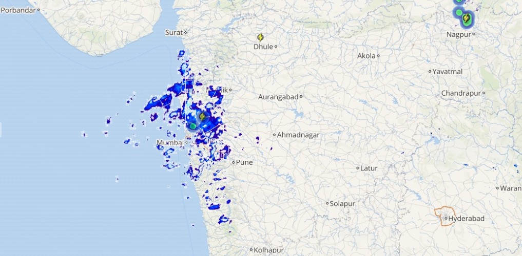
Live status of Lightning and thunder
Normal Monsoon conditions are likely over Odisha, Bihar, Jharkhand, North Interior Karnataka, Coastal Karnataka, Kerala, Northeastern states, Sub Himalayan West Bengal, Sikkim, and Uttarakhand.
Please Note: Any information picked from here should be attributed to skymetweather.com
