
Southwest Monsoon 2019 has finally covered Sri Lanka and is now inching closer to India. The northern limit of Monsoon (NLM) has now covered some more parts of the South Arabian Sea, Maldives Comorin area and a few more regions of Southwestern Bay of Bengal. This advancement took place due to the strengthening of cross-equatorial flow along with the east-west shear zone which has developed across the south Arabian Sea & Maldives area. Southwest Monsoon is likely to hit Kerala in the next 48 hours. Simultaneously, Monsoon 2019 will also cover Northeast India.
A Cyclonic Circulation is over Southeast Arabian Sea and adjoining Lakshadweep. Also, a trough is running off Karnataka and Kerala coast. These systems will lead to the onset of Southwest Monsoon in Kerala and Northeast India in a span of two days. A north-south trough from Central India is also extending up till Southern Peninsula across Andhra Pradesh and Tamil Nadu.
Keeping weather systems in mind, scattered rain and thundershowers will be a sight over Konkan and Goa, Karnataka, Kerala, and Interior Tamil Nadu. While isolated rains will be a sight over Andhra Pradesh and Telangana. Bengaluru, Mangaluru, and Mysore will see isolated heavy rains. Whereas, heavy rains lie ahead for Lakshadweep and Andaman and Nicobar Islands.
Heading to Central India, a Cyclonic Circulation is over East Madhya Pradesh and adjoining North Chhattisgarh and Southwest Uttar Pradesh. Also, dry north-westerlies are prevailing over Central India. Thus, heat wave conditions will be seen in parts of Rajasthan, Madhya Pradesh, Vidarbha, Marathwada, and Chhattisgarh.
Moving up North, a Western Disturbance is moving northeast and induced Cyclonic Circulation is over North Rajasthan. An east-west trough from this system is extending up till Northeast India. The hills of the North would see scattered rain and thundershowers. Whereas, isolated dust storm or thunderstorm activity will be seen over Punjab, Haryana, Delhi and NCR and parts of North Rajasthan. Temperatures over the plains would reel in the range of 40°C-42°C.
Click the image below to see the live lightning and thunderstorm across India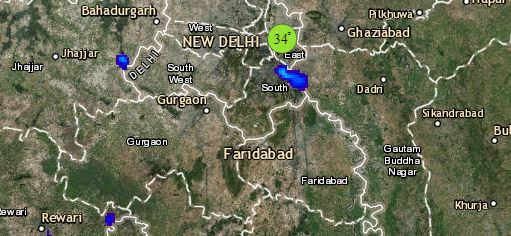
Finally, in East and Northeast India, a Cyclonic Circulation is over Bangladesh and Meghalaya. Also, an east-west trough is moving across Meghalaya, Assam up to Arunachal Pradesh. As this trough is sloping southwards, rainfall activity is expected to increase over extreme southern parts of northeastern states such as Tripura, Meghalaya, and Mizoram.
The experts have to say that rainfall activity would continue over North Bengal and adjoining Northeast India with moderate rains over scattered places like Kolkata, 24 North Parganas, 24 South Parganas, Malda, Murshidabad with southern parts of Odisha coast including Koraput and Malkangiri. Whereas, isolated activities will be seen over rest parts of East Bihar, South Jharkhand, South Bengal and coastal parts of Odisha.
Any information taken from here should be credited to skymetweather.com
