
Beginning with North, a Western Disturbance as an upper air system is over North Pakistan and adjoining Jammu and Kashmir with an induced Cyclonic Circulation over Central Pakistan and adjoining Punjab. Another Cyclonic Circulation is over Pakistan and adjoining West Rajasthan. Due to these systems, rain and thundershowers would continue at many places over Jammu and Kashmir, Himachal Pradesh and some places of Uttarakhand.
While, over the plains, dust storm thundershowers with squalls reaching 50 kmph over many parts of Punjab, Haryana, Delhi, West Uttar Pradesh and North Rajasthan will be a sight. Both, day and night temperatures are likely to drop in the National Capital Region and Delhi in the wake of the weather activities. However, chances of pollution remaining in hazardous category cannot be ruled out.
Heading to East and Northeast India, a Cyclonic Circulation is over North Bihar and adjoining area. Another Cyclonic Circulation is over East Assam and adjoining Arunachal Pradesh. A trough can be seen running from East Uttar Pradesh to Arunachal Pradesh across North Bengal. Thus, rain and thundershowers with squally winds will be a sight at many places in the northeastern states along with Sub Himalayan West Bengal, Sikkim and few parts of North Bihar.
While, isolated activities are likely over East Uttar Pradesh, South Bihar and Odisha. Whereas, uneasy, hot and humid weather would prevail over Kolkata and districts of 24 Parganas.
Meanwhile in Central India, a trough is extending from North Bihar up to North Chhattisgarh and another trough is running from Central Odisha upto Comorin region across Telangana, Andhra Pradesh and Interior Tamil Nadu. These systems might give isolated pre-Monsoon thundershower activities over Madhya Pradesh, Vidarbha and Chhattisgarh. While, due to the flow of south-westerlies, temperatures are likely to drop in Gujarat, Madhya Pradesh and Maharashtra. Afternoon in Mumbai will be uneasy with comfortable evening.
Click the image below to see the live lightning and thunderstorm across India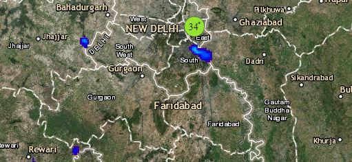
Lastly in South India, this trough would give scattered pre-Monsoon activities over Andhra Pradesh, Tamil Nadu and South Karnataka. While, light to moderate rain and thundershowers with gusty winds would affect Kerala. However, weather would be hot and dry in North Karnataka. There are chances of rain and thundershowers in Bengaluru, while Kerala will observe light rain and cloudy weather. Hyderabad would witness hot and humid weather with chances of rain and thundershowers. While, Trivandrum will see light to moderate pre-Monsoon rain and thundershowers.
Any information taken from here should be credited to skymetweather.com
