
December seems to be promising one for Chennai. So far, Northeast Monsoon has not been up to the mark, resulting in some grave rainfall deficiency for the season. In fact, the city has not seen fanous three-digit rainfall till now. November, which is the rainiest for the city, also went by silently.
The cumulative rainfall deficiency for the season for Chennai stands at 52%, with city recording 344 mm of rains from October 1 to December 11 against the normal average of 714 mm.
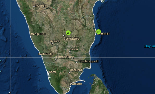
However, we are now hopeful for some heavy spells approaching the state capital. All thanks to a potential system brewing in Bay of Bengal. It is presently seen as a low pressure area over Equatorial Indian Ocean and Central Bay of Bengal. In the next 24 hours, it is most likely to induce a depression.
There are fair chances of system intensifying into a deep depression and might also become a tropical cyclone but it would be a feeble one and for a shorter duration. If this happens, it would be seventh cyclone of the year but the first one to impact Chennai.
 Also Read: Depression shortly in Bay, may become Cyclone; Chennai, TN, Andhra gear up for heavy rains
Rain in Chennai
We can expect system to near the coast by December 14, with which rains would also start making appearance along the Coastal Tamil Nadu and adjoining Coastal Andhra Pradesh.
Rains are likely to peak on December 15 and 16 and we can expect heavy to very heavy rains over Chennai along with Puducherry, North Coastal Tamil Nadu and South Coastal Andhra Pradesh.
The famous three-digit rainfall is also likely during this time over Chennai. Rains would be widespread this time, with at least moderate rainfall covering most parts of the city. These rains would be instrumental in decreasing the rainfall deficiency substantially.
Click here to get the live lightning, rain and thunderstorm report across Chennai
Factors leading to a powerful weather system
Since the system is travelling in lower latitudes, the intensification of the system would be slightly slow. However, this would not deter the system getting more marked. There are several other prominent factors that are just positioned right. Beginning with sufficient heat potential with sea surface temperatures (SST) in the range of 29°C to 31°C and moderate wind shear.
Another important factor is Madden–Julian Oscillation (MJO) which is linked with good rains over the Indian region when in close proximity is also in Indian Ocean. It is presently in phase 3 with fair amount of amplitude and is likely to stay put there till December 16. Thereafter, even when MJO shifts to phase 4 between December 17 and 20, it would continue to be in favourable zone.
The only factor which is not favour is broad weather model consensus in terms of track and intensity of rains. However, majority of them are still favouring for the system to head towards the Tamil Nadu and Andhra coast. Climatology also favours the same which suggests that most of the weather systems forming in Bay of Bengal in December heads for Tamil Nadu.
Image Credit:en.wikipedia.org
Any information taken from here should be credited to skymetweather.com
