
All the three hilly states i.e. Jammu & Kashmir, Himachal Pradesh as well as Uttarakhand started on a poor note in terms of winter rain and snowfall this season. However, some relief was observed due to the last spells that had occurred between January 20 and 23 in terms of improving rain figures.
The intensity of these spells was at peak on January 21, moderate on January 22 while light on January 23. Despite their oscillating intensities, the four days spells had resulted in surplus rainfall over all the three states. Data- wise, Jammu & Kashmir was surplus by 105% followed by Uttarakhand by 80% and Himachal Pradesh by 25%.
However, after witnessing these spells, rains started gradually withdrawing from these states and from January 24 to January 28, only scattered light rains were recorded over the state. As a result, surplus percentage came down gradually and since then has been standing at 58% for Jammu & Kashmir, only 4% for Himachal Pradesh, while Uttarakhand is taking the leading at 67%.
Now, in the span of coming one week, we expect two consecutive Western Disturbances to hit the Western Himalayas back to back. At present, one of these systems, is persisting over North Pakistan and its adjoining areas. This system will start giving activity January 29 evening onward. Gradually, intensity of these activities will increase and rain as well as snowfall will pick up a good pace January 30 onward. These activities will be characterized by widespread rain and snowfall with heavy to very heavy spell at few places.
Further, there are also chances of hailstorm at one or two places. These activities will continue till January 31.Thus, we expect January to end on a satisfactory note for all the three states.Thereafter, there will be a gap of three days and another spell will hit the state February 4 onward. However, during this three day gap, rains will not vacate the state completely and will continue with light intensity. The reason being, remnants of former Western Disturbance plus entry of another Western Disturbance.
However, the second spell that will be observed between February 4 and 6 will be more powerful than the former one. Reason being, the Western Disturbance will induce its Cyclonic Circulation and gain more strength. This happens because whenever Western Disturbance and Cyclonic Circulation work in tandem, they reinforce each other thereby resulting in prolonged spell. Thus, we expect February to begin on a good note for these state. Moreover, it will happen after years that all the three states will perform simultaneously well. However, the risks associated with these heavy spells such as Avalanche and landslides leading to blockage of roads and life threats cannot be ruled out.
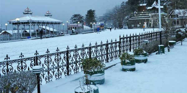
Image Credits – Pinterest
Any information taken from here should be credited to Skymet Weather
