
January is all set to end on a surplus note for the three hilly states, owing to the month long heavy spells of rain and snow. The major contribution came from the recent spell which started from January 20 up till January 22, increasing the precipitation percentage up by a humongous figure.
Snowfall over the hills start much earlier, wherein the month of October witnesses snowfall over the higher reaches of the region. The mid and higher reaches witness precipitation, both in the form of rain and snow in November. However, December and January are the peak months across all the heights. The weather activity continues up till the first half of February.
The pan India rainfall for the month of January is 19 mm. More than 40% contribution comes from the northern hills in terms of rain and snow. However, there has been a backlog across all the hilly states in December. Even January wasn’t performing well except Jammu and Kashmir which has given satisfactory numbers.
The last spell which had initiated on January 20 gave widespread rain and snow with heavy at few places and moderate over many places. During these three days, rains and snow completely wiped out the deficiency across the hills. As of today, the trio of hilly states are in surplus, with Jammu and Kashmir and Uttarakhand having large excess and Himachal Pradesh above the average.
As of today, Jammu and Kashmir is surplus with more than double settling at 105%, Himachal Pradesh stands at 11% and Uttarakhand at 51%. It is not very common to see all the three states performing good simultaneously.
It was the year of 2012 when the month of January ended with a little above average across all three hilly states. Jammu and Kashmir, Himachal Pradesh and Uttarakhand were rain and snow surplus by 26%, 15% and 2%, respectively. Contrary to this, 2016 and 2018 were worst performing years across all the three hilly states. In 2016, Jammu and Kashmir, Himachal Pradesh and Uttarakhand were deficit by 64%, 81% and 90%, respectively. And in 2018, Jammu and Kashmir, Himachal Pradesh and Uttarakhand were highly rain and snow deficit by 95%, 91% and 66%, respectively.
The pictorial representation below will give a much better understanding: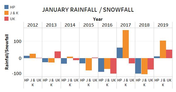
We are still left with one of week of January and as per Skymet Weather, it would be an eventful week, with more weather activity in offing. The rain and snow activity would be minimal across all the three hilly states. Before and after these dates, there would be intermittent light to moderate activities.
January 24 and 25 would witness fairly widespread rain/snow with light spells. January 26 onward, the activity would start receding and would be minimal on January 27 and 28. January 29 onward, there will commencement of light rain activities at isolated places which would continue till month end. The last two days, i.e. January 30 and 31 would witness fairly widespread rain/ snow activities with moderate spells.
It is safe to say that like 2012, this year of 2019 would also end on a surplus note and it could even be better than that in term of average because the activity will not seize as such. Adding to this, the part of surplus might get consumed in the coming week because the remaining week would not have the normal activity which is otherwise supposed to be really heavy.
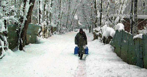
Image Credit: Statesman
Please Note: Any information picked from here must be attributed to skymetweather.com
