

Updated on Dec 23, 2017: Storm Kai Tak has further weakened and is no longer a threat to Malaysia. However, some rainfall activity is expected over the region now. The system is currently over Gulf of Thailand and is expected to move towards Andaman Sea. However, the system will continue to be weak.
Meanwhile, southern parts of Andaman and Nicobar Islands should brace for some heavy showers on December 24 and 25. However, rains will be on the lower side for the northern parts of Andaman and Nicobar Islands.
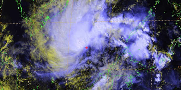
Updated on Dec 21, 2017: Storm Kai Tak continues to linger in the South China Sea close to the Malay Peninsula. The system has now become a depression and in the next 24 hours, is expected to hit the Malay Peninsula giving heavy rains over the region.
Thereafter, the system will weaken further due to its contact with landmass. Also, the system will also move towards the Andaman Sea around December 24 and 25 which will result in heavy rains over the Andaman and Nicobar Islands.
Now, another system has come up in the Pacific Ocean and has become a Tropical Storm named Tembin. The system will follow a similar track and is headed towards Philippines. This system is stronger than Kai Tak and has the potential of intensifying into a Cat 1 storm as well.
However, due to the presence of this system in proximity of Kai Tak, the possibility of Kai Tak intensifying further are quite bleak. This means that Kai Tak may not move further than the Andaman Sea and dissipate there itself.
Meanwhile, hefty rains are expected over North Andaman and Nicobar Islands while moderate rains are likely over the southern parts of the Islands.
Published on Dec 20, 2017: Tropical storm Kai Tak has already given hefty rains in Philippines. Moreover, due to the storm, several people have lost their lives while many continue to remain missing. Flooding rains caused inundation in many areas along with landslides in many areas.
Now, this system is still lingering in South China Sea. However, now Kai Tak is expected to head towards the Malay Peninsula as well as parts of Vietnam. After the storm crossed Philippines, it weakened into a depression, however, it regained strength after entering the open waters.
[yuzo_related]
The system is expected to continue churning in the open sea for another two days where conducive conditions including low wind shear, sea surface temperatures between 28 and 29 degrees exist. Thus, the system will continue to maintain its strength and may get slightly stronger as well.
Currently, the storm is moving at a speed of 80-85 kilometers per hour. Now, the system will head towards the Malay Peninsula and will reach the region around December 22. Thus, heavy rains with some kind damage to eastern parts of Malaysia. At the time of its contact with landmass, the system may again weaken and may become a depression or even a well-marked low-pressure area.
Thereafter, around December 24, the system is expected to regenerate into the Andaman Sea and may strengthen during that time. At the moment, the dynamics of the system are indicating the possibility of the storm recurving towards Myanmar. However, the possibility of the system moving westwards towards Tamil Nadu cannot be ruled out.
While most parts of the country will observe a dry Christmas, the Andaman and Nicobar Islands are likely to witness flooding rains during this period, all because of the notorious and unpredictable Storm Kai Tak.
Image Credit: NullSchool, JTWC
Please Note: Any information picked from here must be attributed to skymetweather.com
