
Updated on September 19, 2018: Monsoon 2018: Low pressure forms in Bay of Bengal, Depression in next 24 hours
As expected, the cyclonic circulation in Bay of Bengal has induced a low pressure area. The system can be seen marked over east-central Bay of Bengal and adjoining areas.
With the system travelling in favourable weather conditions, it is likely to become more organized and intensify into a Depression during the next 24 hours. The low pressure area is most likely to move in west-northwest direction towards the East Coast, to be precise towards the coast of North Andhra Pradesh and South Odisha during the next 24-36 hours.
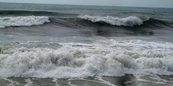
With this system in Bay, sea conditions would be rough to very rough over south, central and north Bay of Bengal and along and off the East Coast from Andhra Pradesh to West Bengal. Fishermen and locals are advised not to venture into the sea.
By Thursday, we can expect heavy to very heavy rain with some extremely heavy spells over Odisha, North Coastal Andhra Pradesh and parts of Telangana. In fact, Gangetic West Bengal, Jharkhand, Chhattisgarh, Nagaland, Manipur, Mizoram and Tripura would also see some good rainy spells, with heavy spells.
Updated on September 18, 2018: Low pressure to form in Bay as a parting gift from Monsoon, rains likely over most parts of the country
A cyclonic circulation has formed in the east-central Bay of Bengal and is expected to get organized in the next two days or so. In the meantime, the remnants of the strongest storm of 2018, Mangkhut as a low pressure area is moving across China. The system is expected to move towards Myanmar before finally going into the Bay of Bengal.
When the system reaches the Bay of Bengal, it is likely to merge with the existing circulation, further strengthening it into a low pressure area in the next 48 hours or so. In fact, there are chances that the system may see further intensification into a well marked low and even a depression while it remains at sea.
The weather system is expected to affect the coastline of West Bengal first along with Odisha, Andhra Pradesh. The peripherals of the system will bring rainfall over Tamil Nadu, Jharkhand and Bihar as well. Even Northeast India will see some good showers with isolated heavy rains during this time.
After crossing coast, the system will have a long journey of about four to five days over land. The moment the system moves inland, it is expected to affect Karnataka, Madhya Pradesh, Maharashtra along with Telangana.
The weather system will further move westwards and give rainfall over Gujarat and Konkan and Goa along with some parts of Rajasthan as well.
By next week, when the system is close to Rajasthan, the northern parts of the country will brace for some moderate to heavy rains with a few extremely heavy showers due to its interaction with the Western Disturbance which will prevail over the Western Himalayas.
Therefore, parts of Delhi, Punjab, Haryana, and Uttar Pradesh along with Rajasthan will see some good showers. Due to these rains, Monsoon withdrawal will also be arrested hence being delayed further.
Image Credit: wikipedia
Please Note: Any information picked from here must be attributed to skymetweather.com
