
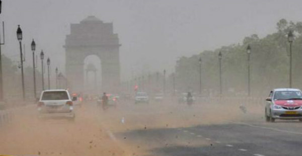
After a long dry spell, pre-Monsoon activities have once again resumed over northwestern plains including Delhi-NCR. Most places of Punjab and Haryana saw light to moderate rain and thundershowers during the wee hours of Monday, however, it escaped Delhi-NCR.
Currently, a trough is extending from Central Pakistan to Odisha across Haryana and Delhi, which will be responsible for these pre-Monsoon activities.
[yuzo_related]
Due to the easterly/southeasterly winds coming from Bay of Bengal, moisture is increasing over the area and temperatures are also crossing 40 degrees.
Yesterday, Palam observatory recorded its maximum temperature at 42.9˚C, while Safdarjung observatory recorded its day temperature at 41.6°C. Ayanagar and Ridge also recorded their maximum temperatures at 41.6°C and 40.1°C, respectively.
Now, we expect maximum temperatures to drop by few degrees over Delhi-NCR region including Noida, Gurugram, Faridabad and Ghaziabad. All these places have been suffering from hot weather conditions since a long time, relief is in sight for people living in and around Delhi.
Therefore, conditions are becoming favorable for few more spells of rain and thundershowers over Delhi-NCR during next 24-48 hours. However, intensity of these rains will not be much.
According to Skymet Weather, on and off pre-Monsoon activities are likely to continue over Delhi-NCR region for next few days, till the onset of Monsoon. The intensity of rains is also likely to increase after June 10.
Image Credit: Dainik Bhaskar
Any information taken from here should be credited to skymetweather.com
