
Unlike every year, rain and snow made quite an early appearance over the hill of North India this season. Usually, the first spell of snowfall occurs around Christmas or New Year but this time, a good spell of rain and snow enthralled us around December 9 only.
In fact, the weather activity during those 2-3 days was able to surpass the monthly average for Jammu and Kashmir and Himachal Pradesh. However, the performance of winter rains has been disappointing thereafter.
[yuzo_related]
Though January saw on and off spells of rain and snow, but they were not enough to even reach near the average mean. Thus, the region was largely rain deficit with Jammu and Kashmir observing a rainfall deficiency of 95%, Himachal Pradesh by 91% and Uttarakhand by 66%.
February too began on a disappointing note, but it seems that the scenario is all set to change. Weathermen are predicting a promising week ahead for Jammu and Kashmir, Himachal Pradesh and Uttarakhand. This spell would probably be able to make up for the shortfall so far.
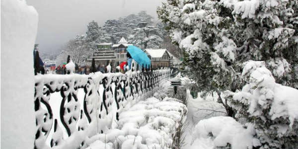
This will also be the best time for tourists to visit the famous hills stations of Srinagar, Pahalgam, Gulmarg, Shimla, Manali, Dalhousie, Kufri, Auli, and Nainital to witness snowfall. Probably, this would be last good spell of the season.
Click the image below to see the live lightning and thunderstorm across the Western Himalayas
Holy destinations such as Badrinath, Kedarnath, and Vaishno Devi are also expected to witness heavy rains and thundershowers, with chances of snowfall. Higher reaches of the hilly states also stand a chance of avalanche, putting armed forces on alert.
According to Skymet Weather, a fresh Western Disturbance is approaching the Western Himalayas. It is touted to be an active system, which would start affecting Jammu and Kashmir by the evening of February 10. The intensity and spread would increase by February 11, as parts of Himachal Pradesh and Uttarakhand would too start recording the weather activity.
Rain and snow intensity may peak on February 12, wherein moderate to heavy rain and snow would lash all the three hilly states. This weather activity is expected to continue on February 13 but with reduced intensity as the system would start clearing away the region. Remnants of the system would continue to give one or two spells of rains on February 14 as well.
This will not be all as another Western Disturbance would start affecting Jammu and Kashmir by February 15. Though it will not be as strong as the previous one but it would surely enhance the rains and snow activity again over Jammu and Kashmir, Himachal Pradesh and Uttarakhand on February 15-16.
IMAGE CREDIT: Makemytrip.com
Any information taken from here should be credited to skymetweather.com
