

Two low pressure areas, in quick succession are likely to form over Bay of Bengal (BoB). Both these weather systems are making way to the northern and central parts of BoB from East Asian countries. Subsequently, both these ‘lows’ are expected to move inland and keep the monsoon rainfall, moderate to intense over eastern, central and western parts of the country in the remaining days of September.

The 1st low pressure area is likely to form on 24th September, during later part of the day. Presently, a cyclonic circulation is marked over Gulf of Martaban and adjoining Myanmar region. The system is partly over land and remaining over the open waters of the gulf and therefore expected to gain energy to become more marked.
This low pressure will form over Northeast Bay and later shift over north and central parts of Bay on 25thSeptember. Low pressure is likely to move west northwestward and cross South Coastal Odisha and North Coastal Andhra Pradesh on 26th September.
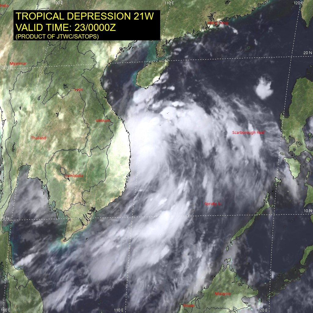
The 2nd weather system is currently located over Vietnam and neighborhood. It is presently placed as a deep depression ( Tropical Depression 21W), centered about 350km southeast of Da Nang (Vietnam). This weather system is nearly a tropical storm, moving west northwestward and will weaken shortly to a depression over Laos and later to a well marked low pressure area over central region of Thailand.
On 25th Sep, as a deep cyclonic circulation, the weather system will enter Gulf of Martaban and subsequently become a low pressure area over central and north BoB on 26thSep. The last low pressure of September will retrace the same path as followed by the previous one. It is expected to cross Odisha-Andhra Pradesh coast on 27thSep.
Month of September has already witnessed 3 active monsoon systems in quick succession. Two more low pressure areas, waiting in the wings, will take it to record 5 during the tail end of monsoon month.
There is already a cyclonic circulation over South Rajasthan and Gujarat and yet another one over Chhattisgarh. The following two will also track across Odisha, Chhattisgarh, Madhya Pradesh, Maharashtra and Gujarat. The peripheral of these systems will also influence weather activity over Telangana and Rajasthan.
Commensurate with extended weather activity, delay in commencement of withdrawal of monsoon is quite imminent. It possibly will roll over to 1st week of October from West Rajasthan. Late withdrawal happened during 2019 and 2020 also. Withdrawal during these 2 years commenced on 09thOctober and 28THSeptember respectively.
