°C
Current temperature
5:30 AM, Jan 01, 1970 Temp (Min/Max)
°C
°C
 Humidity
%
 Rainfall probability
%
 Wind speed
km/h
()Hourly
7 Days
15 Days

Weather buddy
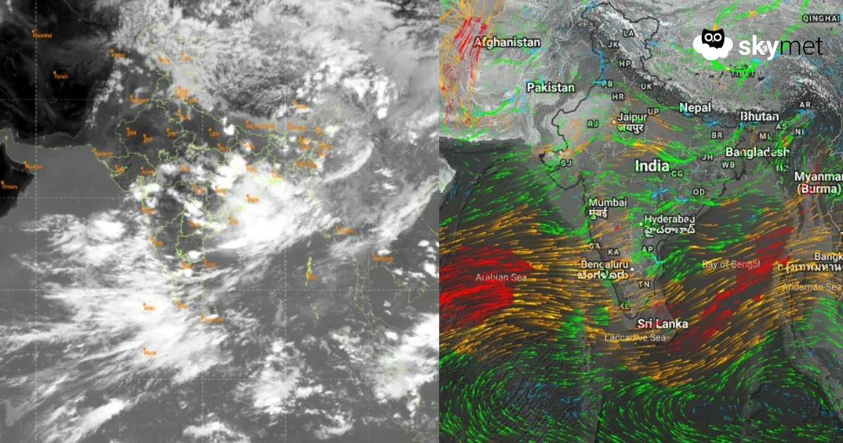
Over the next 15 days, we'll see a gradual decrease in temperature after day 26 with an average low of around 28°C. The highest temperatures are expected to range between 34-39°C from June 22nd onwards, marking the start of a heat wave period that lasts until July 1st. This is not anticipated to be a severe heat wave as daily highs do not exceed 45°C. Expect considerable rainfall starting from day 28 due to thunderstran and overcast conditions, with notable downpours on the final two days of our forecast window. Wind speeds will moderately increase towards the end, averaging around 19 km/h by July 1st. Keep an eye out for changes in weather as we progress through this period!


Rainfall probability

Wind speed

Humidity
Sunrise/Sunset

Moonrise/Moonset


Weather buddy
Today's weather presents a consistent trend of cloudiness throughout the day. Morning temperatures will range from 28°C to 38°C, with humidity levels between 47% and 76%. A slight breeze at around 22 km/h accompanies these conditions. Evening brings a marginal increase in temperature, peaking between 34°C and 39°C, coupled with higher humidity of 44% to 79%, and an expected rainfall of 10 mm. The wind speed will reduce slightly to about 14 km/h. As night falls, the temperature is set to drop between 27°C and 32°C, with higher humidity at 66% to 82%. The cloud cover remains minimal but steady, with a slight decrease in rainfall to around 3 mm. The wind will pick up slightly to approximately 16 km/h. Overall, the day will be characterized by warm temperatures and significant cloudiness, with varying levels of precipitation expected during the evening.
Temp (Min/Max)
CLOUDY Humidity
61%
 Dew Point
24°C
Highly Humid
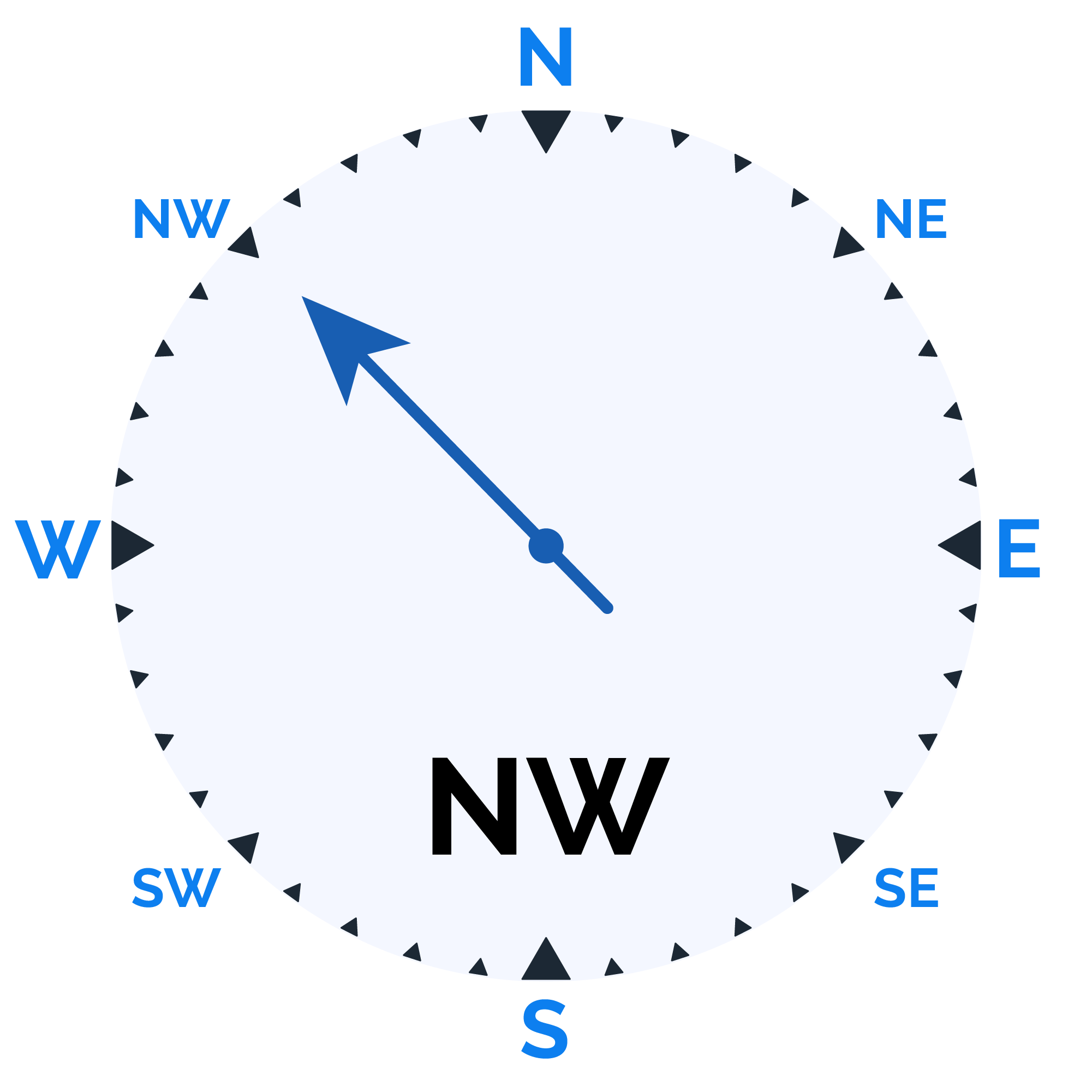
Wind speed
28 km/h
Wind Speed