Share Of El Nino Grows During Monsoon 2026

KEY TAKEAWAYS
- ONI has reached the La Niña threshold, with a short and weak event likely before returning to ENSO-neutral in early 2026.
- CPC forecasts show a rising probability of El Niño developing later in 2026, introducing uncertainty for the next monsoon season.
- All four Nino indices have dipped below -0.5°C for the first time since Feb 2025, signalling earlier-than-expected La Niña establishment.
- Negative IOD and an active MJO phase may support cyclogenesis, including the development of Cyclone Senyar over the Indian seas.
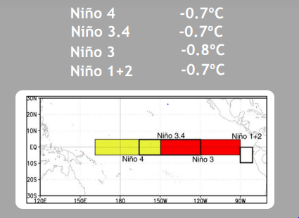
Nino indices are measured over a large area in the equatorial Pacific Ocean. Prominently, four Nino indices are monitored through a range of data collection platforms, including space-based sensors and ocean interactive buoys. Nino 4 is the farthest in the Central Pacific and Nino 1+2 is closest to the American coast, which witnesses large fluctuations. Somewhere in the middle is the Nino 3.4 region, known for El Niño/La Niña monitoring, tracking, and predicting ENSO. This is the region that observes steady and gradual changes in ocean surface temperatures. The Oceanic Nino Index (ONI), which is the three-month running mean of SST anomaly in the Nino 3.4 region, is the principal measure and indicator for determining the presence or absence of El Niño/La Niña.
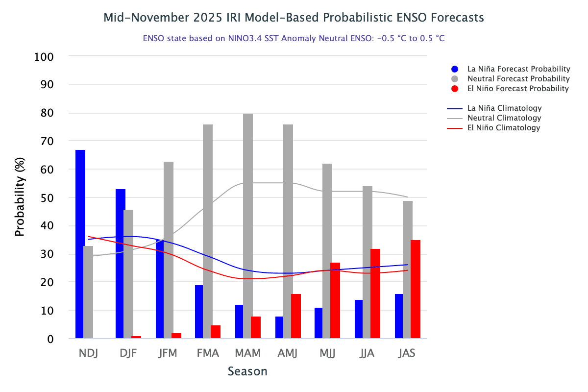
Latest data shared by the WMO indicates a 55% likelihood that sea surface temperatures in the equatorial Pacific will cool to La Niña levels between September and November 2025. The transition has already begun, and the ONI for the quarter Aug–Sep–Oct has reached the threshold mark of -0.5°C. A short and weak La Niña episode is expected, followed by ENSO-neutral during the spring and early summer of the Northern Hemisphere. The WMO predicts a transition from La Niña to ENSO-neutral during early 2026, with minimal chances of El Niño development before or during the monsoon season. WMO forecasts indicate that the monsoon season is unlikely to be negatively impacted by a conflicting El Niño event, and the return to ENSO-neutral may be favourable. Earlier, Skymet had shared this same perspective, consistent with the International Research Institute for Climate and Society. However, the latest CPC Probabilistic and IRI Model-Based Probabilistic ENSO Forecast leaves some uncertainty, and the monsoon verdict may not be easy to decode.
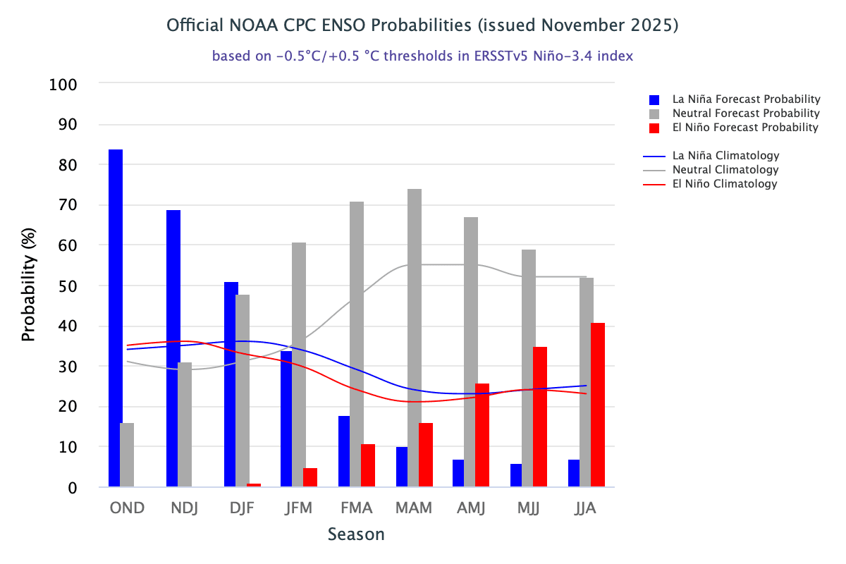
The CPC ENSO Probability Forecast issued in Nov 2025 points toward an increasing El Niño component—from 20% for Apr–May–Jun to 35% for Jul–Aug–Sep. This is a substantial rise and must be watched carefully. The forecast resembles “Evolving El Niño” conditions during the monsoon season. Historically, evolving El Niño years such as 2014 and 2018 adversely affected the Indian Summer Monsoon Rainfall (ISMR). At the same time, these are still early days, and model predictability degrades with longer lead times. A close watch is needed to track any dubious behaviour of the 2026 monsoon.
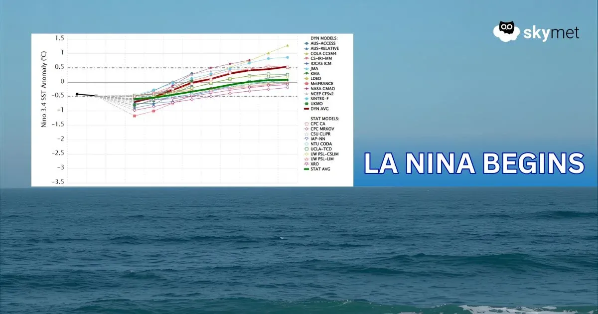
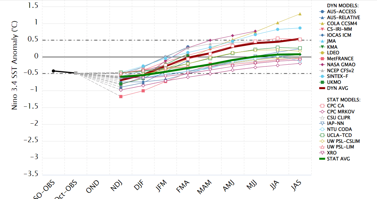
ENSO: Dynamical and statistical models for SST in the Nino 3.4 region do not align consistently, and their historical skills also vary. Model performance generally weakens with longer lead times, and results are most reliable when closest to the forecast period.
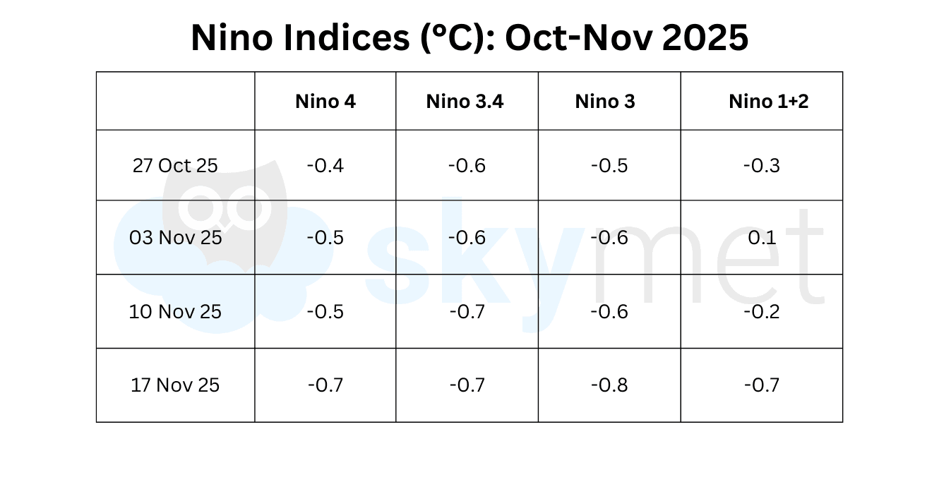
All four Nino regions have shown a significant fall. For the first time since Feb 2025, all are below the threshold mark of -0.5°C. The Nino 3.4 anomaly, the marker for ONI, has remained below the -0.5°C threshold for five consecutive weeks. The La Niña event may establish earlier than expected.
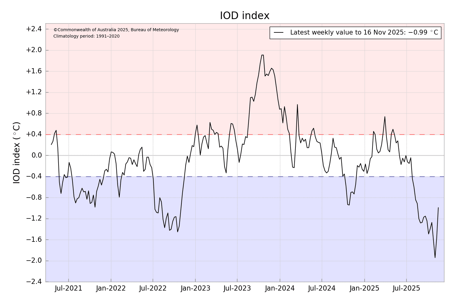
IOD: The negative Indian Ocean Dipole continues. The Bureau’s model predicts that the negative IOD will weaken during November, returning to neutral in December. The index value dropped last week, with the IOD at -0.99°C for the week ending 16 Nov 2025, compared to -1.57°C on 09 Nov 2025. The eight-week trend matches the typical IOD life cycle and aligns with most global models.
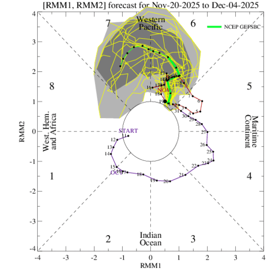
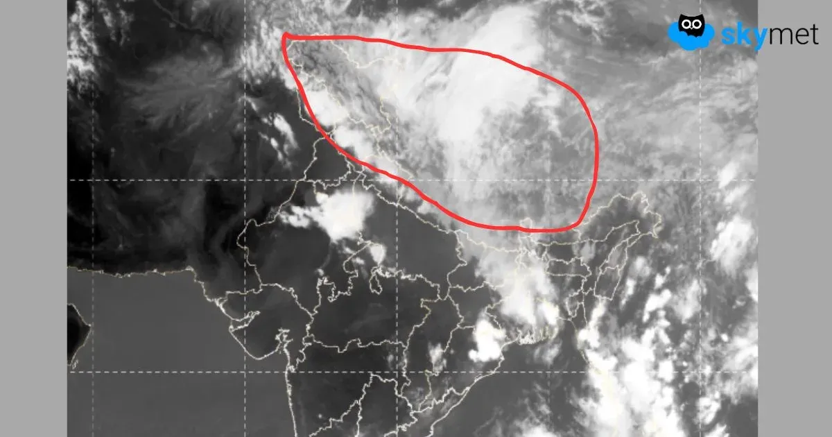
MJO: There is disagreement between the dynamical model RMM forecasts and its extended version. The extended range RMM solutions show the MJO eventually regaining amplitude and resuming eastward propagation across the Western Pacific. Currently, the Madden–Julian Oscillation is positioned over the Western Pacific and is likely to remain in Phase 6 & 7 through Nov 2025. The pulse is expected to amplify, remaining favourable for cyclogenesis over both the Pacific and Indian Seas.
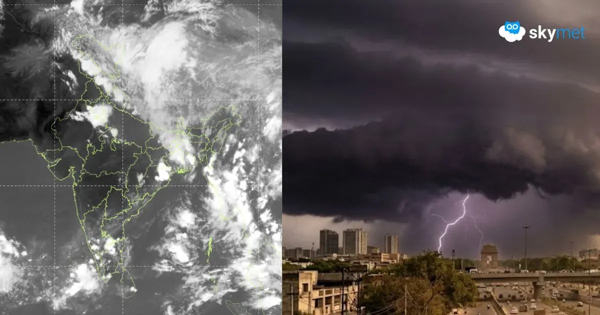
The MJO is supporting convective activity over the Indian seas. The likely cyclonic storm ‘Senyar’ could pose a risk to the East Coast at the start of next week. Cyclones forming during this period have a history of landfalling or skirting the coastline. Through late November, chances of development are higher across the Indian Ocean on both sides of the equator.