Monsoon Withdrawal Gets Stalled : Long Pause Likely

Southwest Monsoon commenced early withdrawal from West Rajasthan on 14thSep 2025. It has retreated from complete Rajasthan, Punjab, Haryana, Delhi, Northern Mountain States, nearly whole of Gujarat, parts of West and North Madhya Pradesh and west Uttar Pradesh. The line of withdrawal passes through Veraval, Bharuch, Ujjain, Jhansi, Shahjahanpur and foothills of Nepal. The withdrawal from all these parts is either before time or just on time. However, further withdrawal may remain ‘in limbo’ and long pause is likely before resuming.
Weather conditions have reversed over plains of North India and it is back to square one. Easterly wind stream, rise in humidity and appearance of sheet clouds are all indicating change in the pattern. Now, even rainfall is likely over the northern plains today-tomorrow and possibly through the week itself. Scattered rains are likely to visit all those areas where the withdrawal of monsoon has been announced earlier. Going by the norms, rains can always come back over such areas but mostly it is a brief and mild activity. The likely wet spell is expected to go on without any firm dates for complete cessation of weather activity.

सैटेलाइन इमेज: Himawari
A series of weather systems are responsible for this scenario. The remnants of weather system from the West Pacific have travelled to the Bay of Bengal, across Vietnam, Thailand and Myanmar. It is nearly continuous and the baton is being handed over from one to the next, before the previous system completes its life cycle.
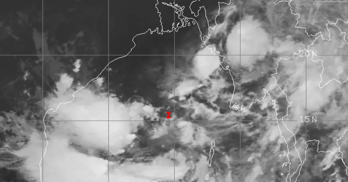
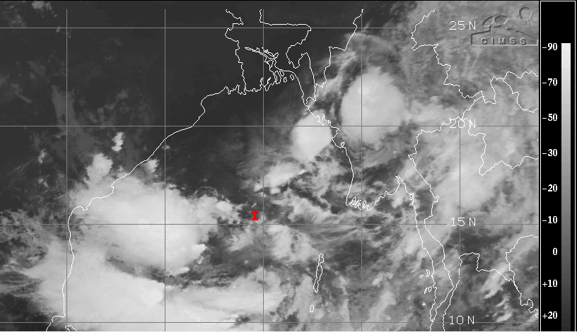
Remnant of one such system has traversed the entire stretch from east to west and is currently marked as a low pressure area over Gulf of Kutch and Saurashtra region. This system is likely to meander over the area for the next about three days and move to the Northeast Arabian Sea in the deeper waters, later. During this period, it is likely to become more marked and may even intensify to a depression. Along side, another weather system is brewing in the Bay of Bengal. Under the influence of a cyclonic circulation over North Andaman Sea and adjoining East-Central Bay of Bengal, a low pressure area has formed. It is centered around 15.6°N and 89.6°E. This low also will gain strength over the sea and later move inland.
Under the impact of these two systems, the monsoon activity will prolong and cover large parts of the country. The rains are likely over West Bengal, Odisha, Bihar, Jharkhand, Chhattisgarh, Telangana, Andhra Pradesh, Maharashtra, Madhya Pradesh, Uttar Pradesh, Delhi, Punjab, Haryana, Rajasthan, Gujarat and Konkan & Goa, including Mumbai, over the next one week, albeit in a staggered manner. Therefore, the process of further withdrawal will cease with for the time being. It may recommence after a ‘break’ of at least ten days or so.


