
May 29, 2017 08:30 AM: Deep Depression intensifies into Cyclone Mora, Monsoon 2017 to reach Kerala soon
The deep depression over east-central Bay of Bengal has intensified into tropical cyclone Mora. With the system still travelling in deep sea, Mora is likely to strengthen further into a severe cyclonic storm during the next 12 hours.
The system is presently centered at Latitude 17°N and Longitude 91.3°E, around 680 km southsoutheast of Kolkata and 580 km southsouthwest of Chittagong, Bangladesh.
Mora will continue to track north northeastwards and cross Bangladesh coast between 91°E and 92°E near Chittagong by May 30. With this, light to moderate rains with squally winds are likely to lash coastal parts of West Bengal including Kolkata during the next 48 hours.
Live status of Lightning and thunder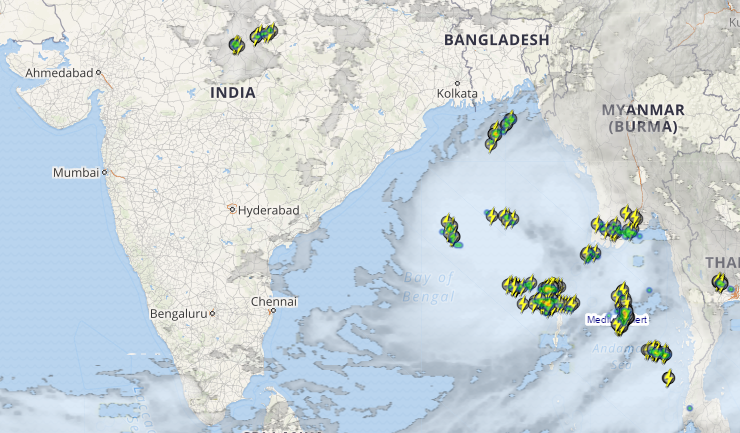
Meanwhile, Northeast India is gearing up to witness heavy to very heavy rainfall by May 30-31. Few places may record isolated heavy showers as well.
In wake of this tropical storm, Southwest Monsoon is likely to progress further into some parts of southeast Arabian Sea, Maldives area, some more parts of Comorin area, southwest Bay of Bengal and east central Bay of Bengal, remaining parts of southeast Bay of Bengal and some parts of west central and northeast Bay of Bengal during next 24 hours.
With westerly winds are also strengthening and likely northward shift of the shear zone, Southwest Monsoon will make onset over Kerala and parts of northeastern states during the next 24-48 hours.
May 28, 2017 01:30 PM: Depression forms in Bay, deep depression soon; Monsoon 2017 inches closer
The weather system which has formed in the Bay of Bengal was a well-marked low-pressure area until the late night hours. However, during the morning hours, the system has intensified into a depression. The system is currently marked over central Bay of Bengal.
The system is currently at latitude 14,5°N and longitude 89.5°E, about 900 km nearly south-southeast of Kolkata and 890 km south-southwest of Chittagong. The system is expected to move north-northeastwards and cross Bangladesh coast between longitude 91.0°E and 92.0°E during the next 48 hours.
During the next 12 hours, the system is likely to intensify into a deep depression. Thereafter, in the subsequent 24 hours, conditions are favourable for further intensification. Thus, a cyclonic storm may form in the Bay of Bengal. This cyclone is likely to be named as Mora.
This system will be responsible for bringing Southwest Monsoon over the Kerala region.May 28, 2017 09:30 AM: Depression likely in Bay of Bengal, Monsoon 2017 inches closer
The low pressure area over southeast Bay of Bengal has got more marked and is now sustaining a strength of well marked low pressure area. It is presently prevailing over east-central and adjoining west-central and southeast Bay of Bengal.
According to Skymet Weather, conditions are favourable for its further intensification into depression during the next 12 hours. Thereafter, as the system will continue to travel in deep sea, it can further intensify into a deep depression in subsequent 24 hours. However, whether it will transform into a tropical cyclone or not, we have to wait and watch.
Also Read: Monsoon 2017 covers more parts of Bay of Bengal, Kerala next
The system will now be tracking north-northeastwards towards Bangladesh coast. It is likely to cross Bangladesh coast by May 30, giving heavy to very heavy rainfall over coastal areas of the country.
Meanwhile, in India, northeastern states of Nagaland, Manipur, Mizoram and Tripura (NMMT) will record heavy to very heavy rainfall.
Not only this, the system has also aided the strengthening of westerly winds and northward shift of shear zone. With this, conditions are also getting favourable for the progress of Southwest Monsoon into some parts of South Arabian Sea, entire MaldivesComorin area and South Kerala during the coming 2-3 days.
During that time, it will also cover NMMT region along some more parts of southwest and east-central Bay of Bengal, remaining parts of southeast Bay of Bengal.
May 27, 2017 12:30 PM: Monsoon 2017 advances further as low pressure area in Bay gets more marked
The low pressure area over southeast Bay of Bengal and adjoining Central Bay of Bengal practically remains stationary. However, cloud cover and atmospheric conditions are indicating that the it has become more marked.
The system has pulled the Monsoon current further advanced into more parts of Bay of Bengal. Now, the Northern Limit of Monsoon (NLM) is passing through Latitude 5°N/ Longitude 76°E, 8°N/83°E, 10°N/ 86°E, 14°N/ 92°E and 16°N/ 95°E.
Also read:Southwest Monsoon to hit Kerala by May 29
According to Skymet Weather, the low pressure area is likely to intensify into a well-marked low pressure area during the next 24-48 hours.
Weather models are even predicting that this system may strengthen into a depression and thereafter, into a deep depression. But weather it transforms into tropical storm, we need to wait and watch.
As per weathermen, the system will continue to move into northerly direction and then into north-northeasterly.
May 26, 2017: Low pressure area forms in Bay of Bengal, to pull Monsoon 2017 further
For last several days, a cyclonic circulation has been persisting over southeast and adjoining west-central Bay of Bengal. After getting more marked, the weather system has now induced a low pressure area over southcentral Bay of Bengal.
Further, weather models are indicating towards its gradual intensification into a well-marked low pressure area during the next 24 hours.
According to Skymet Weather, this system will be crucial in pulling the Monsoon current further over India. “Southwesterly winds are already strengthening due to formation of this low pressure, which will lead to advancement of Monsoon into some more parts of Bay of Bengal in next 24 to 48 hours,” said Mahesh Palawat, VP-Meteorology, Skymet Weather.
At present, the Northern Limit of Monsoon (NLM) is passing through Latitude 5°N/ Longitude 80°E, Latitude 8°N/ Longitude 87°E, Latitude 13°N/ Longitude 92°E and Latitude 16°N/ Longitude 95°E.
The low pressure will continue to move in northerly direction initially and will then track north-northeastwards. The system is expected to reach Bangladesh coast by May 30.
In all this, the weather system will spare the East Coast of India and will not give any weather over the Indian coastal areas ofTamil Nadu, Andhra Pradesh or Odisha.
Weathermen are of view that since the system is still travelling in deep sea, chances of it intensifying into a depression are still bright. However, it is a fast moving system, which may hinder its further intensification.
But in both the cases, Bangladesh will receive heavy to very heavy rain and thundershowers. On May 31, northeastern states of India will also record moderate to heavy showers at many places.
Thereafter, as the system moves into land, it is likely to degenerate rapidly by June 1.
Image credit: The Telegraph
Any information taken from here should be credited to skymetweather.com