Remnants Of Cyclone Ditwah Drowns Chennai: City Gets Heaviest Rainfall Of Season

Key Takeaways
- Cyclone Ditwah weakened into a depression but took an unusual southwestward re-curvature, moving dangerously close to Chennai.
- Extremely heavy rains lashed Chennai, with Nungambakkam recording 172 mm — the season’s highest.
- The city is under red alert, schools are shut, flights cancelled, and several areas face flooding and waterlogging.
- Rain intensity will reduce after 24 hours, with broader clearance expected from 7 December 2025.
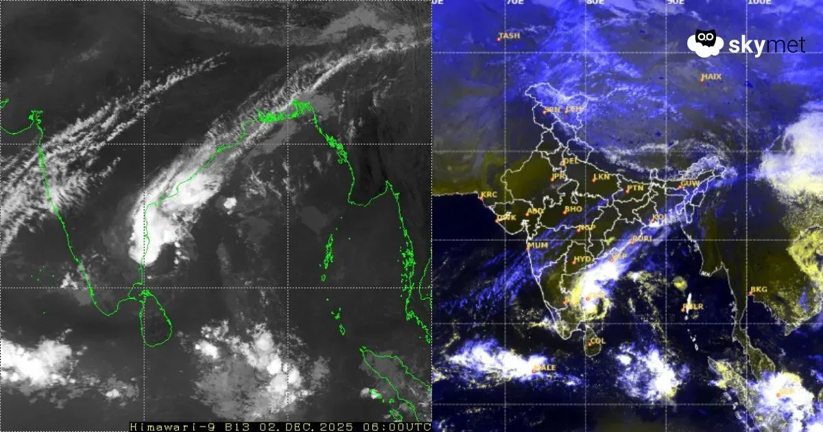
Cyclone Ditwah, while tracking northward, had weakened to a depression yesterday over the Southwest Bay of Bengal. Earlier, the system had spared the capital city Chennai from the storm fury, even while reaching east abeam of the city. In the past 24 hours, the depression has taken a very unusual course and recurved southwestward, heading closer to the coast of North Tamil Nadu, in the proximity of the capital city. The depression has moved very slowly, with a speed of about 3 km/h in the past six hours and is centered nearly east abeam Chennai. The coastline is merely 25 km away from the center of the depression. It is likely to continue the same track for the next 12 hours or so and gradually weaken over the same region later.
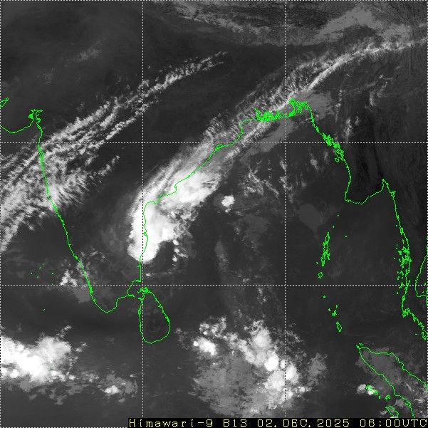
The depression has pounded extremely heavy rains over Chennai and its suburbs in the past 24 hours. The rains were non-stop, accompanied by thunderstorms and strong winds. The rains are expected to continue, almost relentlessly, for the next 12 hours and slow down thereafter. The regional observatory at Nungambakkam has received rainfall in excess of 172 mm in just 24 hours — the heaviest of this season so far. The airport observatory at Meenambakkam registered 90 mm during the same period. Heavy rainfall is continuing.
The city has been placed under a ‘red alert’ for the next 24 hours. All schools and colleges have been ordered shut today. Flight operations were partially disrupted at Chennai Airport, and six flights were cancelled. Roads and streets have been waterlogged, and low-lying areas inundated. Storm surge associated with the depression is raising waves over and above the astronomical tide of about four feet. High tide occurred this morning at 5:39 am and is likely to come up again in the evening at 6:31 pm. Exercise caution for huge splashes of water over and above the shoreline.
Chennai, Tiruvallur and Kancheepuram districts are at higher risk of inclement weather conditions. Heavy rains will lash Chengalpattu, Tambaram, Mahabalipuram and Vellore as well. The intensity and spread will reduce considerably after the next 24 hours. However, light to moderate normal monsoon rains will continue till the weekend. A broad clearance is expected on and after 07 December 2025.


