Rainfall Intensity To Reduce Over Delhi - Light Weather Activity On Weekend


Light Scattered Rainfall Occurred in Delhi, Image: AI-Skymet
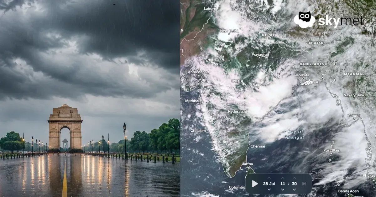
Most parts of Delhi witnessed decent showers for the second consecutive day. The spread of rainfall was good over Noida, Ghaziabad, Gurugram, and Faridabad as well. Base station Safdarjung recorded 20 mm rainfall. Najafgarh and Ridge observatories also recorded 26 mm and 28 mm, respectively. The highest rainfall of 41 mm was registered at Pitampura. The scale and expanse of showers will reduce as the week progresses.
There were three factors working in tandem to lash the capital city and suburbs over the last two days. There was a cyclonic circulation over Haryana and adjoining Rajasthan. A western disturbance was actively moving across the mountains. The seasonal monsoon trough also remained in close proximity to Delhi/NCR. All three features will remain in place for another 24 hours and relax thereafter. However, the spread and intensity of rainfall will show a substantial reduction starting today itself.
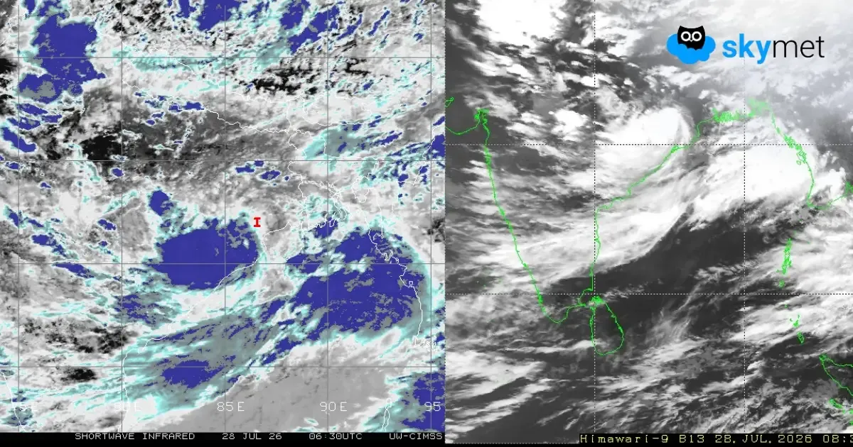
There is a fresh low-pressure area lying over the northwest Bay of Bengal. This system will move inland across Odisha tomorrow and track further through the central parts. This will drag the monsoon trough far to the south of Delhi, decelerating the monsoon activity over and around the national capital. In lieu, the western states like Rajasthan and Gujarat will come in for a fresh wave of monsoon bursts on the approaching weekend.
The southward oscillation of the monsoon trough will still have the potential to sweep some parts of Delhi with moderate showers in the evening hours today. Between 4th and 7th September, there will be a constant weakening of weather activity, becoming the least by the weekend. The mercury will rise once again, likely breaching the 35°C mark between 6th and 8th September. The next round of uptick in weather activity for the Delhi region can be expected during the first half of next week.