Depression Over Arabian Sea: No Immediate Threat Of Storm

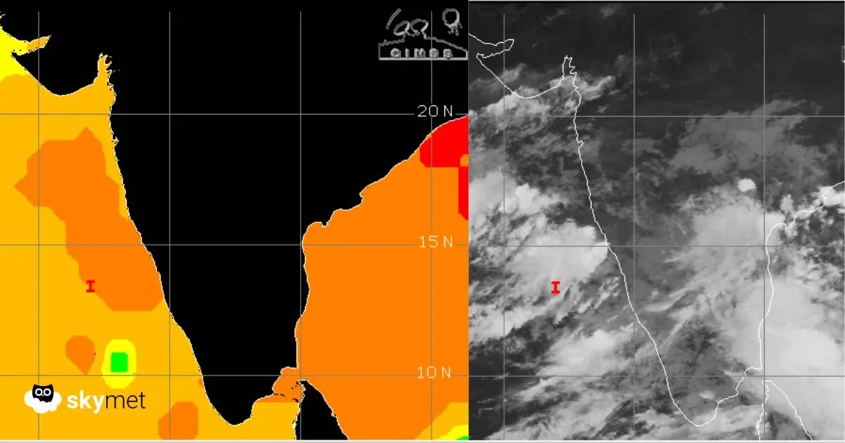
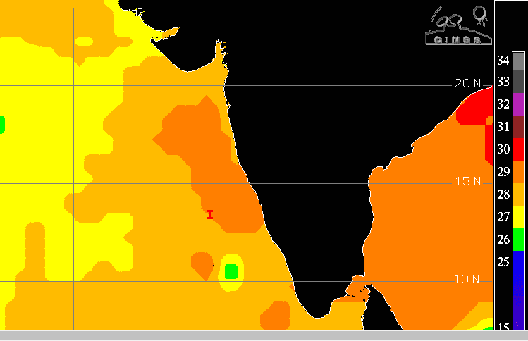
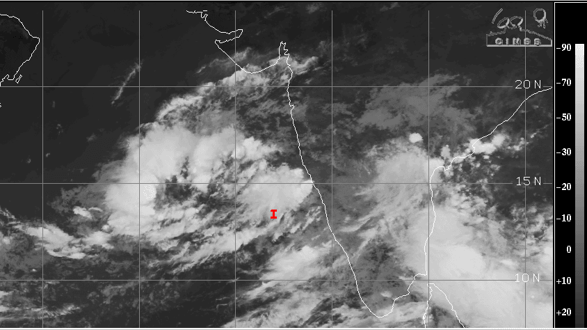
Satellite Image, Courtesy: CIMSS
The well-marked low-pressure area over the Arabian Sea has intensified into a depression. The weather system has moved north-northeast in the past 12 hours and is centered around 13.5°N and 71°E, about 450 km west abeam Mangalore, over the east-central and adjoining southeast Arabian Sea. It is likely to retain its track and move closer to the Indian coastline. There is no likelihood of the depression strengthening into a storm, at least in the next 48 hours. However, the system needs to be constantly watched for its track and intensity.
The environmental analysis reveals marginal conditions for development into a significant cyclone over the next couple of days. There is persistent moderate to high vertical wind shear, diffluent outflow, and borderline sea surface temperatures of 27°–28°C. Pockets of high temperatures are shallow, and cooler waters prevail in the deep ocean, away from the coast. Under such a scenario, the potential for development into a cyclone in the next 48 hours is low.
As the system moves further northeastward, the peripherals of the depression will reach closer to Konkan & Goa, South Gujarat, and the Saurashtra Coast bordering the Arabian Sea. The cloud bands will even travel deep up to Coastal Karnataka and Kerala. Scattered heavy rainfall is expected over Konkan & Goa and Gujarat over the next 4–5 days, at least till 28th October.
Unseasonal rains are likely over Mumbai and suburbs, Sindhudurg, Ratnagiri, Alibag, Dahanu, and Goa. The rains along South Gujarat and Saurashtra will include Surat, Vapi, Valsad, Navsari, Bharuch, Bhavnagar, Mahua, Jafarabad, Somnath, and Veraval. The sea condition will be very rough over most parts of the Arabian Sea, off the Western Ghats extending up to the deep waters of the ocean. Strong winds, turbulent waters, and high-intensity waves are likely during this period. It is advised that no venturing over this part of the ocean should be undertaken.
The weather system will be kept under close watch to assess any further development. Sea condition variability becomes high. Climatologically, the timings and region favor the formation of a tropical storm. Such systems do carry the potential of swirling towards the Gujarat Coast without giving adequate warning. Utmost caution needs to be observed until an ‘all clear’ announcement.