Low Pressure Area To Form Over Arabian Sea: Accelerate Northeast Monsoon Over South India

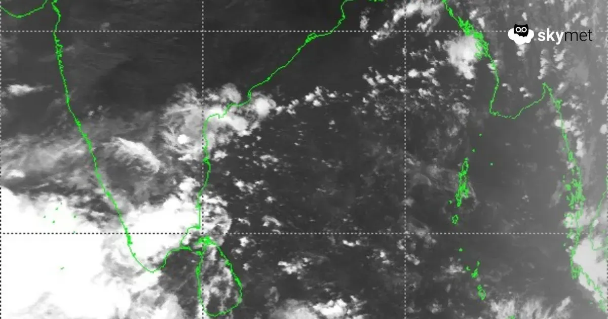
Live Sat Image, Courtesy: Himawari
There is a cyclonic circulation over the Southeast Arabian Sea and adjoining Comorin region, next to the equatorial Indian Ocean. An east-west elongated trough is extending from the west coast of Sri Lanka to the Lakshadweep region, passing through the center of this circulation. Under the influence of this circulation, a low-pressure area is likely to form over the Southeast Arabian Sea and Lakshadweep region in the next 48 hours.
The cyclonic circulation is extending up to mid-tropospheric levels. The well-marked circulation is manifested as cloud clusters over a large area covering the Comorin region, Southeast Arabian Sea, and Lakshadweep. The flock of clouds is extending along the coastline and interiors of Kerala and Tamil Nadu. It has triggered moderate to heavy rain and thundershowers over the southern peninsula, extending up to the coastal parts of Tamil Nadu and south coastal Andhra Pradesh. Kavali, Nellore, Parangipettai, Pamban, and Kanyakumari received moderate rainfall in the past 24 hours, while Tuticorin, Palayankottai, and Cochin received heavy showers during this period. This has favored the onset of the Northeast Monsoon over the southern peninsula, and monsoon activity will hasten further over the weekend.

The low-pressure area is likely to become well-marked soon after inception. Scattered rains are likely over all the sub-divisions of the Northeast Monsoon, namely Tamil Nadu, Kerala, Rayalaseema, Coastal Andhra Pradesh, and South Interior Karnataka. The weather system is likely to become a depression over the south-central and adjoining Southeast Arabian Sea on 20th October. Environmental conditions appear favorable for further intensification. There is a fair chance of the development of another cyclonic storm during the first half of next week. A precise outlook for the storm will be shared after the formation of the low-pressure area. Suffice it to say that the upcoming storm will not pose any threat to the Indian coastline. The cyclone, if it forms, will head toward the Somali coast and the Gulf of Aden during the latter half of next week.
