Low Pressure Likely To Form Over Arabian Sea: Track Away From West Coast


Key Takeaways:
- A low-pressure area may form over the South-Central Arabian Sea around 23rd May 2026.
- A cyclonic circulation is expected to develop first before intensifying into a low-pressure system.
- The system could impact monsoon flow over Kerala, Lakshadweep and the Southeast Arabian Sea.
- Stormy weather risks may increase over the Somali Coast, Yemen, Oman and the Horn of Africa if the system intensifies.
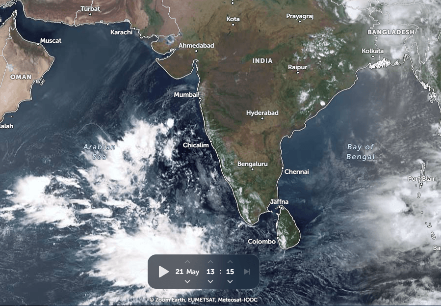
There is a likelihood of a low-pressure area forming over the South-Central Arabian Sea on 23rd May 2026. Currently, there is an extended east-west trough from the south-central parts to the Lakshadweep region in the lower levels. A cloud cluster is also seen with embedded convection over the same area. A cyclonic circulation is expected to form over this region by tomorrow and further turn into a low-pressure area a day later.
There is a lot of diversity amongst the models regarding the formation of the system. Clarity will emerge only after the formation of the low-pressure area. The observation period of the next 24 hours will be crucial, during which the wind pattern may get appropriately organized. If so, the sea environment seems to be favourable for its sustenance and growth.
Such low pressure systems, on intensification, invariably track away from the West Coast. The Somali Coast, Horn of Africa, Yemen and Oman bear the risk of getting struck by stormy conditions in due course of time. These systems also influence the streamline flow of the Arabian Sea. Since the Southwest Monsoon is just round the corner, it may vitiate the desired westerly flow over Lakshadweep Islands, Southeast Arabian Sea, Maldives region, and off the coast of Kerala and Karnataka. Such a scenario reduces rainfall over Kerala and delays the arrival of the monsoon. However, these are tentative situations, and strict observation over the next 48 hours is needed for an authentic forecast.