Well Marked Low Pressure Area Over Bay Of Bengal : Active Monsoon Conditions Continue

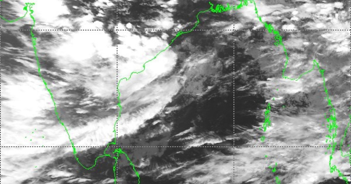
Well Marked Low Pressure Area Over Bay Of Bengal, satellite image
Under the influence of cyclonic circulation over the Northwest Bay of Bengal, a low-pressure area formed over the same region. The system has now intensified to a well-marked low-pressure still over the sea. The cyclonic circulation is extending up to higher levels and tilting southwest with height. This is a pertinent sign of strength. The low pressure will slowly move west-northwest across Odisha in the next 24 hours.
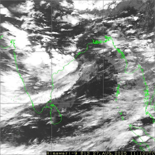
Satellite Image: Himawari
The weather system is manifested as an area of intense cloud clusters covering South Odisha, Andhra Pradesh, Chhattisgarh, Telangana, and Maharashtra. The zone of convergence is extending far ahead of the center of the system. Active to vigorous monsoon conditions are likely over eastern, central, western, and northern parts of the country during this week, albeit in a staggered manner.
Fairly widespread rain and thundershowers are likely over Andhra Pradesh, Telangana, Chhattisgarh, and Maharashtra in the next 24 hours. Heavy rainfall belt will reach most parts of Maharashtra, Madhya Pradesh, and the outskirts of Rajasthan and Gujarat in the subsequent 24 hours. Entire Gujarat, Rajasthan, and Madhya Pradesh will witness heavy rainfall between 29th and 31st August 2025. Parallelly, widespread rains will cover the Indo-Gangetic plains, lashing West Bengal, Bihar, Jharkhand, Uttar Pradesh, Haryana, Punjab, and Delhi during this week. Moderate rain and thundershowers will occur all along the Western Ghats and more so in Konkan & Goa, including Mumbai and suburbs. Most pockets of the South Peninsula will receive scanty rainfall. These will include Tamil Nadu, Rayalaseema, Karnataka, Kerala, and the Lakshadweep Islands. Must Read: Jammu Division Gets Deluged : All Time Record Heavy Rainfall At Jammu-Udhampur
