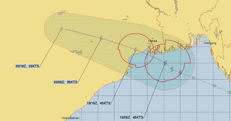
The depression which was in the Bay of Bengal and was supposed to intensify into a deep depression has now become a Tropical Cyclone as per the Joint Typhoon Warning Center. The storm is centred about 200 km southeast of Kolkata in the North Bay of Bengal.
The storm is moving west northwestwards and is expected to cross coast anytime in the late evening hours between Balasore and Sagar Islands as a tropical storm. The system will maintain its intensity for the next few hours at least.
At the moment, the winds are almost to the tune of 80-85 kmph. After making a landfall, the system will weaken but is expected to maintain its status of a Tropical Storm for the next 6-8 hours, thereafter, it will weaken into a deep depression and then into a depression while it moves towards Jharkhand and North Chhattisgarh.
Squally winds are expected over West Bengal Coast and adjoining Odisha. This will give heavy rains over parts of East India, which have been waiting for some rains. Weather will be inclement over West Bengal, Jharkhand, Odisha and Chhattisgarh in the next 24 hours.
It is a very unusual thing, Normally in Monsoon months, it is not common to have a Cyclonic Storm and that too storm is positioned a little north to the usual position. Storms go to Odisha while this one will be tracking west northwestward and affect more of West Bengal region.