

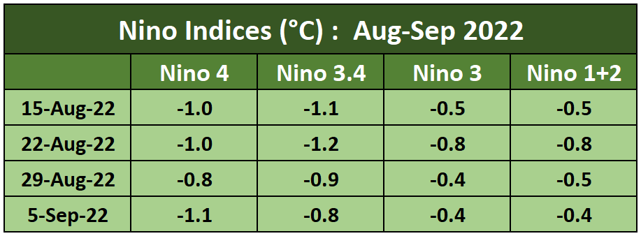
La Nina conditions in the tropical Pacific Ocean have intensified as trade winds strengthened in recent weeks. This is impacting the temperature and rainfall pattern. Nino 3.4 index, the principal indicator of La Nina, had earlier reached close to the threshold of -0.5°C during 1st week of July 2022. However, for the last 5 weeks, renewed cooling of the central equatorial Pacific Ocean has indicated a strengthening of La Nina conditions. Accordingly, the current La Nina will run through the fall of this year and possibly extend to the winters of next year. Therefore, the La Nina event will step into 3rd consecutive winter of the Northern Hemisphere. Conversely, the event will see 3rd successive summers of the Southern Hemisphere.
Back-to-back La Nina events are not uncommon. However, the La Nina event lasting for 3rd year in a row is rarely seen. Such an event is termed ‘Triple Dip La Nina’. It has happened earlier thrice, since 1950, when reliable records were maintained. Earlier occasions were: May 1954 - Sep 1956, May 1973 - May 1976, and July 1998 - May 2001. The current event started in Aug 2020 and is expected to last till Jan 2023.
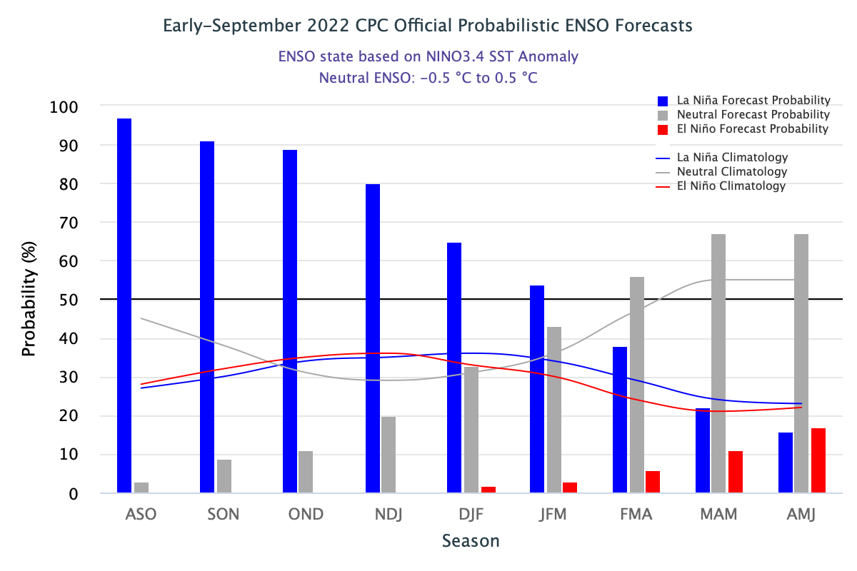
ENSO: Ocean waters seem to retain thermal memory more than the landscape. Sustained cooling across the equatorial Pacific Ocean is controlling the La Nina conditions for a fairly long. Oceanic Nino Index (ONI) based on Nino 3.4 index, is the principal measure for monitoring, assessing and predicting ENSO. During the last 5 weeks, the central Pacific Ocean has remained cooler than the flanks on either side.
Model projections indicate a slow rise of thermal potential over the sea surface and sub-surface of the equatorial Pacific Ocean. Nino 3.4 is expected to remain below the threshold for a couple of months or even longer. La Nina is expected to continue, albeit with decreasing chances from 86% during the Autumn season to 65% in winter 2022-23.
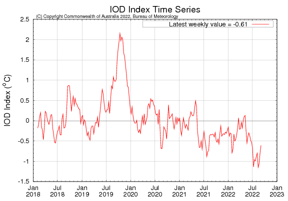
IOD: A -ve Indian Ocean Dipole event is underway. The latest IOD index value for the week ending 05 Sep 22 was -0.61°C. IOD value has risen from the lowest of -1.15°C on 15th Aug 22 to -0.61°C on 05th Sep 22.
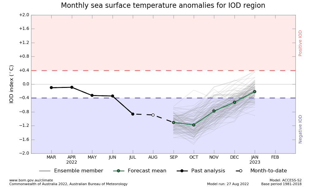
The rise in the index value is against the model projections which show a consistent drop till October. Since the index has been persistently below the threshold mark (-0.4°C) since mid-June and completed 8 weeks, it has qualified to be listed as a -ve IOD event.
MJO: Madden Julian Oscillation was moderately strong in the Western Indian Ocean. However, it is becoming weak having small amplitude and factually becoming indiscernible. MJO is characterized as an eastward moving pulse of cloud and rainfall near the equator that typically recurs for 30-60 days. However, the signal of MJO in the tropical atmosphere may give amiss at times and may not be traceable along the equator. MJO’s effects are more evident in the Indian Ocean and West Equatorial Pacific Ocean. It does have a bearing on the development and strength of the monsoon pattern.
All the naturally occurring climate events like La Nina/El Nino/ IOD/SAM seem to be getting impacted with global warming. These are possibly defying the pattern and predicted timelines under the shadow of human-induced climate change. Apparently, the challenge is growing to keep the predictions accurate and precise.
