Hong Kong Prepares For Super Typhoon 'RAGASA': Chinese Coastline Face Deadly Risk


Image Courtesy: CIMSS
There is a super typhoon ‘Ragasa’ sailing in the Western Pacific, heading for Hong Kong. The severe storm is centered around 20°N and 118°E in the South China Sea. It is moving west-northwest at a speed of about 18 kmph. The system is crossing the 20°N latitude and tracking along a steady bearing to the west-northwest. The storm is described by forecasters as the most powerful on Earth so far this year. It is packed with maximum sustained winds of 185 kmph and gusts up to 230 kmph. The typhoon had earlier crossed between Taiwan and the Philippines, keeping Taiwan at a safe distance to the right. Gale force winds and heavy rains lashed extreme northern parts of the Philippines, claiming three casualties.
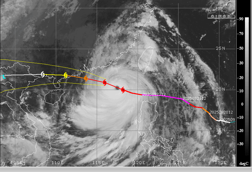
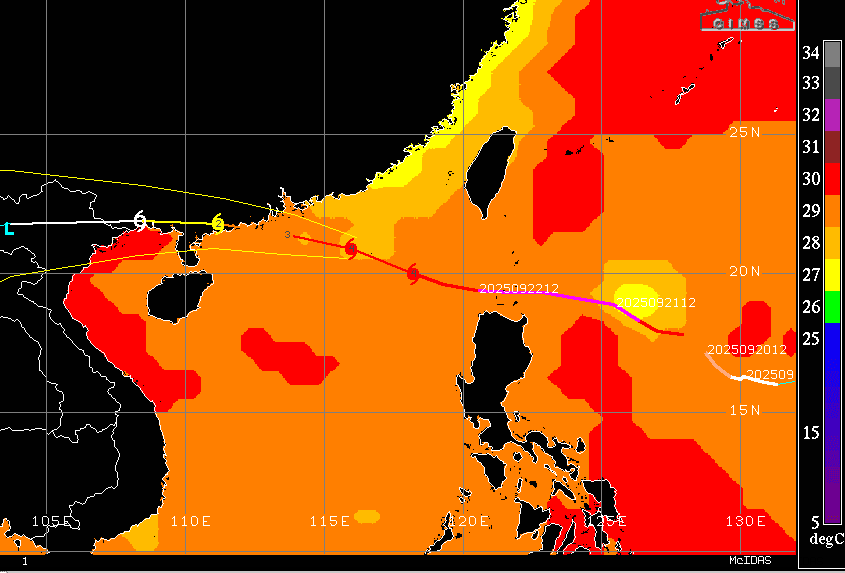
The eye of the storm is the dominating feature and represents the fierce force of the storm. It is showing signs of constriction, down from 25 NM to 19 NM in diameter. Typhoon Ragasa is entering an environment with slightly more wind shear, but the Sea Surface Temperature along the track is very consistent, sustaining the heat potential. The typhoon will veer a little more towards the northwest and will pass seaward of Hong Kong, whipping up gale force winds in excess of 190 kmph. A slight veering of the track may take the storm ashore before it reaches the Luichow Peninsula, slamming into the Chinese coast at nearly 200 kmph. Landfall is likely in the early hours tomorrow, as per local timings.
Once over land, the system will weaken but still maintain its intensity as a storm because of ocean moisture. It will weaken after reaching deep inland over North Vietnam. The storm will dissipate further and weaken into a depression/low pressure before reaching Thailand. Hong Kong has announced the closure of schools and offices. Thousands of people have been evacuated to safe shelters in Shenzhen.
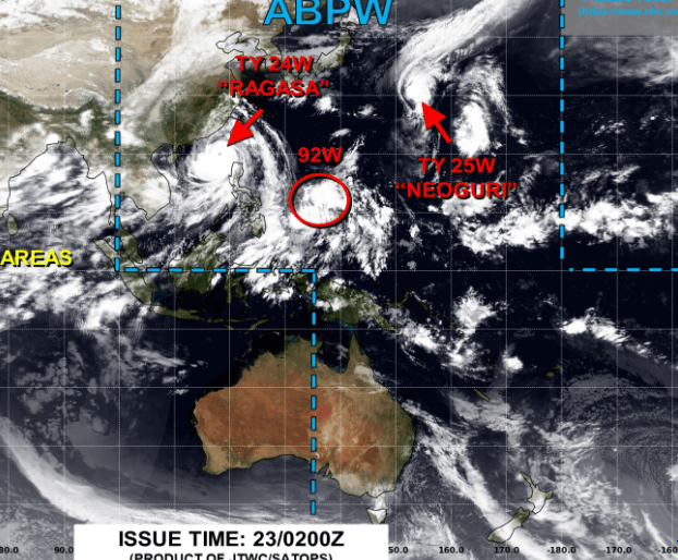
The remnants of such systems keep tracking westward as weak low pressure. Moving across Thailand and Myanmar, they can reach the Bay of Bengal and strengthen again as monsoon depressions. The remnants of the storm will aid the formation of a low-pressure area in the Northeast Bay of Bengal on 25th/26th September. There is another typhoon, ‘Neoguri,’ in the West Pacific, off the Sea of Japan. However, this typhoon will meander over the sea for the next 3–4 days and finally track away from the landmass of Japan and China. It is likely to weaken over the ocean itself as it tracks northward after recurvature.
