Monsoon 2026: El Nino Chances Minimal

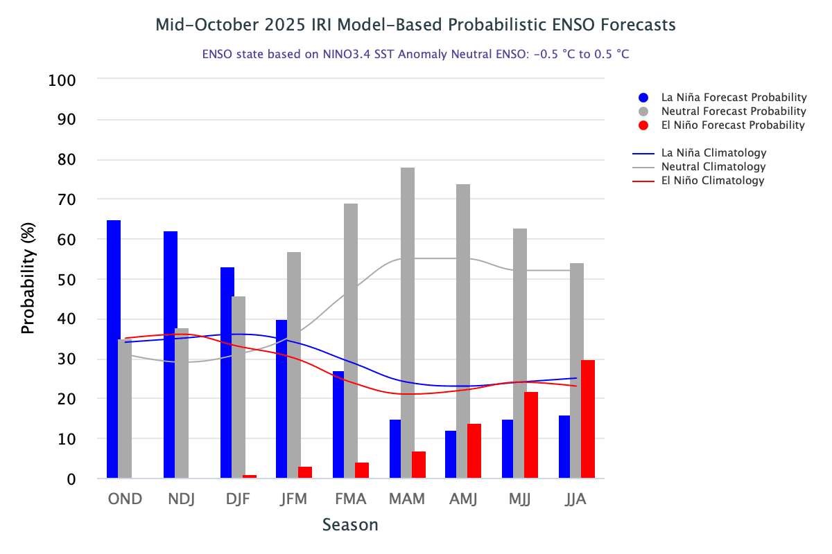
The International Research Institute (IRI) ENSO plume indicates persistence of La Niña conditions through Dec-Jan-Feb 2026 with a reasonable chance of 53%.
Beginning with Jan-Feb-Mar, ENSO-neutral conditions are expected to become dominant once again. In the next six months or so, there will be a quick transition from the current ENSO-neutral state to La Niña, which is likely to have a short stint through the boreal winters. It will be followed by the return of ENSO-neutral conditions that will last till the end of the forecast period. During this time, the chances of El Niño developing remain minimal and, at best, may reach about 30%, which is considered safe for the monsoon. This forecast needs to be viewed with caution, as model skills generally decrease as the lead time increases.
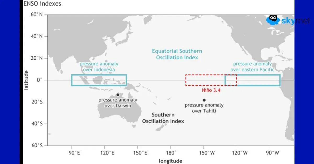
ENSO: The SST anomaly in the Niño 3.4 region during the Jul-Sep 2025 season was -0.28°C. For the month of September alone, it was -0.42°C and lowered further to -0.5°C in October 2025. It has now touched the threshold mark for the first time this season. At this rate, La Niña conditions may appear for the quarter Sep-Oct-Nov itself, as against the earlier expectations for the season Oct-Nov-Dec. As of end-October 2025, both atmospheric and oceanic indicators continue to show ENSO-neutral conditions. The SOI still remains slow to respond favourably for La Niña conditions. The traditional Southern Oscillation Index (SOI) for September 2025 was nearly zero, while the equatorial SOI registered a value of 1.2. For an ideal bonding between ocean and atmosphere to promote La Niña conditions, the SOI needs to rise adequately for the period Oct 2025, for which the readings are awaited.
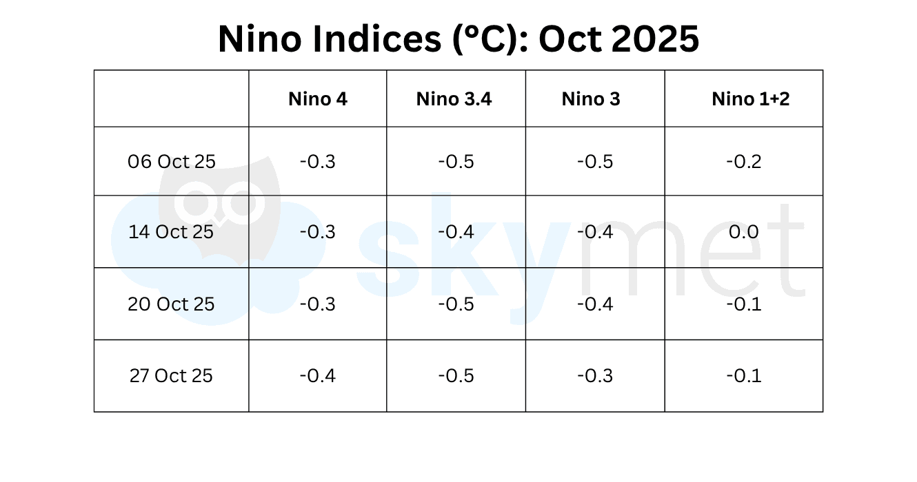
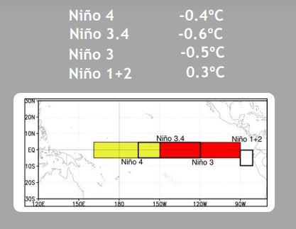
During the last four weeks, mostly below-average equatorial SSTs were present across the central and eastern Pacific Ocean. The Niño 3.4 region, the marker for ONI, has been the coldest part for over six weeks. It has recorded a temperature anomaly of -0.6°C for the second consecutive week, the lowest value since the La Niña period of winter 2025. Niño 3.4 and Niño 3 together hold larger stakes for the occurrence of La Niña or El Niño.
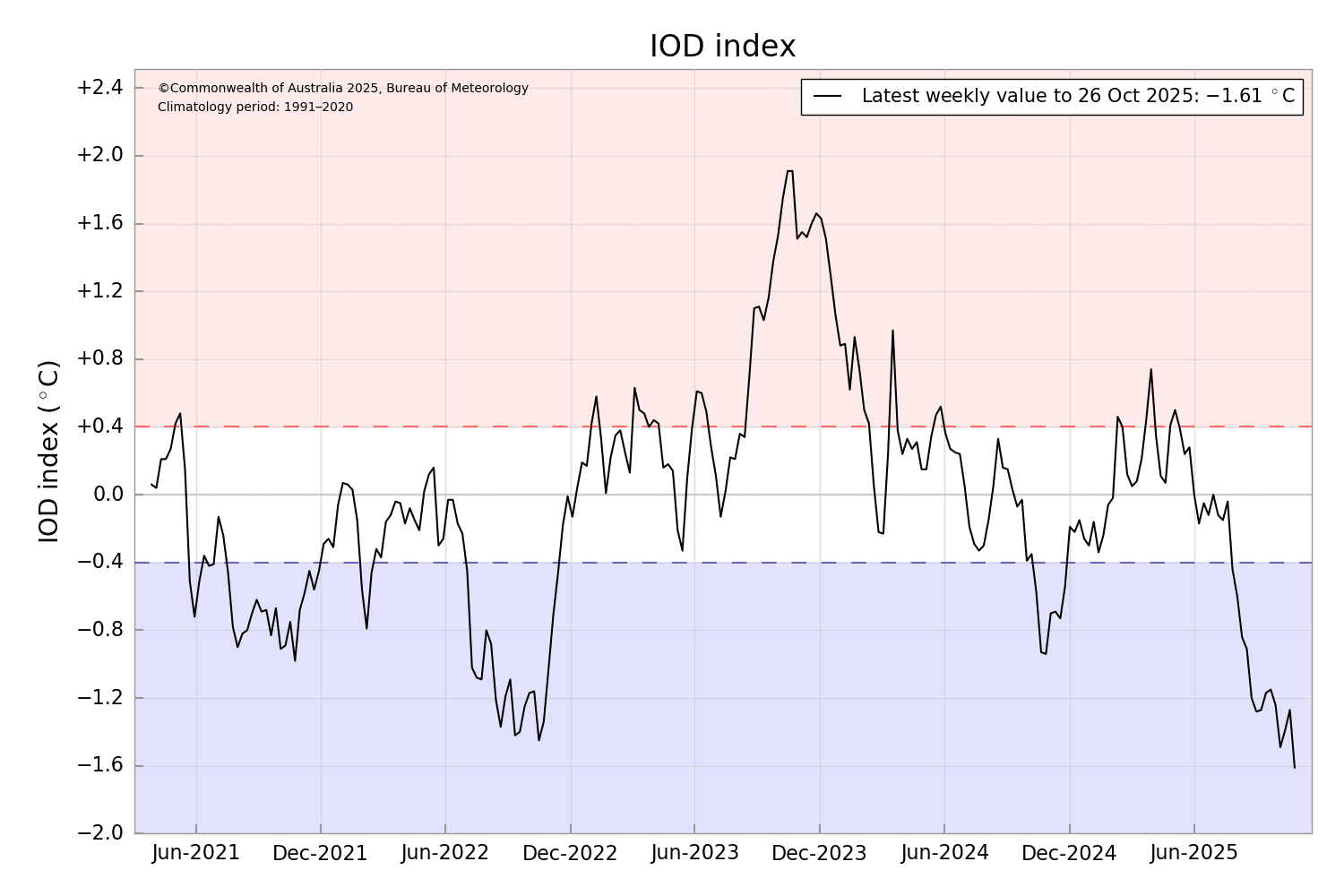
IOD: The Indian Ocean Dipole index has touched a new low of -1.61°C. As per the Bureau of Meteorology, Australia, the negative IOD event remains active, with the latest index value reaching -1.61°C for the week ending 26th Oct 2025 – the most negative value recorded since the Bureau’s dataset began in Aug 2008. The Bureau’s model predicts the negative IOD event to continue through the Northern Hemisphere autumn, with a return to neutral in early winter next year. This is consistent with most international models assessed and typical of the IOD life cycle.
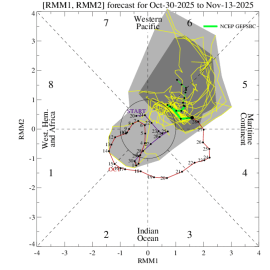
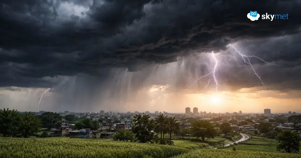
MJO: The Madden-Julian Oscillation strengthened during mid to late October and recently propagated from the Indian Ocean to the Maritime Continent. There was enormous cyclogenesis activity around the globe. In the last ten days of October, two tropical cyclones formed: Somia in the Eastern Pacific (short-lived) and Montha in the Bay of Bengal, which battered the Andhra Pradesh coastline. Another Category-5 hurricane, Melissa, the most powerful storm in the last 147 years, packed with winds of 225 kmph, slammed Jamaica and Cuba in the Caribbean. The Arabian Sea remained under constant watch as a depression lingered for over ten days. The MJO favours tropical cyclone development across the West Pacific during the next two weeks.
The swift transition from La Niña in winter 2026 to ENSO-neutral during spring is a favourable verdict for the 2026 monsoon. The chances of El Niño are minimal during this period. The return of ENSO-neutral conditions, patched with a befitting IOD, may prevent any scare of a conflicting monsoon.