Cyclonic Storm Likely Over Bay Of Bengal: Track And Timelines Remain Tentative

KEY TAKEAWAYS
- A well-marked low-pressure area has formed near the Strait of Malacca and is likely to intensify into a depression soon.
- Weather models support storm formation but remain inconsistent about the system’s future track.
- Atmospheric and oceanic conditions are favourable, though rapid intensification in the next 24 hours is unlikely.
- Historical patterns show November storms often recurve toward West Bengal and Bangladesh, though Tamil Nadu and Andhra remain possible impact zones.
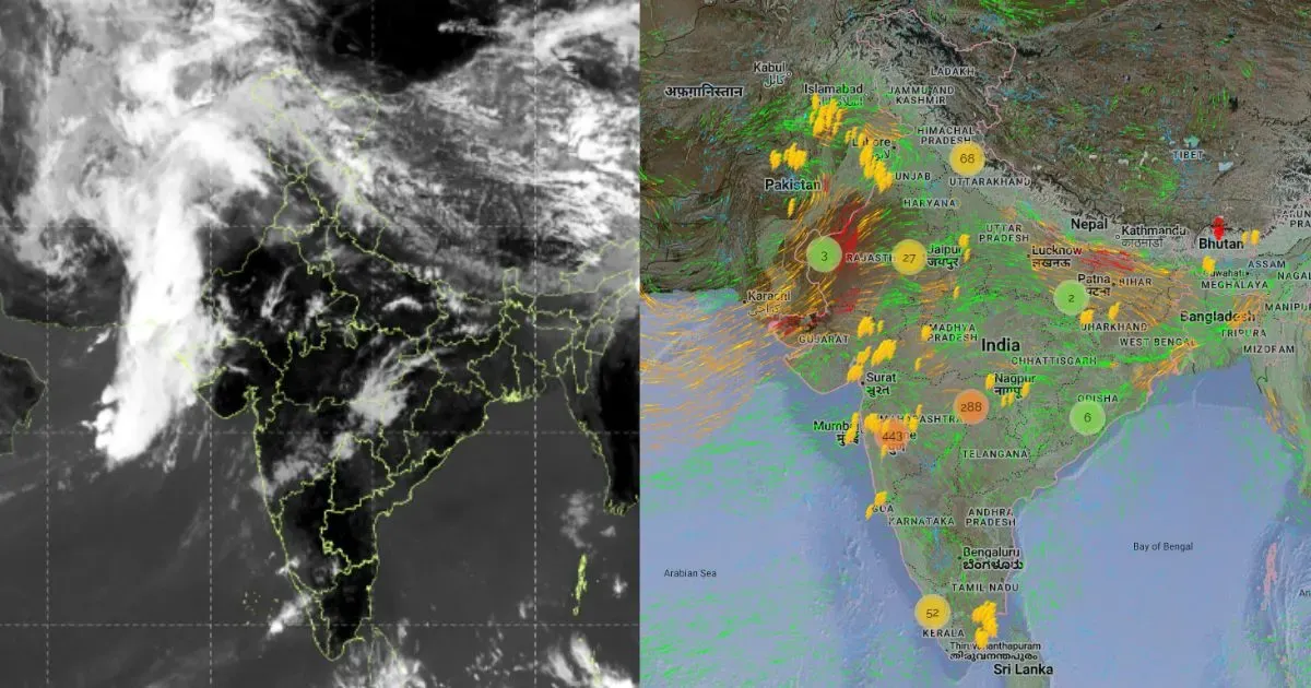
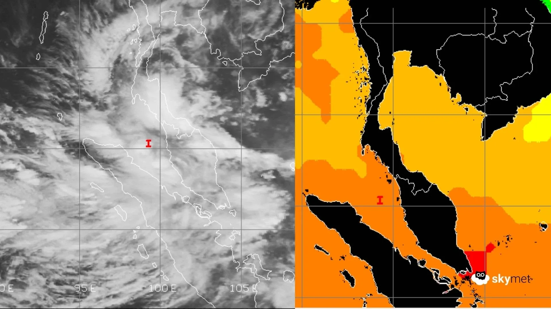
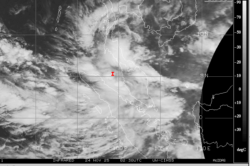
Under the influence of a persisting cyclonic circulation, a low-pressure area has formed over the Strait of Malacca and adjoining Andaman Sea. The system has now become well-marked and is associated with a cyclonic circulation extending up to high tropospheric levels. On course for further intensification, a depression is likely to form over the same area and quickly shift to the Southeast Bay of Bengal and adjoining South Andaman Sea.
There is no clear agreement among various models regarding this system. While the models support the formation of a storm, they remain indecisive about its further movement. The north equatorial region, in close proximity to the Bay of Bengal and Arabian Sea, has been an active basin. A series of low-pressure areas and disturbances have kept the region in turmoil. Any clear verdict about the upcoming storm is unlikely in the next 48 hours. Clarity is expected thereafter, once the system gains latitude and becomes better organized.
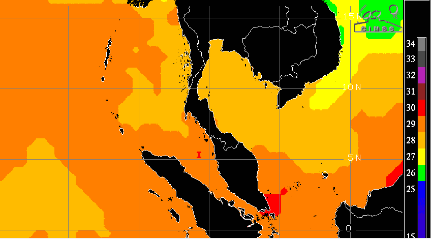
The domain of low-level circulation is well defined. Both oceanic and atmospheric conditions are favourable for intensification. Vertical wind shear is low to moderate, and ocean surface temperatures are warm enough to generate and sustain heat potential. Once better organized, the system will have a long sea travel, giving it inherent potential to strengthen. However, the likelihood of it developing into a cyclonic storm within the next 24 hours remains low.
This will be the second cyclonic storm of the current post-monsoon season over the Bay of Bengal. Earlier, storm ‘Montha’ struck Andhra Pradesh in the last week of October 2025. Storms are often mysterious and frequently defy expected tracks, intensities, and timelines, especially while traversing open ocean waters. Climatologically, most storms in November tend to skirt and recurve toward West Bengal and Bangladesh. However, some do stray and strike the coastline of Tamil Nadu and Andhra Pradesh. A close 48-hour observation window will be essential for precise and confident forecasting.