

Low-Pressure Area Over Jharkhand-West Bengal: Heavy Rains Likely

Key Takeaways:
- The existing low pressure area is likely to move slowly towards the Bihar-Jharkhand-Chhattisgarh tri-junction and linger for a day or two.
- Another cyclonic circulation may develop around August 27 over the North Bay of Bengal and adjoining Odisha-West Bengal coast, potentially triggering a fresh low pressure area.
- Widespread rainfall is likely across Jharkhand, North Odisha, North Chhattisgarh and East Madhya Pradesh, extending into parts of Uttar Pradesh and West Madhya Pradesh.
- The prolonged wet spell may continue into early September, with isolated very heavy rainfall posing a risk of localized flooding and waterlogging.
- Forecast Validity: Next 2 to 3 days.
Advertisement
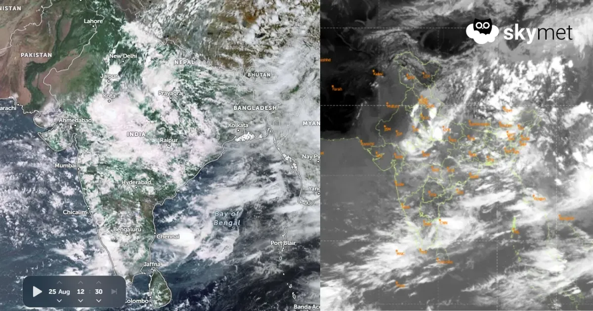
Yesterday’s low pressure area now lies over Gangetic West Bengal, North Odisha and Jharkhand. The cyclonic circulation extends beyond 20,000 feet, tilting southwestward with height. It is likely to move northwestward, albeit slowly, and get placed over the tri-junction of Bihar, Jharkhand and Chhattisgarh. The system is unlikely to move deep inland and is expected to linger over the same area for a day or two.
Advertisement
There is a likelihood of another cyclonic circulation coming up over the North Bay of Bengal and coastal parts of Odisha and West Bengal around 27th Aug 2026. The remnant of the existing low pressure area may retract and merge with the fresh system to trigger another low pressure area in quick succession over the eastern region.
An east-west oriented shear zone is marked along 22°N and is aligned with the axis of circulation of the low pressure area. Under the influence of these two systems, weather activity will be widespread over Jharkhand, North Odisha, North Chhattisgarh and East Madhya Pradesh region.
The extended arm of the main system will reach parts of West Madhya Pradesh and Southeast Uttar Pradesh. The places at risk will include Guna, Gwalior, Tikamgarh, Bhind, Morena, Shivpuri, Neemuch, Rajgarh, Ratlam, Ujjain, Khandwa, Khargone, Dhar and Indore. In Uttar Pradesh, the focus of weather activity will cover Prayagraj, Kanpur, Lucknow, Chitrakoot, Fatehpur, Raebareli, Ayodhya and adjoining regions.
After the reunion of the two weather systems on 27th Aug 2026, a fresh wave of intense weather activity is likely over the eastern states. A prolonged wet spell during the remaining days of August will even spill over to the start of September as well. Isolated places will have very heavy rainfall for a few days. Persistent weather activity for days together may lead to localized flooding and waterlogging in that area.
Most of the eastern and adjoining sub-divisions of central India, outside West Bengal and Odisha, are rain deficient. The extended wet spell will reduce the margins of shortfall, more so for Bihar, which is the extreme deficit pocket in that region.
In the meantime, the northern, western and southern parts of the country will observe the least weather activity, which includes Rajasthan, West Madhya Pradesh, Gujarat, the landlocked sub-divisions of Maharashtra and the South Peninsula.
Trending:



