

Low-Pressure Area To Become Depression: Heavy Rains Over West Bengal, Odisha, Jharkhand, Chhattisgarh

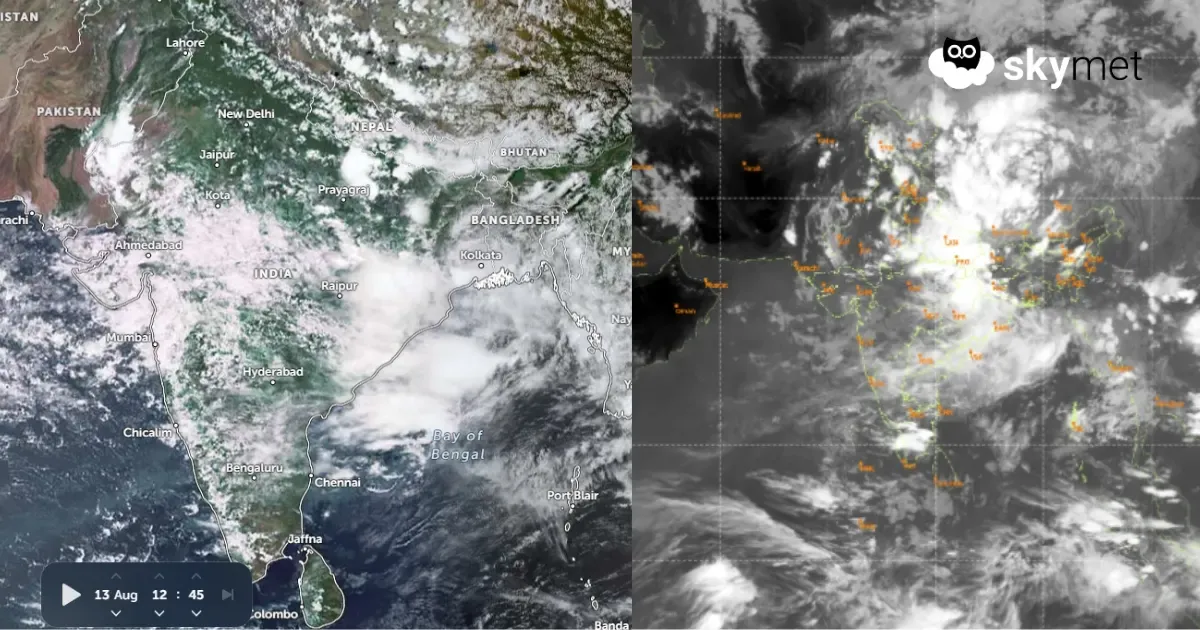
Key Takeaways:
- The depression over coastal West Bengal is expected to move northwestwards across Gangetic West Bengal and Jharkhand.
- Intense rainfall will gradually shift towards Chhattisgarh, East Uttar Pradesh and East Madhya Pradesh around Independence Day.
- East Uttar Pradesh, Bihar and adjoining Himalayan foothills may face very heavy rainfall and localized flooding next week.
- Rajasthan, Gujarat and large parts of western, central and southern India are expected to remain away from the most intense monsoon activity associated with the system.
- Forecast Validity: Next 3 to 5 days.
Advertisement
The well-marked low-pressure area over the North Bay of Bengal (BoB) has intensified into a depression today. The system will move northwest and lie completely over land, covering parts of Odisha, West Bengal and Jharkhand. Unlike its predecessor, the depression is not expected to move into the hinterland of Madhya Pradesh. Therefore, the states of Rajasthan and Gujarat will remain aloof from any fierce weather activity in the coming days.
Advertisement
The well-marked low has lashed parts of West Bengal and Odisha with scattered heavy to very heavy rains. Haldia in West Bengal and Balasore in Odisha recorded 243 mm and 169 mm of rainfall, respectively, in the past 24 hours. Today, the weather activity will be confined largely to Gangetic West Bengal and Jharkhand. The peripheral effect will reach the interiors of Odisha and North Chhattisgarh.
Tomorrow, the intense weather activity will cover some parts of East Uttar Pradesh and the outskirts of East Madhya Pradesh. The tri-junction area of Chhattisgarh, Uttar Pradesh and East Madhya Pradesh will be vulnerable to extreme weather activity. On Independence Day, the intense weather will vacate Odisha, West Bengal and Jharkhand, but the contiguous areas of Chhattisgarh, East Uttar Pradesh and East Madhya Pradesh will witness very heavy rainfall.
Subsequently, the depression will more or less remain stagnant over these parts, and the monsoon activity will shift all along the foothills and Indo-Gangetic plains. Inclement weather activity will reach the foothills of Uttarakhand and Himachal as well during this period.
Strangely, the cyclonic circulation of the weather system will keep meandering over the eastern states, with minor shifts to the left and right. The foothills of East Uttar Pradesh and Bihar, coupled with the foothills of Nepal, bear the risk of very heavy rains during next week. It may lead to a localized flood situation as well.
A break-monsoon condition, as envisaged earlier, may not happen. The eastern end of the monsoon trough is unlikely to shift close to the foothills, which is the foremost requirement for a ‘break’. However, most other parts of the country—the Western, Central and Southern regions—will escape the monsoon fury and will rather lie dormant till the third week of August.
Trending:



