

Low Pressure Area Forms Over Bay Of Bengal: Vigorous Monsoon Conditions Likely

Key Takeaways:
- A low-pressure area over the Bay of Bengal will strengthen monsoon activity across large parts of India.
- Heavy to very heavy rainfall is expected across central and western India over the next week.
- Multiple cities across Maharashtra, Gujarat, Rajasthan, and Madhya Pradesh face flood risk.
- India’s monsoon rainfall deficit has reduced from 40% to 33% and may improve further.
- Forecast Validity: Next 6 to 8 days.
Advertisement
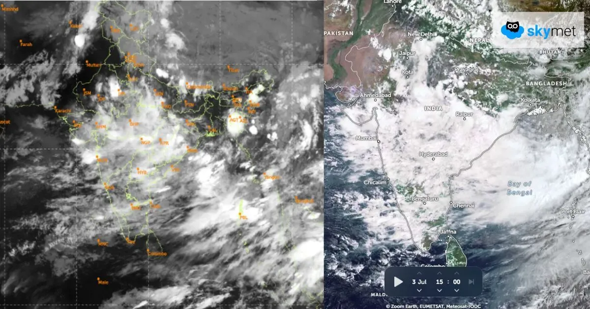
A low-pressure area has formed over the Northwest Bay of Bengal (BoB). It is now placed over the coastal parts of Odisha, West Bengal, and the adjoining BoB. The cyclonic circulation is extending up to mid-tropospheric levels. It is likely to become more marked and move further closer to the coastline. The system will move west-northwest slowly and accentuate the monsoon activity over eastern, central, and western parts of the country.
Advertisement
There are multiple factors joining hands and working in tandem, enhancing the spread and intensity of rainfall over large parts of the country. There is an east-west shear zone in the medium levels extending from South Gujarat to North Odisha, aiding weather activity in association with the low pressure. There is likely to be a week-long intense weather activity spanning across Odisha, Chhattisgarh, Madhya Pradesh, Maharashtra, Gujarat, and Rajasthan, albeit in a staggered manner.
Weather activity has already commenced, and heavy rainfall has been recorded over Odisha, Madhya Pradesh, Vidarbha, and the Konkan region. There is a likelihood of flooding rains over some parts of Madhya Pradesh, Maharashtra, Rajasthan, and Gujarat during the next one week. The cities at risk will include: Mumbai, Dahanu, Alibag, Ratnagiri, Pune, Nashik, Jalgaon, Nandurbar, Dhule, Ahmednagar, Surat, Vapi, Valsad, Bharuch, Ahmedabad, Baroda, Dungarpur, Banswara, Udaipur, Chittorgarh, Jhalawar, Kota, Sirohi, Rajsamand, Khargone, Khandwa, Barwani, Harda, Dewas, Indore, Jhabua, Alirajpur, and Ujjain.
June was rain deficient by a huge 40% rainfall. Courtesy of heavy monsoon bursts in many parts, the deficit has dropped to 33%. The expected vigorous monsoon activity over central and western parts, complemented by heavy rainfall along the Western Ghats, will reduce the shortfall to about 20% over the next one week or so.
Trending:



