

Mumbai Rains To Ease Out Tomorrow: Usual Weather For Next One Week

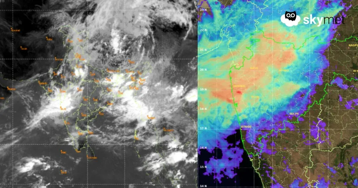
Satellite Imagery: Mosdac.gov.in
Key Takeaways:
- Mumbai has received over 1,100 mm of rainfall during the first eight days of July.
- The city's intense monsoon spell is likely to continue for another day before easing.
- Weakening synoptic systems are expected to reduce heavy rainfall activity across Mumbai and the Konkan region.
- Light and scattered showers may continue even after the prolonged break in intense rainfall.
- Forecast Validity: Next 3 to 5 days.
Advertisement
The capital city, Mumbai, has been deluged with nearly non-stop monsoon bursts, throwing life out of gear. Earlier, there was a total lull as the monsoon got delayed substantially. Finally, it arrived on 23rd June 2026, with a delay of about two weeks from its usual date of 11th June, just short of the most delayed arrival of 25th June 2023. There was complete silence till the third week of June, and the chaos started with the first downpour of over 200 mm on the day of arrival. Subsequently, the deluge started from the first day of July and has continued non-stop till today. The onslaught may extend for another day before resting and taking a week-long break.
Advertisement
The month of July has a track record of being notorious for heavy monsoon bursts. The city had clocked seven years of excess rainfall in July between 2018 and 2024, with an all-time record of 1,771 mm in July 2023, an El Niño year. This July has also started with a bang, and there has been a perpetual downpour every day. The city has received over 1,100 mm of rainfall during the first eight days of the month and is still counting. Yes, a breather is likely, and that too a prolonged one, commencing soon.
The triggers accentuating the rainfall activity along the Konkan region in general and Mumbai in particular are likely to weaken soon. Monsoon bursts are expected to fall silent and give the much-needed break for over one week for recovery. Light and sporadic showers will continue over the city and suburbs following the cessation of intense weather activity.
The weakened low pressure area, the remnant of the first depression of the season, now lies over Northwest Madhya Pradesh and Southwest Uttar Pradesh. This position favours the acceleration of monsoon westerly winds along the Konkan Coast, reinforcing rainfall along the Ghats. The low pressure area is likely to weaken further, and the associated cyclonic circulation is expected to drift towards the foothills of West Uttar Pradesh before finally breaking up over the region. The north-south offshore trough from South Coastal Gujarat to Coastal Karnataka is also losing strength. No fresh monsoon system is likely to develop over the Bay of Bengal during the next few days. All these factors put together will ease the ongoing intense monsoon activity over Mumbai and its suburbs.
Trending:



