Heavy To Moderate Rainfall Over Chennai Likely: Northeast Monsoon Sets In

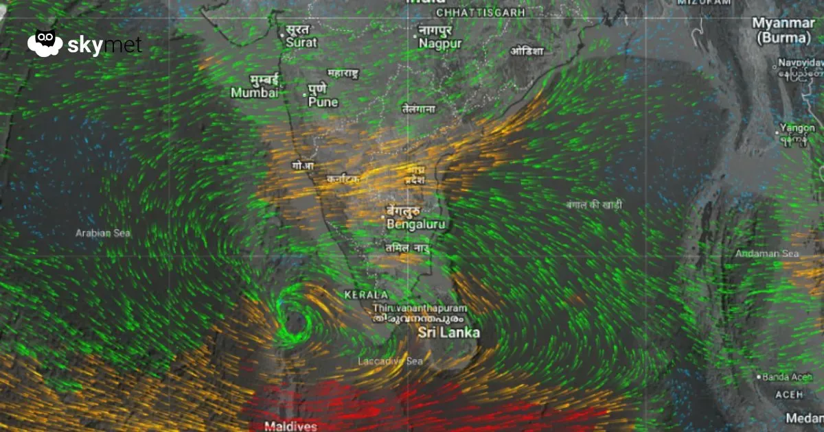
Wind System Circulating Over Southern India, Image Courtesy: Skymetweather.com
The onset of the Northeast Monsoon is manifested as increased rainfall activity along the Tamil Nadu coast in general and the capital city Chennai in particular. Northeast Monsoon easterly winds have been sweeping across the coastline and most parts of the Bay of Bengal. Moderate to heavy showers were witnessed over all the sub-divisions of the Northeast Monsoon across the South Peninsula. The intensity and spread of weather activity will increase along the Tamil Nadu coast and South Coastal Andhra Pradesh.
There is a cyclonic circulation over the Southeast Arabian Sea and Comorin region of the equatorial Indian Ocean. This feature has strengthened the easterly flow over North Coastal Tamil Nadu and adjoining Coastal Andhra Pradesh. Also, a north–south trough is extending from the southern tip of the peninsula to Coastal Andhra Pradesh across the capital city Chennai and its suburbs. This has facilitated the timely onset of the Northeast Monsoon today. Simultaneously, the Southwest Monsoon has completely withdrawn from the country.
There have been no typical Chennai rains so far in the month of October. The average rainfall for October is about 300 mm. The Nungambakkam observatory has recorded about 51 mm of rainfall, while the airport observatory has received a shade higher at 82 mm — halfway through the month. Under the combined influence of the circulation and north–south trough, intense rainfall is likely over Chennai and its suburbs today, during the evening and night. Moderate showers will continue tomorrow as well. Light to moderate rainfall activity will persist during the weekend and early next week. Heavy rains are unlikely next week between 20th and 26th October 2025.
Must Read: Low Pressure Area To Form Over Arabian Sea: Accelerate Northeast Monsoon Over South India
