Northeast India has been seeing some intense rainfall activities which has led to floods in parts of Assam as well as Meghalaya. More effect has been seen over western parts of Assam adjoining Sikkim and Sub Himalayan West Bengal.
The flood situation is unlikely to improve in the next three days at least. In fact, we can expect the floods to persist over Assam, parts of Meghalaya and its adjoining areas for at least the next three days.
Improvement can be seen around June 24 and 25, as another system in Bay of Bengal is expected to develop in the Bay of Bengal which will alter the wind pattern. Thus, rains will reduce only then and significant relief is likely by June 27 or so.
The state of Rajasthan has been witnessing intense weather activities. Rains shifted from Gujarat to southern parts of Rajasthan as remnants of Biparjoy also moved. Western parts of the state thereafter saw some rainfall activities.
In fact, during the last 24 hours from 8:30 am on Sunday, Ajmer recorded 132 mm of rain, Bhilwara 42 mm, Bundi 35 mm, Chittorgarh 33 mm, and Udaipur 26 mm.
During the Monsoon period, these systems are not able to shift from west to east for a longer period. Therefore, this system which is over the northeastern parts of Rajasthan and adjoining northern parts is expected to stay and only a marginal shift is expected towards more of the Madhya Pradesh region by tomorrow.
For the next three days, we can expect heavy to very heavy rainfall over parts of northern Madhya Pradesh including Gwalior, Guna, Tikamgarh, Datia, Sheopur, and Ashoknagar. For Rajasthan, cities like Kota, Dholpur, Sawai Madhopur will be seeing heavy showers.
Southwest monsoon has literally struggled to establish itself over South Peninsula this season so far. In the first phase, the monsoon travels from south to north to cover the complete peninsula in about 10 days' time. By 15th June, it reaches South Coastal Gujarat, the entire Maharashtra, half of Chhattisgarh, Bihar, Jharkhand and the entire Odisha & West Bengal.
From its earlier date of 10th June, as per revised dates, the monsoon reaches Mumbai on 11th June. The western arm of the monsoon is stalled since 11thJune when it reached Ratnagiri and has not moved an inch thereafter. Even the eastern arm is stagnant for the last week.
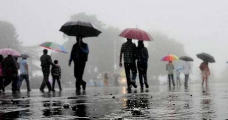
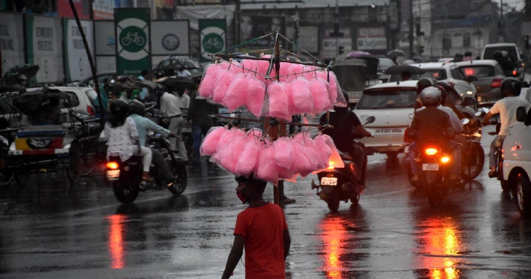
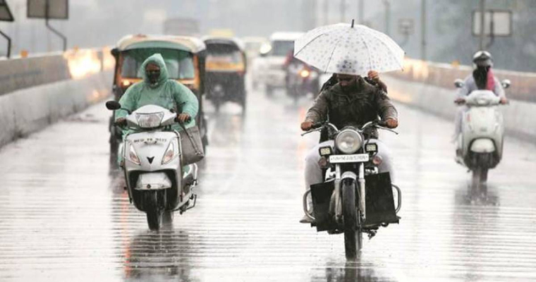
Monsoon arrived over Kerala with a delay of one week. Further progress was weak and sluggish. Rainfall deficiency over most southern states has mounted to 70-80%. Further up, Maharashtra has witnessed a large deficit of 80-90%. Most parts of Konkan have observed extremely poor monsoon rains till now. The financial capital Mumbai is nearly starved in the first 3 weeks of June.
Mumbai receives about 526.3mm of average rainfall in June. More than halfway through the month, the city has measured only 17.1mm so far. Few showers have been recorded in the last 7 days with a maximum of a mere 6 mm in 24 hours. One more week will not be any different and showers are going to be far and few.
Mumbai observed the most delayed monsoon on 27th June in the year 2009. Coincidentally, this delay was attributed to the El Nino, phenomenon of warm Pacific Ocean waters during monsoon months. 2nd longest delay since 2009 was in 2019 when the monsoon reached on 25th June.
In 2016 also, the monsoon made delayed arrival on 20th June. In addition, the monsoon in Mumbai also got delayed in 2012, 2014 and 2015 due to El Nino like conditions. Monsoon knocked at Mumbai a little before time on 09th June 2018. Mumbai has only received sporadic and fleeting showers so far. Though the criteria like onset over Kerala satisfying rainfall, clouds, OLR and speed and depth of westerly winds were fulfilled last week, typical monsoon rains have given amiss. Monsoon arrival over Mumbai is never without the submerging showers disrupting normal life.
This year, to start with, the monsoon arrived late over Kerala and was later deranged by cyclone Biparjoy. It is almost similar to 2019 when the monsoon landed on 25th June. This was one of the most delayed arrivals in the last 45 years. The monsoon was stalled by cyclone ‘VAYU’ which was similar to ‘BIPARJOY’ in track, timings and intensity. However, the storm had weakened over the sea and did not make any significant landfall over Gujarat. Prior to that, another cyclone ‘NAUNAK’ in 2014 over the Arabian Sea had corrupted the monsoon onset.
Cyclone Biparjoy has weakened to a depression. Remnant of the cyclone continues to give downpours over Rajasthan and is likely to extend reach up to North Madhya Pradesh for the next 72 hours. The weather system is likely to get filled up over the same region and make way for the advance of the monsoon. There is the likelihood of monsoon system forming over the Bay of Bengal during the early 4th week of June.
The first monsoon system of the season over the Bay of Bengal will push the monsoon deep inland after the 25th of June. This weather system will take the rains to parched areas of Maharashtra and the other central parts. This feature will also accentuate the monsoon surge along the West Coast, more so for the Konkan region. Mumbai can expect one of the most delayed monsoon coinciding with the earlier record date of 27th June. Heavy rains are likely for 2-3 days commencing 27th June and lasting till fag end of the month.
दक्षिण पश्चिम मानसून इस मौसम में अभी तक दक्षिण प्रायद्वीप पर स्थापित होने के लिए सचमुच संघर्ष कर रहा है। पहले चरण में, मानसून लगभग 10 दिनों के समय में पूरे प्रायद्वीप को कवर करने के लिए दक्षिण से उत्तर की यात्रा करता है। 15 जून तक, यह दक्षिण तटीय गुजरात, पूरे महाराष्ट्र, छत्तीसगढ़ के आधे हिस्से, बिहार, झारखंड और पूरे ओडिशा और पश्चिम बंगाल तक पहुंच जाता है। अपनी पूर्व की तारीख 10 जून से संशोधित तिथियों के अनुसार मानसून 11 जून को मुंबई पहुंचता है। मानसून का पश्चिमी भाग 11 जून से रुका हुआ है जब यह रत्नागिरी पहुंचा और उसके बाद एक इंच भी आगे नहीं बढ़ा। यहां तक कि पूर्वी हाथ भी पिछले एक सप्ताह से स्थिर है।
केरल में मानसून एक सप्ताह की देरी से पहुंचा। आगे की प्रगति कमजोर और सुस्त थी। अधिकांश दक्षिणी राज्यों में वर्षा की कमी 70-80% तक बढ़ गई है। इसके अलावा, महाराष्ट्र में 80-90% की बड़ी कमी देखी गई है। कोंकण के अधिकांश हिस्सों में अब तक बेहद खराब मानसूनी बारिश हुई है। वित्तीय राजधानी मुंबई जून के पहले 3 हफ्तों में लगभग भूखी है।
जून में मुंबई में औसतन 526.3 मिमी बारिश होती है। महीने के आधे से अधिक रास्ते में, शहर ने अब तक केवल 17.1 मिमी मापा है। पिछले 7 दिनों में 24 घंटों में अधिकतम 6 मिमी के साथ कुछ बौछारें दर्ज की गई हैं। एक और सप्ताह कोई अलग नहीं होगा और बारिश बहुत कम होने वाली है।
मुंबई ने वर्ष 2009 में 27 जून को सबसे अधिक विलंबित मानसून देखा। संयोग से, इस देरी का श्रेय मानसून के महीनों के दौरान अल नीनो, गर्म प्रशांत महासागर के पानी की घटना को दिया गया। 2009 के बाद से दूसरी सबसे लंबी देरी 2019 में हुई जब मानसून 25 जून को पहुंचा। 2016 में भी मानसून ने 20 जून को देरी से आगमन किया था। इसके अलावा, अल नीनो जैसी स्थितियों के कारण 2012, 2014 और 2015 में भी मुंबई में मानसून में देरी हुई। मॉनसून ने 09 जून 2018 को समय से थोड़ा पहले मुंबई में दस्तक दी थी। मुंबई में अब तक छिटपुट बारिश ही हुई है। हालांकि, केरल में संतोषजनक वर्षा, बादल, ओएलआर और पश्चिमी हवाओं की गति और गहराई जैसे मानदंड पिछले सप्ताह पूरे हो गए थे, लेकिन सामान्य मानसूनी बारिश ने इसे गलत साबित कर दिया है। मुंबई में मॉनसून का आगमन सामान्य जीवन को अस्त-व्यस्त करने वाली जलमग्न बौछारों के बिना कभी नहीं होता।
इस वर्ष, शुरुआत में, मानसून केरल में देरी से पहुंचा और बाद में चक्रवात बिपरजोय ने उसे विक्षिप्त कर दिया। यह लगभग 2019 के समान है जब मानसून 25 जून को उतरा था। यह पिछले 45 वर्षों में सबसे विलंबित आगमन में से एक था। मॉनसून चक्रवात 'वायु' द्वारा रोक दिया गया था जो ट्रैक, समय और तीव्रता में 'बिपार्जॉय' के समान था। हालाँकि, तूफान समुद्र के ऊपर कमजोर पड़ गया था और गुजरात के ऊपर कोई महत्वपूर्ण भूस्खलन नहीं हुआ था। इससे पहले, अरब सागर के ऊपर 2014 में आए एक और चक्रवात 'नौनक' ने मानसून की शुरुआत को खराब कर दिया था।
चक्रवात बिपारजॉय कमजोर होकर डिप्रेशन में बदल गया है। चक्रवात के अवशेष राजस्थान के ऊपर बारिश दे रहे हैं और अगले 72 घंटों के लिए उत्तरी मध्य प्रदेश तक पहुंचने की संभावना है। मौसम प्रणाली के उसी क्षेत्र में विलुप्त हो जाने और मानसून के आगे बढ़ने की संभावना है। जून के चौथे सप्ताह की शुरुआत में बंगाल की खाड़ी के ऊपर मानसून सिस्टम बनने की संभावना है। बंगाल की खाड़ी के ऊपर मौसम की पहली मानसून प्रणाली 25 जून के बाद मानसून को अंतर्देशीय गहराई तक धकेल देगी। यह मौसम प्रणाली बारिश को महाराष्ट्र के सूखे क्षेत्रों और अन्य मध्य भागों में ले जाएगी। यह विशेषता पश्चिमी तट के साथ-साथ कोंकण क्षेत्र के लिए मानसून की वृद्धि को भी तेज करेगी। मुंबई सबसे विलंबित मानसून में से एक की उम्मीद कर सकता है जो 27 जून की पहले की रिकॉर्ड तारीख के साथ मेल खाता है। 27 जून से शुरू होकर महीने के अंत तक 2-3 दिनों तक भारी बारिश होने की संभावना है।
Since the time of the onset of the Southwest Monsoon over the city of Chennai, rains have been far and few. However, in the last 24 hours, Chennai's Meenambakkam observatory recorded a whopping 158 mm of rains. Nungambakkam observatory also witnessed heavy rains to the tune of 85 mm.
The suburbs of Chennai have also seen rains over 100 mm in some parts. With this, the district administrations have announced the closure of schools in various districts of Tamil Nadu today due to heavy rainfall. Apart from Chennai, schools in Ranipet, Kancheepuram, Tiruvallur, Chengalpet, and Vellore will also remain closed.
Moreover, as per reports, persistent heavy rainfall has caused waterlogging in low-lying areas such as Velachery, Guindy, Vepery, GST Road, and KK Nagar. Moreover, several flights scheduled to land at Chennai Airport were diverted to Bengaluru Airport during the early hours of Monday. In fact, many flights bound for international destinations have faced delays.
As per the weathermen, Chennai rains are expected to continue for the next couple of days and might remain heavy leading to more problems for residents in the city as well as its adjoining areas.
The onset of southwest monsoon 2023 was delayed by one week over Kerala. In the subsequent two to three days monsoon covered Antar North East India as well as read up to south coconut over West Coast. Since then, monsoon became stagnant. One of the reasons can be the formation of a cyclone over the Arabian Sea which restricted the law of south-westerly winds towards south Peninsula.
Cyclone Biparjoy has made landfall over the Kutch region of Gujarat and is now seen as a depression over Central parts of Rajasthan. The impact of the cyclone has faded away. Westernly and South West Delhi flow of winds from the Arabian Sea has intensified leading to increase rain activities over South Peninsula. There will be a significant increase in rain over Kerala, Karnataka, Tamil Nadu, Rayalaseema, and parts of South Telangana.
Almost all the Meteorological divisions of South India are rain deficient to large rain deficient except Andaman and Nicobar Islands. Now the situation will improve gradually with the active conditions of monsoon.
आधा जून बीत चुका है लेकिन मानसून अपने निर्धारित समय से काफी पीछे चल रहा है। आमतौर पर 15 जून तक मानसून पूरे दक्षिण प्रायद्वीप, बिहार के कुछ हिस्सों, झारखंड, ओडिशा के अधिकांश हिस्सों, महाराष्ट्र और छत्तीसगढ़ को कवर कर लेता है और गुजरात के दक्षिणी हिस्सों तक पहुंच जाता है। 18 जून तक, मानसून की उत्तरी सीमा ने दक्षिण कोंकण और गोवा, कर्नाटक के आधे हिस्से, रायलसीमा के कुछ हिस्सों, उत्तर पूर्व भारत, सिक्किम, पश्चिम बंगाल में उप-हिमालय और पूर्वोत्तर बिहार को कवर कर लिया है।
पूर्वी भारत में मानसून के आगे बढ़ने के लिए परिस्थितियाँ अब अनुकूल होती जा रही हैं। राजस्थान के मध्य भागों पर बना डिप्रेशन कम दबाव के क्षेत्र के रूप में उत्तर प्रदेश के मध्य भागों में धीरे-धीरे आगे बढ़ेगा।
यह निम्न दबाव बंगाल की खाड़ी से मानसूनी धाराओं को खींचेगा। अगले 48 घंटों में बिहार, झारखंड और ओडिशा के पश्चिम बंगाल भागों में बारिश तेज होगी। बारिश बढ़ने से इन राज्यों में मानसून की शुरुआत होगी। देश के पूर्वी हिस्सों में लू से लेकर गंभीर लू की स्थिति जल्द ही कम हो जाएगी।
18 जून तक, पूर्वी भारत के अधिकांश हिस्सों में मुख्य रूप से वर्षा की कमी है। ये आगामी बारिश अंडाकार निश्चित रूप से बारिश के आंकड़ों में सुधार करेगी। और किसानों को फसलों की बुवाई शुरू करने में मदद करें।
More than half of June has passed but the monsoon is way behind schedule. Usually by June 15 monsoon covers the entire south Peninsula, parts of Bihar, Jharkhand, most parts of Odisha, Maharashtra as well as Chhattisgarh, and reaches Southern parts of Gujarat. As of June 18, the northern limit of the monsoon has covered south Konkan and Goa, half of Karnataka, parts of Rayalaseema, North East India, Sikkim, Sub-Himalaya in West Bengal, and northeast Bihar.
Conditions are now becoming favourable for the advancement of monsoon over East India. The depression is over the central parts of Rajasthan will move gradually over Central parts of Uttar Pradesh as a low-pressure area.
This low pressure will pull the monsoon currents from the Bay of Bengal. Rain will intensify over west Bengal parts of Bihar, Jharkhand and Odisha in the next 48 hours. Increased rain will result in the onset of monsoon over these States. Heatwaves to severe heatwave conditions prevailing over Eastern parts of the country will subside soon.
As of June 18, most parts of East India are predominantly rainy deficient. These upcoming rains oval certainly improve the rain statistics. And help farmers to commence the sowing of crops.
केरल में मानसून की शुरुआत में एक सप्ताह की देरी हुई। यह 17 जून है और मानसून अपनी सामान्य तिथियों के अनुसार आगे नहीं बढ़ा है। यह वेस्ट कोस्ट, दक्षिण प्रायद्वीप और पूर्वी भारत के साथ-साथ देश के मध्य भाग में समय से पीछे है। दक्षिण प्रायद्वीप और पूर्वी भारत में मानसून के आगे बढ़ने के लिए परिस्थितियाँ अनुकूल होती जा रही हैं।
चक्रवाती तूफान बिपरजोय कमजोर होकर राजस्थान के ऊपर से आगे बढ़ गया है। दक्षिण-पूर्वी हवाएँ दक्षिण-पूर्व अरब सागर के ऊपर मजबूत होंगी, जिससे दक्षिण प्रायद्वीप पर सक्रिय मानसून की स्थिति बनेगी। यह मानसून उछाल दक्षिण प्रायद्वीप पर मानसून की आगे बढ़ने में मदद करेगा।
राजस्थान के मध्य भागों पर दबाव कम दबाव के क्षेत्र के रूप में धीरे-धीरे मध्य और पूर्वी उत्तर प्रदेश में आगे बढ़ेगा। यह कम दबाव का क्षेत्र बंगाल की खाड़ी से मानसूनी धाराओं को खींचेगा। 18 से 21 जून के बीच बिहार, झारखंड और पश्चिम बंगाल में बारिश की गतिविधियां धीरे-धीरे बढ़ सकती हैं।
उस अवधि के दौरान दक्षिण पश्चिम मानसून इन राज्यों में आगे बढ़ सकता है। 23 जून तक मानसून के पूर्वी उत्तर प्रदेश पहुंचने की संभावना है। हालांकि आने वाले सप्ताह में मध्य प्रदेश में बारिश की गतिविधियां तेज हो जाएंगी, मध्य भारत को वहां मानसून की शुरुआत के लिए कुछ और समय तक इंतजार करना होगा।
The onset of monsoon over Kerala was delayed by one week. It is 17 June and the monsoon has not progressed as per its normal dates. It is behind the schedule over West Coast, South Peninsula, and East India as well as over the Central part of the country. Conditions are becoming favourable for the further progress of the monsoon over the South Peninsula and East India.
The cyclonic storm Biparjoy has weakened and moved over Rajasthan. Southwesterly winds will strengthen over the southeast Arabian Sea leading to active monsoon conditions over South Peninsula. This monsoon surge will help in the further progression of the monsoon over the South Peninsula.
The depression over central parts of Rajasthan will move gradually over central and East Uttar Pradesh as a low-pressure area. This low-pressure area will pull the monsoon currents from the Bay of Bengal. Rain activities may increase gradually over Bihar, Jharkhand, and West Bengal between June 18 and 21.
Southwest monsoon may progress over these states during that period. There are chances of the monsoon reaching east Uttar Pradesh by June 23rd.
Although rain activities will intensify over Madhya Pradesh in the coming week, Central India will have to wait for some more time for the monsoon to make its onset there.
Very severe cyclone Biparjoy battered many parts of Kutch during the last two days. It has done massive damage to the environment and property. It uprooted many trees, damaged houses, flooded low-light areas, and damaged power and communication lines.
Another very important feature associated with this cyclone is heavy to very heavy rain going on over many parts of Gujarat. Heavy rain continues over the Kutch region of Gujarat. Okha recorded 228 mm, Bhuj 125, Kandla 124, Dwarika 56, Rajkot 87, Deesa 79, Naliya 61 & Ahmedabad received 42 mm of rain in the last 24 hours. Okha clocked a total of 472 mm in the last 4 days, it is 92% of annual rain, which is 512 mm. More rain is possible during the next 24 hours. In fact, many stations in the Kutch region of Gujarat have recorded more than 50% of annual rainfall in the last three to four days.
The cyclone has weakened into a deep depression and has moved over Southwest Rajasthan. Its impact will be felt over the Northern districts of Gujarat for another 24 hours. After that, the weather of Gujarat may go dry. Rain activities may resume once again over the Gujarat region by June 26 or 27. We can expect the onset of monsoon over Southern parts of Gujarat during that time.
चक्रवात बिपारजॉय ने 15 जून की शाम को एक अति प्रचंड चक्रवात के रूप में उत्तरी गुजरात पर दस्तक दी। अब यह उत्तर पश्चिम गुजरात और पाकिस्तान के दक्षिण सिंध के आसपास के हिस्सों पर एक चक्रवात के रूप में देखा जा रहा है। यह आज 16 जून की शाम तक डिप्रेशन के रूप में दक्षिण राजस्थान के ऊपर उत्तर पूर्व दिशा में आगे बढ़ेगा। सौराष्ट्र और कच्छ के ज्यादातर हिस्सों में मध्यम से भारी बारिश हुई है। चक्रवात 16 जून की शाम तक कमजोर होकर डिप्रेशन में बदल जाएगा और दक्षिण मध्य राजस्थान के ऊपर पहुंच जाएगा।
प्रारंभ में, बारिश की गतिविधियाँ दक्षिण-पश्चिम राजस्थान के जालोर, सिरोही और बाड़मेर जैसे स्थानों पर मध्यम से भारी बारिश होने की उम्मीद है। जैसे-जैसे डिप्रेशन उत्तर पूर्व के लिए आगे बढ़ेगा रैना गतिविधियाँ राजस्थान के कई अन्य जिलों जैसे जैसलमेर, जोधपुर, पाली, राजसमंद, भीलवाड़ा, अजमेर, टोंक, नागौर, बीकानेर, सीकर, जयपुर, दौसा, करौली, भरतपुर और अलवर को कवर करेंगी। .
हालांकि, गुजरात के उत्तरी जिलों में 17 जून की सुबह तक मध्यम बारिश जारी रह सकती है। इसके बाद मौसम साफ होना शुरू हो जाएगा। वहीं, उत्तर और पूर्वोत्तर राजस्थान में बारिश की गतिविधियां 20 जून तक जारी रहेंगी।