
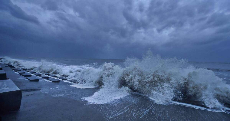
Indian Ocean and Indian Seas ( Bay of Bengal & Arabian Sea ) are the hottest basins for cyclogenesis during the pre monsoon season. Since, the tropical storms rarely develop between equator and 5°N, the Indian coastline becomes vulnerable to storms originating only over the Indian Seas and not the Indian Ocean. For academic purpose, both these seas can be considered as extended arms of the Indian Ocean.
Gray’s parameters for cyclone development stipulate essential requirement of Sea Surface Temperature (SST) crossing the threshold of 26°C. Few of the researchers have mandated this requirement to be at least 82°F. Higher SST’s provide higher rate of evaporation and pumps more moisture in to the cyclone. Factually, in addition to the SST, ocean thermal energy up to the depth of 60mtr is required to be maintained above the threshold for cyclone development. Preferably, the moist stability also need to sustain, from surface to middle atmospheric levels for growth of tropical storms ( 5°N - 30°N ).
As an offshoot of global rise of temperatures, oceans across the globe have been warming, albeit slowly but steadily. However, tropical oceans are much warmer than the mid latitude and polar oceans. Within the tropics also, Indian Ocean and the Indian Seas are getting warmer at a faster rate than others. Since 1951, on an average, rise of 0.1°- 0.15°C over a decade has been observed. It also means that, Indian Seas have become warmer by about 1°C between 1951 – 2020. Rise of 1°C amounts to an exponential rise of the heat potential, consequently increasing the capacity of ocean beds to churn storms.
Bay of Bengal has been warmer than the Arabian Sea. Accordingly, more number of storms have emerged threatening eastern coast much more than the western side. Box like structure of Bay of Bengal invites more strikes and landfall all along the eastern shore from Tamil Nadu to West Bengal. Storms over the Arabian Sea have a tendency to drift away from the West Coast towards African coastline and Persian Gulf. Exceptions have always been there for some of these storms striking Maharashtra, Goa and Gujarat coast.
The near surface BoB remains significantly warmer than the Arabian Sea during pre monsoon and summer monsoon. Analysis of heat budget of the near surface Arabian Sea and BoB shows significant difference between them during this period. In the Arabian Sea, associated winds are stronger and favour the transfer of heat to deeper layers owing to overturning and turbulent mixing. In contrast, the weaker winds over BoB induce a slackened circulation unable to disturb the oceanic flow. This feature is not able to make any significant change in the heat flux near the surface layers.
Since 1975, a total of 151 tropical storms have formed over BoB and even less than half of it (66) over the adjacent basin of Arabian Sea. Notwithstanding the number, intensity of the cyclones does not get compromised. Majority of these storms head for Somalia, Horn of Africa, Yemen, Oman and Persian Gulf. In the recent past, there is evidence of Arabian Sea catching up with heat, possibly due to dynamic forcing altering atmospheric circulation pattern. Year 2019 witnessed record 6 storms in the Arabian Sea as against 3 in the BoB.
A low pressure area is likely to form over South Andaman Sea and adjoining southern parts of Central BoB in the next about 36hours. As a precursor, cyclonic circulation has appeared over that area and is expected to consolidate further. Observation watch will commence shortly to monitor and track this weather system. There are no authentic clues at the moment to previse its further development. More clarity is likely after 24-48hr.
