Severe Cyclonic Storm Shakhti Weakens: No Threat To Indian Coastline

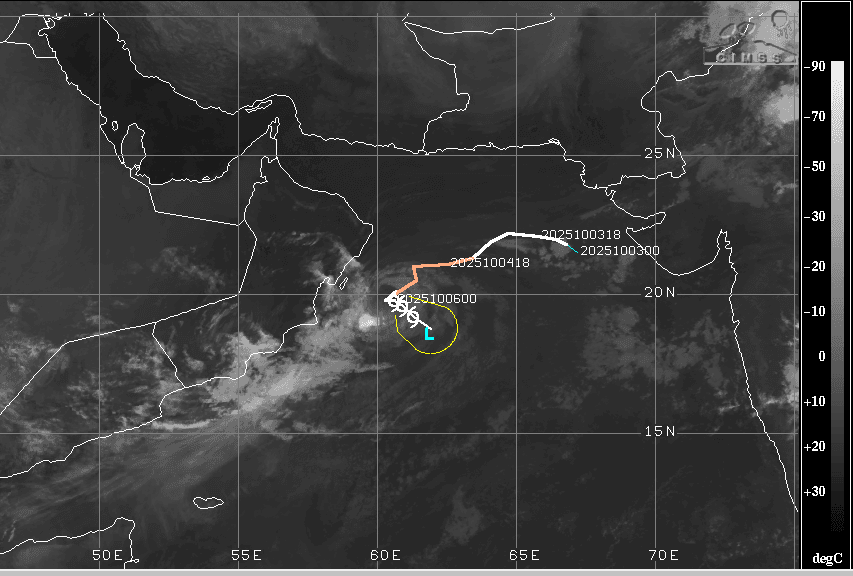
Cyclonic Storm Shakhti, Sat Image, Courtesy: CIMSS
The severe cyclonic storm over the northwest Bay of Bengal has weakened into a cyclonic storm over the same region. The storm reached quite close to the Oman coast yesterday and has nearly stalled thereafter. Over the last three days, the first cyclonic storm of this year and season in the Indian seas had been drifting away from the Gujarat coast and was located as far as 900 km from the westernmost point of Naliya in the Kutch region. As expected, the storm will turn around and move back over the deep sea, albeit with weakening potential.
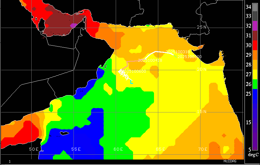
Courtesy: CIMSS
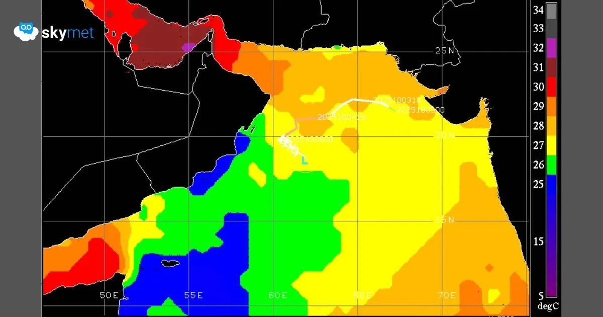
The cyclonic storm is centered this morning around 19.8°N and 60.6°E, about 200 km east-southeast of Masirah Island. The environmental conditions have degraded, and the frictional forces have increased. There is still a tight low-level cyclonic circulation, but the sea conditions do not seem favorable. The steering current will move the storm southeastward, away from the coastline of Oman. There is persistent dry air entrainment at all levels and moderate to strong vertical wind shear, fracturing the storm configuration. The drop in sea surface temperature has lowered the heat potential and will lead to rapid weakening of the system over the sea itself.
Courtesy: CIMSS
The storm may maintain its strength for another 4–6 hours before weakening into a depression by late evening. Tomorrow, it may further weaken into a low-pressure area over the ocean surface. During this time, it will track eastward, heading toward the Gujarat coastline, but will ultimately diffuse over the open sea, well short of the Indian coastline. Factually, it will not make landfall anywhere and will stay at a safe distance from the coastlines of India, Pakistan, Iran, Oman, and Yemen.
The major reasons for its weakening are the reducing sea surface temperature and strong wind shear. The sea surface, as such, is the coldest over this part of the Arabian Sea at this time of the year. The monsoon winds do not permit an explosive rise in temperature. The subtropical ridge remained to the north of the storm’s axis and, being in close proximity, restricted its northward gain in latitude. Rather, it has pushed the system southward, against the normal west or west-northwest track. Despite the storm’s weakening, sea conditions will remain rough for another 48 hours. Even the remnants of the system will churn the sea surface and cause squally winds in the lower levels. ‘Ops Normal’ conditions are likely to prevail after 7th October 2025.
