Delhi Continue To Sizzle This Week: Relief Next Week Likely


Delhi temperatures kept soaring to reach the highest of this season so far. Base station Safdarjung, with a maximum of 43.8°C yesterday, recorded the hottest day of this year, overtaking the earlier high of 43.4°C just a day prior. Some observatories in the Delhi region like Ayanagar, Ridge, and Mungeshpur breached 45°C, resulting in heat wave conditions. Marginal changes are likely today, and the mercury is unlikely to shoot up abruptly in the next 2–3 days. Rather, the temperature may drop by about 2°C around the weekend.
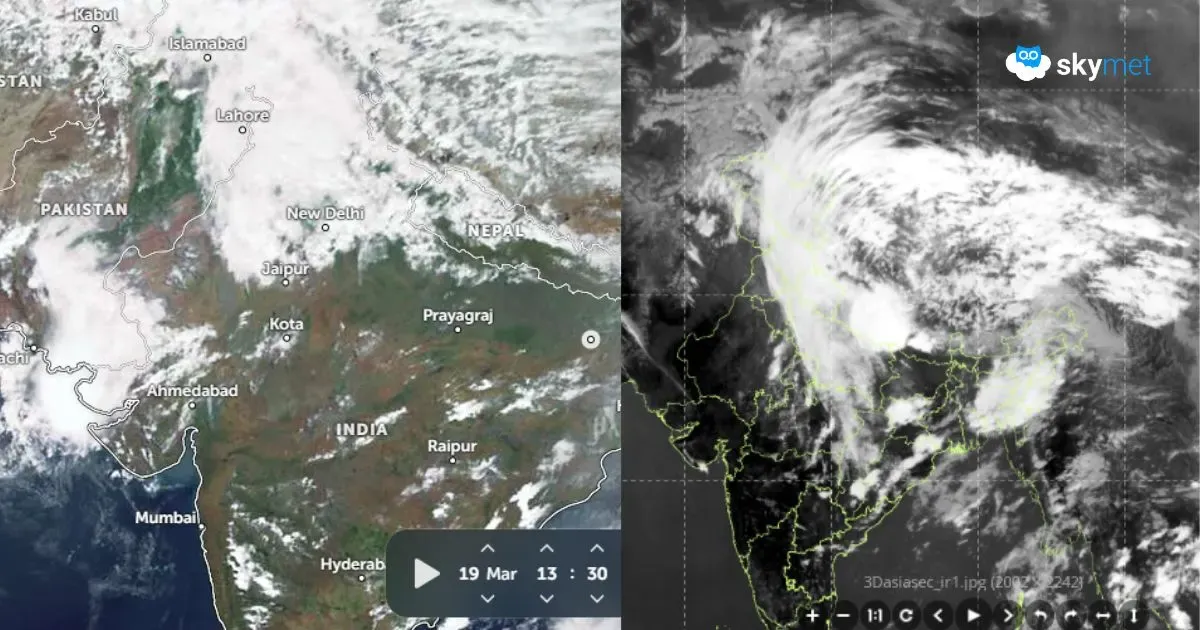
There is a weak cyclonic circulation over Punjab and adjoining border areas. The usual east-west trough close to Delhi is not in the picture. The western disturbance as an upper air trough over the mountains is too weak to influence the weather over the plains, including Delhi. Though accumulated heat over the last three days increases the chances of pre-monsoon activity to balance it out, it does not seem to be the right time for any relief in the next 3–4 days. Delhi will continue to reel under scorching conditions. At best, the extreme dry heat may shrink and give way to sultry conditions over the weekend. In such a scenario, the day temperatures may dip a little, but nights are likely to become warm and humid.
Southwest Monsoon arrives around 27th June over Delhi. These are still early days to make any announcement. However, courtesy of a monsoon system coming up as a cyclonic circulation over the Bay of Bengal on 14th June, some change in the wind pattern is anticipated. Dry and hot northwesterly winds necessarily will have to be replaced by a warm and moist easterly stream before the monsoon arrives. Some pre-monsoon showers for a day or two customarily precede the arrival of the monsoon. The overall build-up of the pattern does not point towards any undue delay for the ingress of monsoon over the Delhi region.