Low Pressure Intensifies To Depression Over Bay: Strengthen Further And Cross Coast Soon

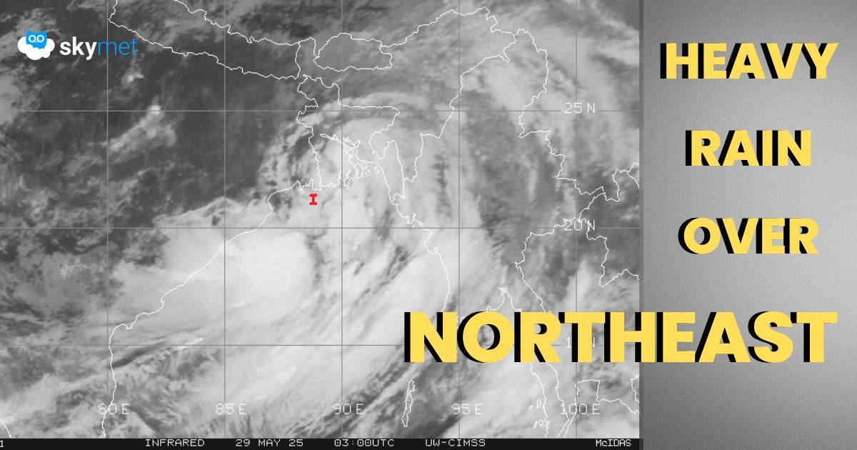
Satellite Image, Courtesy: CIMSS
Yesterday’s low pressure over the Northwest Bay of Bengal (BoB) has intensified into a depression. The system is centered around 21.4°N and 89°E, about 260 km south of Kolkata.
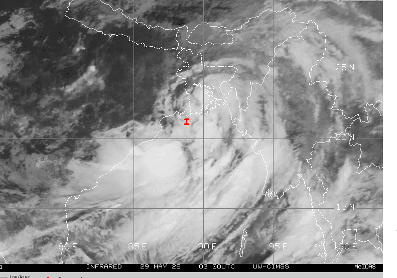
It is likely to become a deep depression soon and move northward. The peripheral clouds of the depression have reached the coastline. Scattered rain and thundershowers have lashed coastal Odisha, North Coastal Andhra Pradesh, and coastal parts of Gangetic West Bengal.
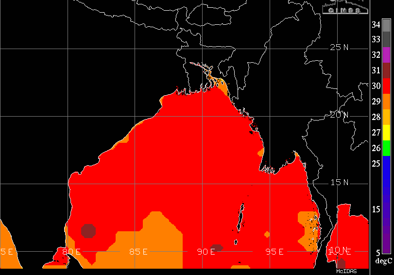
The weather system is placed in a favorable environment of low vertical wind shear and very warm sea surface temperature. A nicely curved band of clouds with decent inflow and outflow favors intensification of the system. However, it is unlikely to develop into a cyclonic storm because of limited sea travel and close proximity of land. As a deep depression, the system is likely to cross the Bangladesh-West Bengal coast, between Sagar Islands (India) and Khepupara (Bangladesh), later in the afternoon hours.
The deep depression will weaken to a depression in the night and to a well-marked low pressure in the wee hours tomorrow.
Heavy to very heavy rainfall is likely over Northeast India and Bangladesh for the next 48 hours. Extremely heavy rainfall is expected at some places over Assam, Meghalaya, Arunachal Pradesh, and Nagaland.
Scattered heavy thundershowers are likely over Manipur, Mizoram and Tripura. The spread and intensity of weather will be more in the next 48 hours and reduce thereafter. Fairly widespread moderate rains will continue even thereafter for the subsequent 2 days. Monsoon has already set in over the northeastern parts, and so the normal monsoon rains over the region will be a regular feature from now on.
