Fresh Low Pressure Area Likely To Form In Bay Of Bengal: September Starts With Active Monsoon

The remnant of the earlier low-pressure area, which moved deep inland yesterday, is now lying as a cyclonic circulation over Central Madhya Pradesh. It is likely to meander over that area for the next 3–4 days. In the meantime, another low-pressure area is likely to emerge over the Northeast Bay of Bengal (BoB) shortly. This will maintain the continuity of monsoon bursts over the eastern, central, and western parts of the country. The month of September will commence on a rainy note and unleash the monsoon surge through the week across large parts of the country.
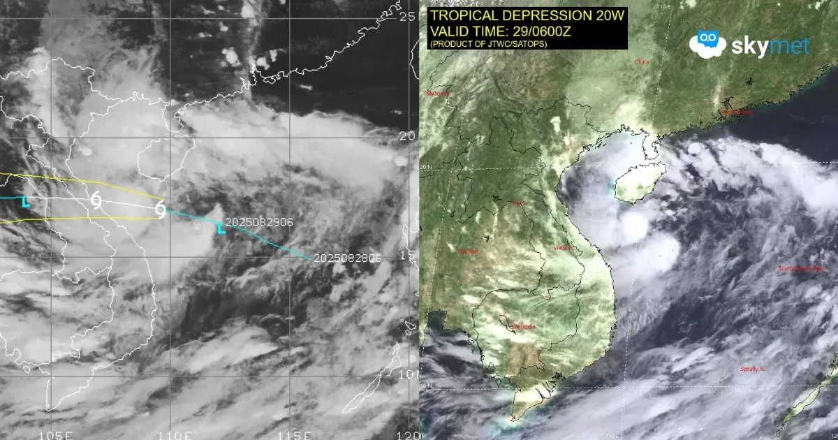
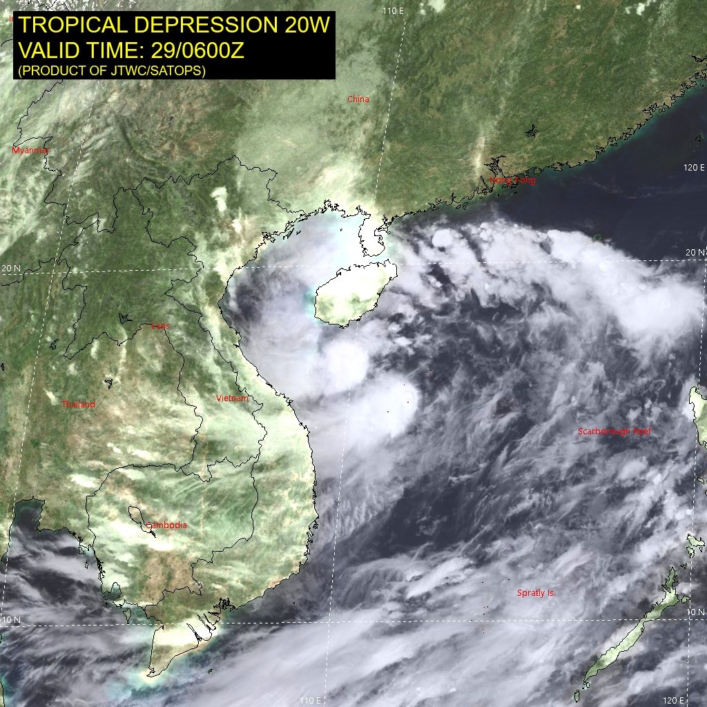
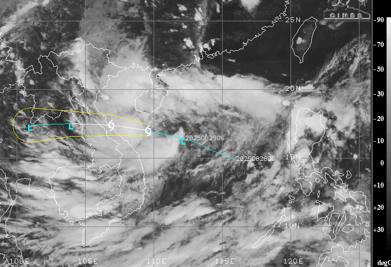
The fresh low-pressure area will have its roots in the South China Sea. A tropical depression (TD 20) is marked in the South China Sea, just south of the Chinese province of Hainan. This will cross the North Vietnam coast tonight and thereafter travel across Laos, North Thailand, and the interiors of Myanmar. The remnants of this system will enter the BoB on 01st September 2025. This will quickly organize into a low-pressure area within 12–24 hours. Further, the weather system is likely to strengthen into a well-marked low pressure on 02nd–03rd September.
This low pressure is likely to breach the coastline of Odisha on 04th September. On this date, the two weather systems—first, the remnant of the earlier system over Gujarat and second, the fresh low over Odisha–West Bengal—will be connected with the east–west oriented monsoon trough. Along this trough, an active shear zone will escalate monsoon activity. These two systems, in their respective areas, will also boost monsoon rainfall over a large portion of the country. Overall, active to vigorous monsoon conditions will prevail during the first week of September. These will extend to cover West Bengal, Odisha, Jharkhand, Madhya Pradesh, Uttar Pradesh, Rajasthan, Gujarat, Madhya Maharashtra, and Konkan & Goa (including Mumbai).
Mumbai Rains: Rainy Days Ahead For Mumbai: Heavy Rainfall Next Week


