
Depression over Bay of Bengal, a precursor to the likely tropical storm Michaung, has intensified in to a deep depression. Next intensity elevation will take the weather system to cyclone category. It is likely to happen by late tonight or in the wee hours tomorrow. The depression has moved west - northwest and travelled over 400km in the past 24hours and likely to retain the same coarse till it becomes a cyclonic storm over southwest Bay of Bengal.
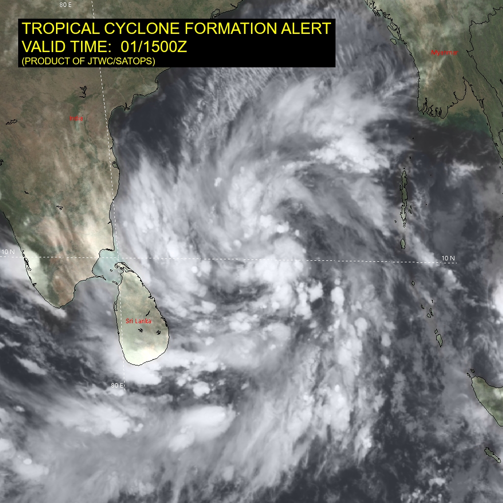
The deep depression is centered around 11 degree North and 83 degree East. It is still about 400km east-southeast of Chennai. Circulation center of the deep depression is getting overlaid and masked with clouds. The satellite imagery depicts consolidated bands of deep convection wrapped around the broad area of low level circulation.
The weather system is placed in favourable environment. Sea surface is warm enough with temperature of 29degree and vertical wind shear remains low, of the order of 10-15Kts. These two factors should essentially support for sustenance of systems over deep sea. The cloud configuration also has decent inflow and outflow. The fourth storm of this year over Bay of Bengal is ready to evolve, anytime in the next 16-18 hours.
The cyclonic storm will be named 'Michaung' and will be the sixth named storm of this year in the Indian Seas. Once it becomes a storm, the steering current will move it more of northwest first and north-northwest later, as it approaches coastline of South Coastal Andhra Pradesh. The northeast - souwest orientation of the coastline will force the storm to go for landfall, anywhere between Nellore and Kakinada. As a tropical storm, the system will have the promity of land, increasing friction and drop in the sea surface temperature, reducing the heat potential.
Therefore, Michaung may not become very severe and may strike coastline as a tropical storm. It will still be powerfull enough to cause deluge with blinding rains and uproot some trees and damage transmission poles due to roaring squally winds. People staying next to the coast may need to taken to safe shelters, lasting not longer than 48hours.
Parts of North Tamil Nadu, including the capital city Chennai need to remain on alert for heavy rains and gusty winds. Coastline of Andhra Pradesh from Nellore, Kavali, Ongole, Bapatla, Machilipatnam, Kakinada and Tuni also need to observe similar or rather high alert, commencing wee hours of 03rdDecember, Sunday.
After making landfall, the storm may get eroded due to terrain effect and therefore weaken, a bit. However, after landfall, the steering current will move the storm more northward first and northeastward later, nearly parallel to the coastline, right up to South Coastal Odisha. The vicinity of the Bay of Bengal, during this phase, may not permit rapid weakening of the storm, as it usually happens, after landfall. The storm will weaken substantially, only by 06th December. All cautions need to be observed, till 'all is clear, signalled by the weather and relief agencies.
