
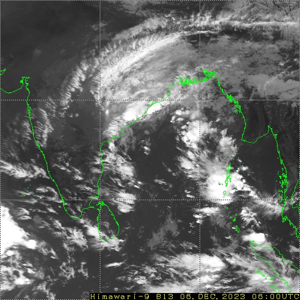
Cyclone Michaung crossed Andhra Pradesh coast near south of Bapatla yesterday and weakened to a deep depression in the early night. The system has weakened further and lies as depression over trijunction of Telangana, South Chhattisgarh and North Coastal Andhra Pradesh. Precisely, the depression is centered northeast of Khammam by about 60km. The system will move northward first and then northeast to become a low pressure area shortly. Cyclonic circulation of the depression is extending up to medium levels in the upper atmosphere.
The cyclone had earlier deluged North Tamil Nadu, particularly Chennai and South Coastal Andhra Pradesh covering Nellore, Tirupati and Kavali. The cyclone weakened after making landfall, as it usually happens and degraded to a depression. Notwithstanding the drop in strength, there have been heavy rains in the past 24 hours over East Telangana and Andhra Pradesh. Chief amounts of rainfall being Bhadrachalam-176mm, Khammam-63mm, Narsapur-213mm, Nandigama-115mm, Tuni-124mm and Koraput (Odisha)- 67mm. Moderate rainfall with strong winds lashed parts of Chhattisgarh and Odisha , as well.
The weakened system will shift more of north and northeast and therefore moderate to heavy rains will still strap all these parts in the next 24 hours. Rainfall belt will reach even parts of Jharkhand and West Bengal, albeit mostly light and moderate intensity. Locations along the coast of Andhra Pradesh and Odisha may still have fairly widespread rain with isolated heavy falls. Locations at risk will include Bapatla, Machilipatnam, West & East Godavari, Krishna Delta, Kakinada, Vizag, Vizianagram , Srikakulam, Chatrapur, Satpada, Puri, Jagatsinghpur, Kendrapara, Bhadrak, Ganjam, Gajapati and Rayagada.
Shifting rains accompanied with moderate winds will affect these areas and parts of Chhattisgarh, Jharkhand and West Bengal, today and tomorrow. Weather conditions will ease out largely from 08thDecember onward. Excess rains in these areas in association with the cyclone and its remnant, may have some waterlogging continuing even after improvement in the weather conditions. Standing crop may have to take a beating on account of untimely and incessant rainfall.
