
Wait for cyclone extends further, as the storm may spin up not earlier than 02nd December 2023. Well marked low pressure continue to persist over southeast Bay of Bengal (BoB). It is likely to strengthen over same region, with little drift to the northwest in the next 24 hours. Subsequently, fourth tropical storm of this year over BoB can be expected during this week itself.
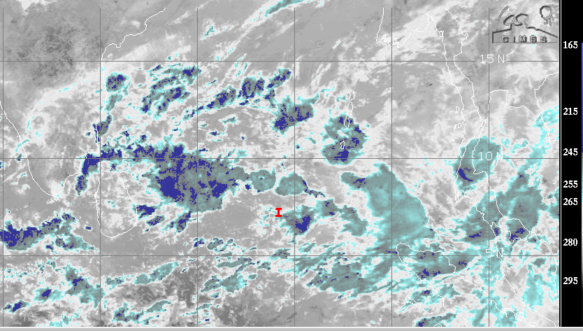
Yesterday, the low pressure area over southeast BoB and South Andaman Sea was centered around 5.5°N/ 91.3°E. Today morning, it is located over Southeast BoB, approximately 7.4°N and 89.2°E. It means, the system has moved nearly northwest and is likely to retain this track. The weather system is likely to intensify to a depression, little slowly, by late tomorrow. Later, further strengthening and northwest movement is expected. Possibly, the cyclone will evolve over southwest BoB and neighbouring southeast Bay.
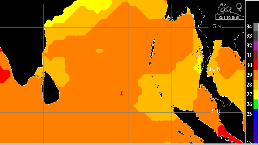
Sea and atmospheric conditions are favourable for consolidation, sharpening and boosting of the storm. Low vertical wind shear, warm sea surface, friction free windfield and decent outflow in the higher levels are all conducive for further concentration of the system. Due to limited gain in latitude in the past 24 hours, the potential for development in to a significant cyclone in the next 24 hours remains low. Intensification process is likely to speed up after the depression crosses 10°N.
Numerical models continue to differ in assigning track and timelines of the storm. ECMWF ( European Center for Medium Range Weather Forecast) favours bringing the system towards North Tamil Nadu and South Andhra Pradesh coast and even crossing it, early next week. The GFS model tracks it all along the coast from Tamil Nadu, Andhra Pradesh, Odisha and West Bengal and heads for Bangladesh. During the recurvature, the storm moves dangerously close to the shore and ultimately landfalling over Bangladesh. The suspense will remain for another 24hours and more clarity is likely by tomorrow.
Notwithstanding the final track, the storm will cause heavy to very heavy rains over Tamil Nadu and Coastal Andhra Pradesh. It is likely to become severe storm while over the sea. Gale speed winds will accompany torrential rains. Sea condition, off Tamil Nadu and Andhra Coast will be extremely rough and dangerous for off shore platforms. Utmost caution need to be observed to secure life and assets.
