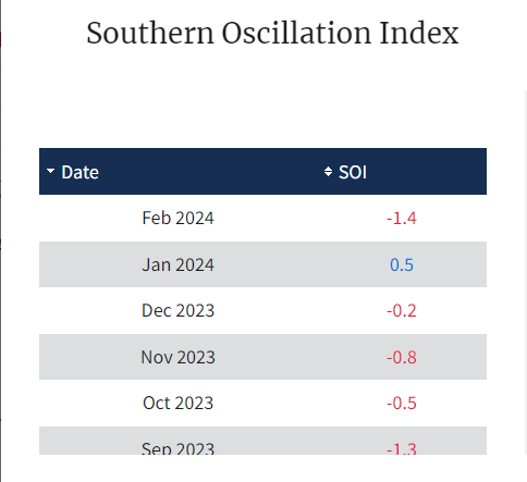
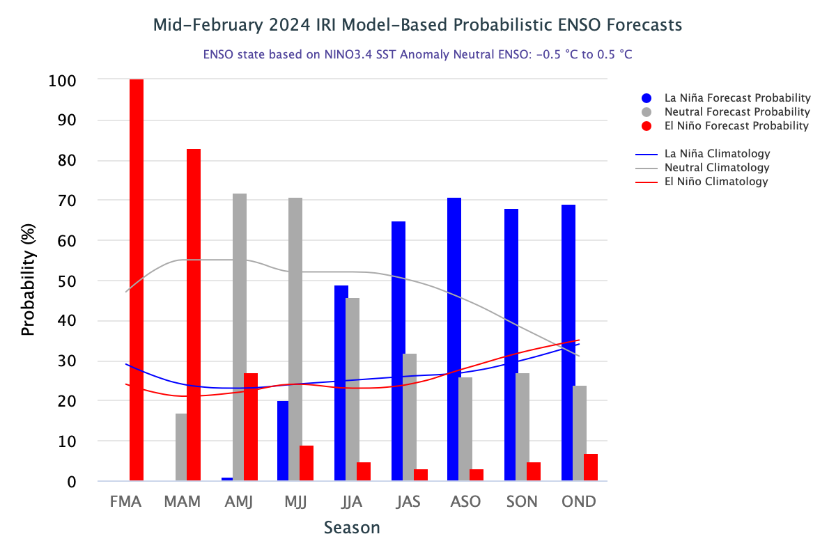
Despite the persistence of El Nino, a steady weakening trend is evident from the oceanic indicators. Models indicate a continued decline of Sea Surface Temperature (SST), albeit at a slower pace. Southern Oscillation Index (SOI), the atmospheric wing of ENSO, has abruptly shot up, with an average of -1.4 for the month of February. It may be construed that the weakening of El Nino may slow down or even stall for some time. But then, the temporary fluctuations of the ENSO atmospheric indicator are common during summer and are not taken at the face value of El Nino strength. However, the SST in the central and eastern Pacific Ocean are expected to continue dwindling and are forecast to return to ENSO-neutral towards the end of spring of the Northern Hemisphere. Be apprised that, El Nino/La Nina forecasts before spring tend to be inexplicably unreliable due to a so-called ‘spring unpredictability barrier’.
ENSO: Based on historical records from 1900, around 50% of El Nino events have been followed by an ENSO – neutral years and 40-50% have been followed by La Nina. However, the Super El Nino events have invariably been followed by La Nina. There have been six occasions of Super El Nino, since 1950, when the Oceanic Nino Index (ONI) reached or exceeded the 2°C mark, qualifying for the Super El Nino. Five of these six Super El Nino events were followed by La Nina, including the last one of the 2016 episode. 1965-66 was the exception having remained neutral after Super El Nino.

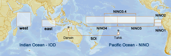
The central parts of the Nino region have a steady decline in the temperature anomaly. Nino 3.4 region, representative of ONI, had a uniform decline from 1.8°C to 1.3°C over the last 5 weeks. Nino 1+2 was the most volatile, showing inconsistent changes. The ONI (3-month running mean of SST anomalies in Nino 3.4 region) for the quarter Dec-Jan-Feb was 1.8. It had earlier peaked at 2.0 in the quarter Nov-Dec-Jan. Taking a clue from the likely ENSO-neutral by May and the impending cooling of the Pacific Ocean, La Nina ‘watch’ has been issued.
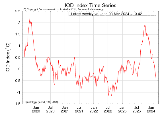
IOD: The Indian Ocean Dipole is an inherent mode of climate variability over the Indian Ocean, independent of the El Nino/La Nina phenomenon. The IOD is currently negative-neutral, with the IOD index being -0.42°C for the week ending 03 March 2024. This is the highest negative value since October 2022, the year when IOD remained negative throughout the monsoon season. Nothing much should be read from the negative stance of the index, as the IOS events are typically unable to form between December and April. The conductive pattern starts emerging with the ITCZ becoming prominent near the equator and stretches across a vast equatorial band from Indonesia to the West Tropical Indian Ocean.
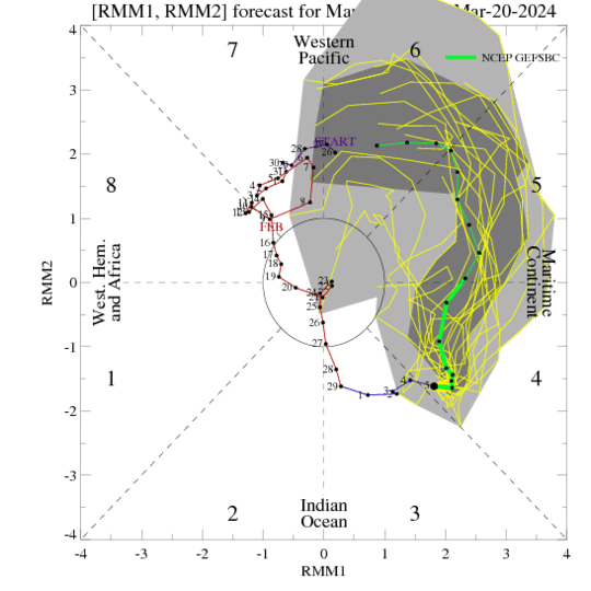
MJO: The Madden-Julian Oscillation is currently in the eastern Indian Ocean. It is likely to propagate eastward to Maritime Continent in Phase 4&5, over the next 2 weeks. The global tropics have generally been quiet for over a week now. However, the invested area has emerged close to Madagascar and another one in the equatorial belt of the south-central Indian Ocean. The convective envelope is forecast to continue moving eastward. ECMWF envisage tropical storm formation in the Indian Ocean to the north of the coast of Australia and the Gulf of Carpentaria.
A transition from El Nino winter to La Nina summer has historically tended to produce a surplus monsoon. Pre-monsoon and Monsoon circulation tend to be stronger in La Nina years. It is too early to preempt the role of the Indian Ocean Dipole, which is currently witnessing a seesawing of sea surface temperature over the western Indian Ocean. It may or may not enhance the summer monsoon rainfall but any adverse impact is unlikely this season.