
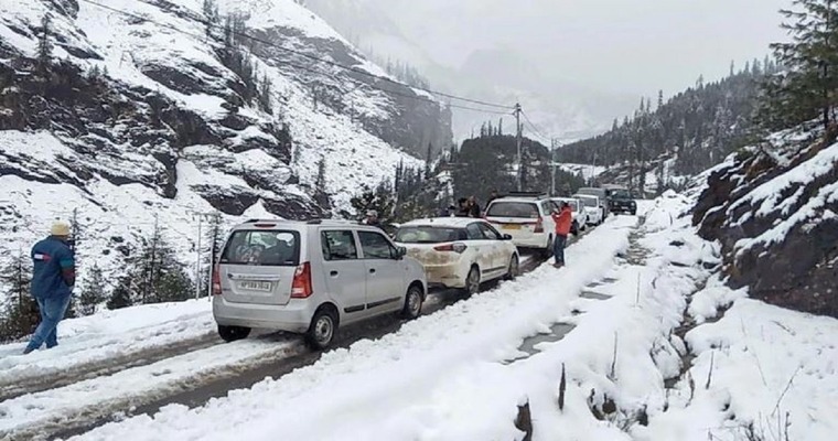
A pair of active western disturbances moving across the northern mountains, in tandem, has resulted in the heaviest widespread snowfall of this season. Low and mid reaches of Jammu and Kashmir have been loaded with piles of snow, both, in the Valley and the peaks. Himachal Pradesh has been snowed white across all the snow spots favourite with the tourists. Joshimath, Badrinath and Kedarnath have witnessed moderate snowfall in Uttrakhand. Both Garhwal and Kumaon hills have been lashed with decent winter snow in the mid-ranges and rain/thundershowers over the lower hills.
The entire range of Shivalik and Pir Panjal has turned picturesque, with a pristine layer of snow. The entry points to the Kashmir Valley have snowed heavily, leading to the closure of the national highways. There is nearly 4-5 feet of snow over Badugam, Tulail and Gurez in Bandipora – North Kashmir. Qazi Gund and Banihal, the entry points received 77mm and 84mm of rain/snow, overnight. Gulmarg and Pahalgam recorded 59mm and 40mm of rainfall/ snowfall in the past 24 hours. Bhaderwah, Poonch, Baramulla, Kupwara, and Muzaffrabad also received heavy snowfall. Capital city Srinagar measured 29mm rainfall in 24 hours. The weather activity is continuing.
Earlier, Kashmir Valley had faced a dry spell amidst the harsh dry winters in January 2024. Courtesy, the current spell of snow, the second phase of ‘Khelo India Winter Games’ in Gulmarg from 21st Feb will get facilitated, desirably. Also, the glaciers, streams, rivers, lakes and water bodies, the lifeline for the summer months, will get recharged, sufficiently. The entire region, despite some recovery early in the month, still faced a shortfall of 50-60% seasonal rainfall/snowfall. The current spell will adequately compensate and build up the reserves for the upcoming summer months.
The western disturbance still persists over the mountains. The most intense phase, however, seems to be over. Yet, scattered snowfall and rainfall, with isolated heavy falls, at a few places are likely over the next 2 days, 20th and 21st Feb. The intensity and spread will reduce significantly on 22nd Feb. Weather conditions will improve substantially on 23rd Feb. However, the real break could be very short and sweet. Another western disturbance is likely to move in, from 25th Feb onward, lasting till fag end of the month.
Image Credit: indiatvnews
