Low Pressure Area Over Southwest Bay Of Bengal: Heavy Showers For Tamil Nadu-Kerala

Key Takeaways:
- A low-pressure system near Sri Lanka is driving heavy rain over the island and nearby seas.
- Tamil Nadu and Kerala will see increasing rainfall between 19–22 February.
- Heavy weekend showers are likely across the southern tip of Peninsular India.
- Weather clearance begins 23 February, with rain shrinking to isolated pockets afterward.
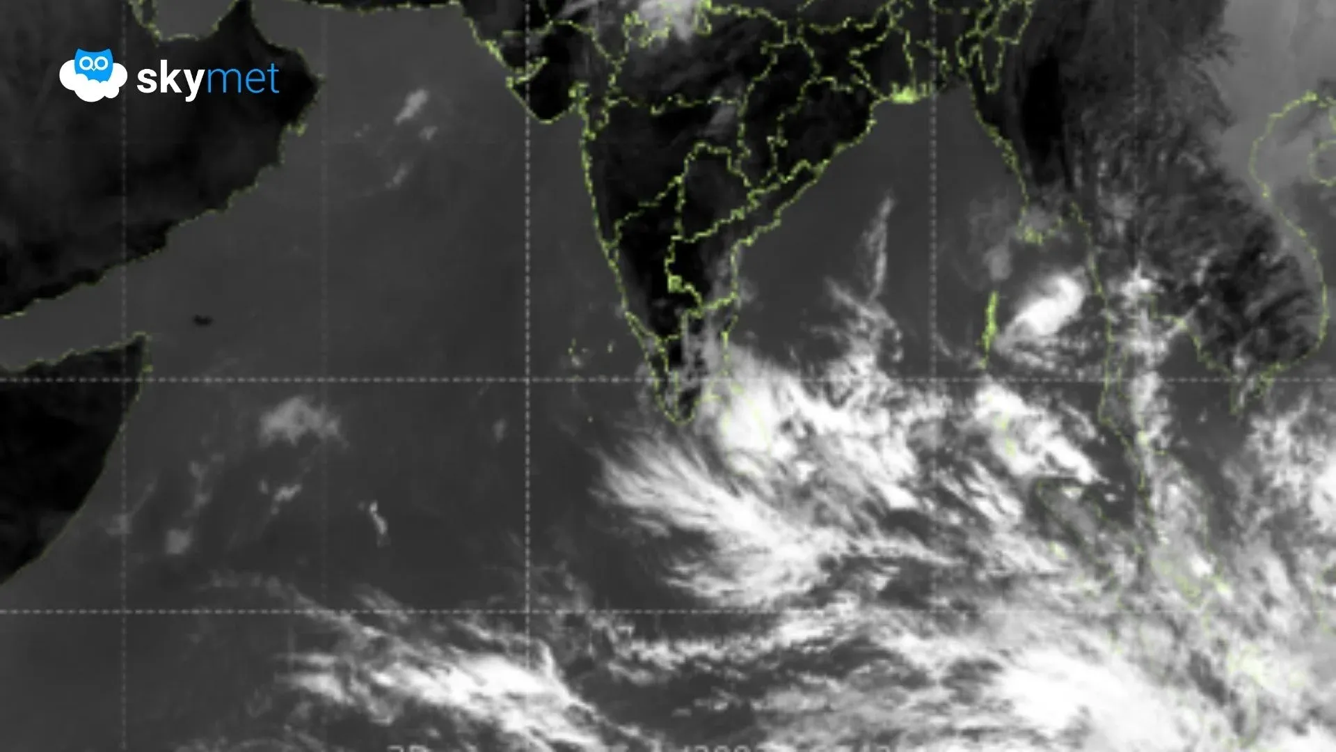
A low-pressure area over Sri Lanka and the adjoining Bay of Bengal (BoB) has now moved west-northwest and is positioned over the southwest BoB and the adjoining equatorial region. The system continues to remain in close proximity to the island nation, Sri Lanka. Heavy rainfall has occurred over the southeast coast of the country, with Batticaloa recording 129 mm in 24 hours. More heavy rain is likely across most parts of Sri Lanka. Weather activity will extend to the southernmost parts of Tamil Nadu and Kerala over the next 3–4 days.
The low-pressure area is likely to become more marked over the next 24 hours and move further westward. However, the core weather activity will remain just south of Sri Lanka, travelling across the Comorin region and further toward the Maldives. The system may not travel deep into the southern parts of the Arabian Sea near the equatorial region and may instead keep meandering between the Maldives, Comorin, and Sri Lanka.
Delhi Weather: Delhi Breaks Jinx Of Dry Spell: More Showers Likely
The states of Tamil Nadu and Kerala are likely to receive scattered rainfall between 19 and 22 February 2026. Tomorrow, the weather activity will begin with light rainfall along the southeastern coastal parts of Tamil Nadu. Later, on 20 February, the spread will increase, and light to moderate showers are likely over the interiors of south Tamil Nadu and Kerala. The scale and spatial coverage will increase further on 21 and 22 February 2026.
Over the weekend (21–22 February), the southern tip of Peninsular India is expected to receive fairly widespread showers on either side of the coastline, mostly confined south of 10°N latitude. Heavy showers are likely over Pamban, Tuticorin, Tondi, Palayankottai, Atiramapattinam, Palakkad, Thiruvananthapuram, Alappuzha, Punalur, Thrissur, Kottayam, and Cochin.
From 23 February onward, broad clearance is expected. Weather activity will start receding and remain confined to only a few places for the rest of the month.