Pre-Monsoon season spans from March to June and alongside this cyclone season also starts for India. June is though an onset month for the Southwest Monsoon but since it largely overlaps with Pre-Monsoon season, the month can host season's storms. In the last 10 years i.e. between 2010 and 2019, no cyclonic storm formed in April in the Arabian Sea, and similarly, no storm emerged in June in the Bay of Bengal. The month of May has been common to both the basins and the storms were nearly equally distributed in number. The last decade has seen 4 cyclones each in either of these basins. 'Maarutha' was the earliest storm of the decade, with the shortest life span. It had formed on 15th April 2017 and weakened within 24 hours due to strong vertical wind shear.
The cyclonic storms forming in April or the first half of May are mostly the recurving storms that invariably strike Bangladesh or Myanmar. Storm Fani was an exception last year, which ravaged Odisha towards the end of April. However, Odisha cyclone of 1999 remains the strongest storm to hit the Indian coast, as well as strongest in the basin till date.
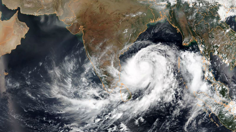
Maiden cyclone of this season will be forming in the Bay of Bengal shortly. A cyclonic circulation over the Andaman sea will come up on the 27th April. This becomes organized and more marked to induce a low-pressure area over the same region on the 28th. Environmental conditions will be favorable for further strengthening to Depression on 29th and later to a Deep Depression on 30th April. Warm Sea Surface Temperature and light to moderate wind shear in that area will support the cyclogenesis further and a Cyclonic Storm is likely to form in the North Andaman Sea on the 01st May 2020. Right from inception to a cyclone, the complete range of islands in the Andaman Nicobar Sea will experience torrential rains and gusty winds.
The track of these cyclones is governed by the high-level winds in that area, commonly called steering current. This current will bring the storm to the South-Central parts of the Bay of Bengal. Thereafter, with the approach of a deep westerly trough and prevailing steering current, the cyclone could take a course of re-curvature. The system is expected to intensify to a Severe Cyclonic Storm, keeping a safe distance from the Indian coastline. The storm will gain strength further and head for Myanmar - Bangladesh coast. It is too early to preempt its landfall, but the coastline from Yangon (Myanmar) to Chittagong (Bangladesh) remains vulnerable.
The first storm of the season has all the heat potential of the ocean at its disposal and therefore tends to be fierce and rapacious. The track record of some of the storms is quite notorious. They have been defying the predicted intensity, track, speed, and timelines. It is advisable to take all measures and precautions, right up to the Indian coast, to prepare for the challenge of the stormy season. Some of these storms could be just ruthless and hard-hitting.